MyTopo
Nowthen Minnesota US Topo Map
Couldn't load pickup availability
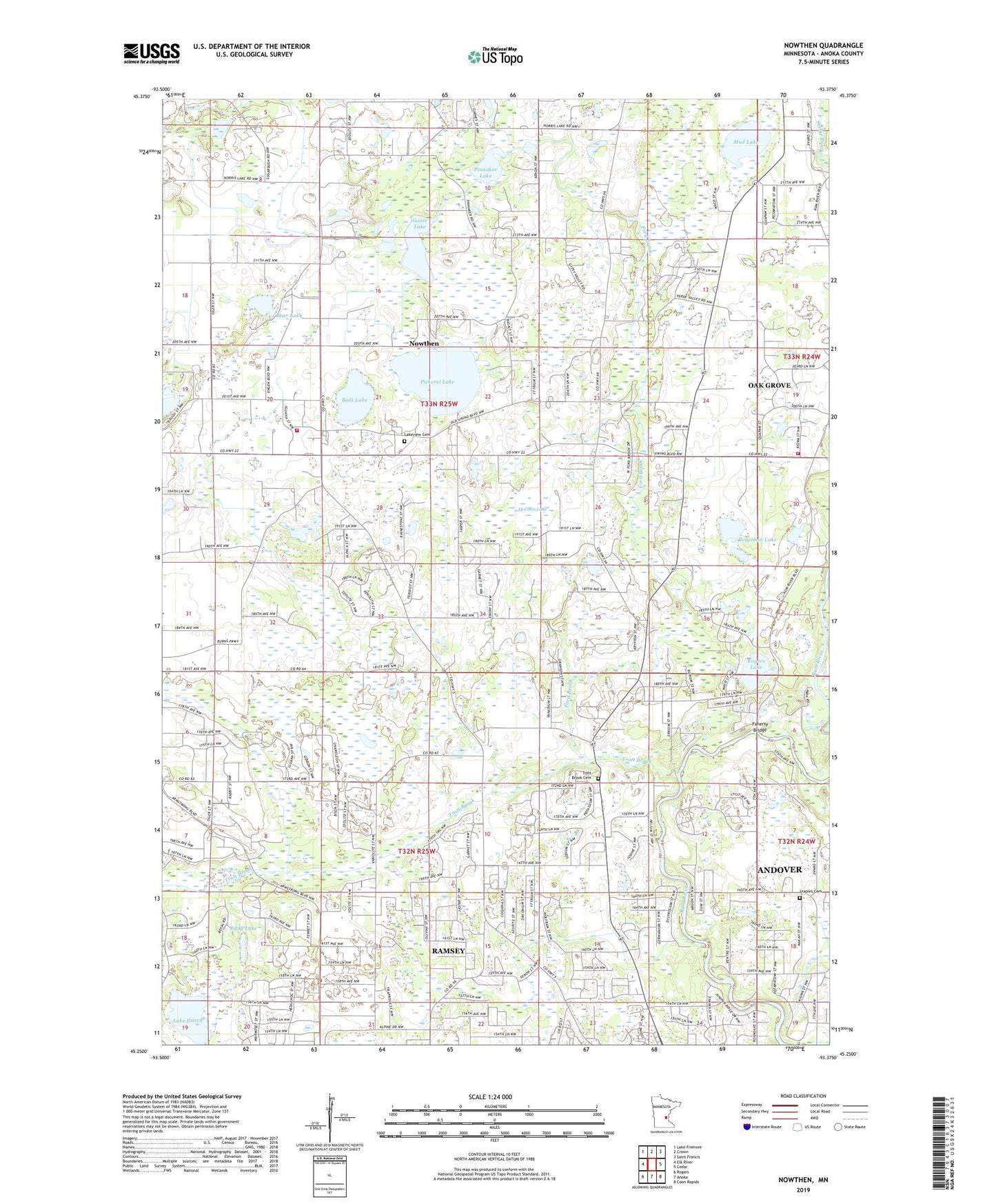
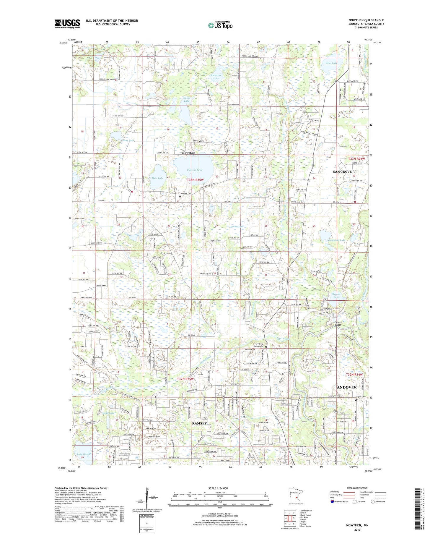
2019 topographic map quadrangle Nowthen in the state of Minnesota. Scale: 1:24000. Based on the newly updated USGS 7.5' US Topo map series, this map is in the following counties: Anoka. The map contains contour data, water features, and other items you are used to seeing on USGS maps, but also has updated roads and other features. This is the next generation of topographic maps. Printed on high-quality waterproof paper with UV fade-resistant inks.
Quads adjacent to this one:
West: Elk River
Northwest: Lake Fremont
North: Crown
Northeast: Saint Francis
East: Cedar
Southeast: Coon Rapids
South: Anoka
Southwest: Rogers
Contains the following named places: Baker School, Bass Lake, Bear Lake, Benjamin Lake, Breezy Point School, Burns Evangelical Free Church, Burns Town Hall, Central Park, City of Nowthen, City of Ramsey, County Ditch Number Fiftyone, County Ditch Number Fourteen, Demarest Post Office, Differding School, Dunn School, Eddy Lake, Faherty Bridge, Faherty School, Ford Brook, Goose Lake, Itaska Post Office, KQQL-FM (Anoka), Lake Itasca, Lake Itasca Park, Lakeside School, Lakeview Cemetery, Lord of Life Church, McCann Lake, Mitchell Corners, Mud Lake, Nowthen, Nowthen Post Office, Nowthen School, O J Holstein Farm, Oak Grove Fire Department Station 2, Pickerel Lake, Pinnaker Lake, Ramsey, Rogers Lake, Staples Cemetery, Township of Burns, Township of Ramsey, Trott Brook, Trott Brook Cemetery, Trott Brook Church, Trout Brook School, Twin Lake School, WCTS-FM (Minneapolis), ZIP Code: 55303