MyTopo
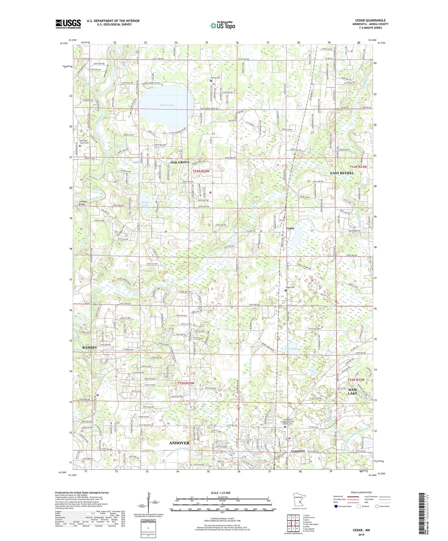
Cedar Minnesota US Topo Map
Couldn't load pickup availability
2022 topographic map quadrangle Cedar in the state of Minnesota. Scale: 1:24000. Based on the newly updated USGS 7.5' US Topo map series, this map is in the following counties: Anoka. The map contains contour data, water features, and other items you are used to seeing on USGS maps, but also has updated roads and other features. This is the next generation of topographic maps. Printed on high-quality waterproof paper with UV fade-resistant inks.
Quads adjacent to this one:
West: Nowthen
Northwest: Crown
North: Saint Francis
Northeast: Isanti
East: Coon Lake Beach
Southeast: Circle Pines
South: Coon Rapids
Southwest: Anoka
This map covers the same area as the classic USGS quad with code o45093c3.
Contains the following named places: Allina Health Emergency Medical Service, Andover Fire Department Station 2, Andover Fire Department Station 3, Cedar, Cedar Cemetery, Cedar Creek, City of Andover, City of Oak Grove, Clark School, Constance, Constance Evangelical Free Church Cemetery, Constance Post Office, County Ditch Number Fortyeight, County Ditch Number Nineteen, County Ditch Number Seventyone, County Ditch Number Six, County Ditch Number Thirtyseven, County Ditch Number Twentynine, Crooked Brook, Gillespie Bridge, Grass Lake, Hickey Lake, Immaculate Heart of Mary Academy, Lake George, Lake George County Park, Lifelong Learning Center, Mahoney Brook, Oak Grove, Oak Grove Fire Department Station 1, Oak Grove Town Hall, Oak View Middle School, Oakgrove Post Office, Pierce Cemetery, Rum River Elementary School, Saint Patricks Church, School Number 10, School Number 33, Seelye Brook, Swan Lake, Township of Grow, Township of Oak Grove, Ward Lake, West Oak Grove Cemetery, ZIP Code: 55011