MyTopo
Oklee Minnesota US Topo Map
Couldn't load pickup availability
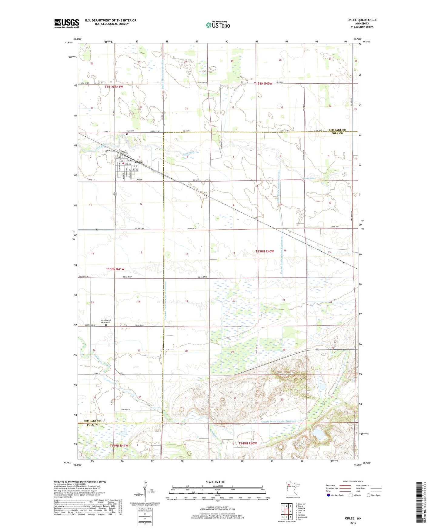
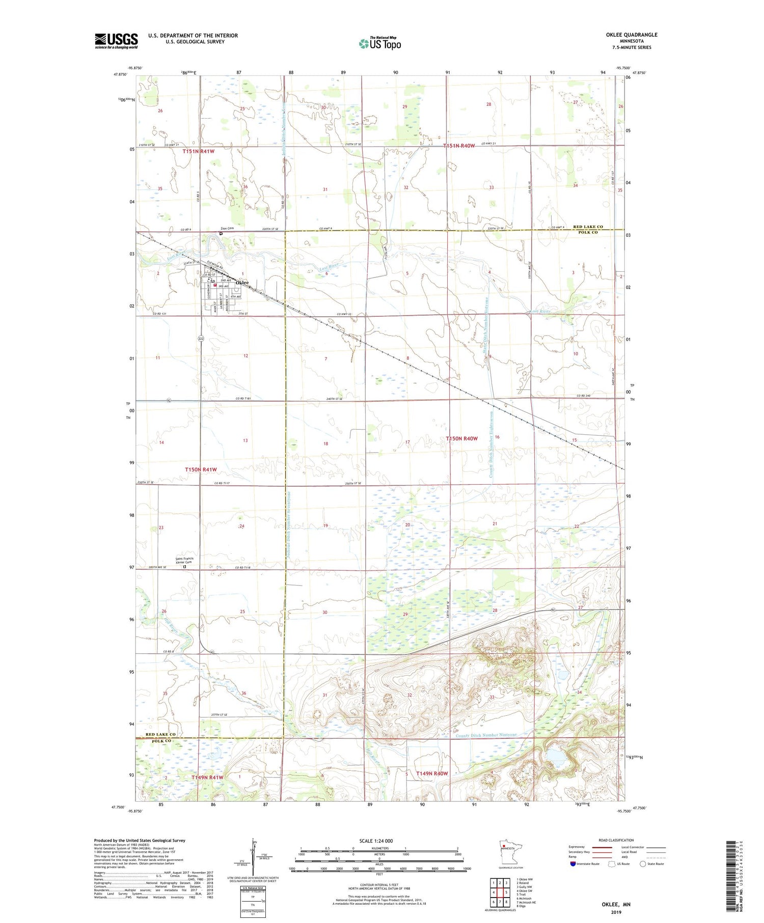
2019 topographic map quadrangle Oklee in the state of Minnesota. Scale: 1:24000. Based on the newly updated USGS 7.5' US Topo map series, this map is in the following counties: Polk, Red Lake. The map contains contour data, water features, and other items you are used to seeing on USGS maps, but also has updated roads and other features. This is the next generation of topographic maps. Printed on high-quality waterproof paper with UV fade-resistant inks.
Quads adjacent to this one:
West: Oklee SW
Northwest: Oklee NW
North: Roland
Northeast: Gully NW
East: Trail
Southeast: Olga
South: McIntosh NE
Southwest: McIntosh
Contains the following named places: City of Oklee, County Ditch Number Eightyseven, County Ditch Number Nintyone, Espetveh Post Office, First Care Medical Services Building, Judicial Ditch Number Four, Judicial Ditch Number Seventyone, Lessor State Wildlife Management Area, Lindsay Post Office, Oak Park Evangelical Lutheran Church, Oklee, Oklee Emergency Squad, Oklee Lutheran Church, Oklee Post Office, Oklee Volunteer Fire Department, Saint Francis Xavier Cemetery, Saint Francis Xavier Church, State Ditch Number Sixtyone, Township of Chester, Zion Cemetery