MyTopo
Olga Minnesota US Topo Map
Couldn't load pickup availability
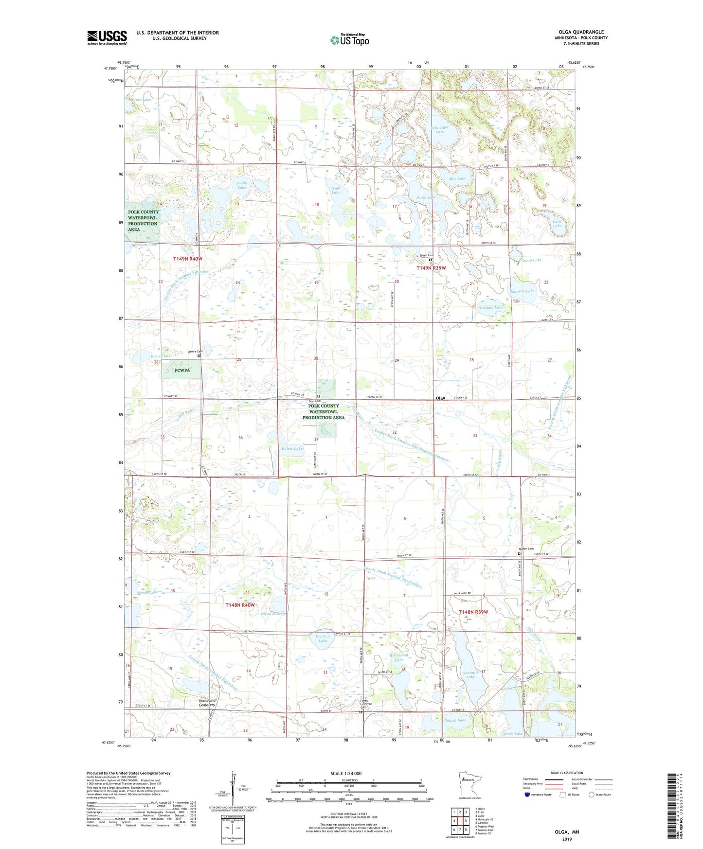
2022 topographic map quadrangle Olga in the state of Minnesota. Scale: 1:24000. Based on the newly updated USGS 7.5' US Topo map series, this map is in the following counties: Polk. The map contains contour data, water features, and other items you are used to seeing on USGS maps, but also has updated roads and other features. This is the next generation of topographic maps. Printed on high-quality waterproof paper with UV fade-resistant inks.
Quads adjacent to this one:
West: McIntosh NE
Northwest: Oklee
North: Trail
Northeast: Gully
East: Gonvick
Southeast: Fosston SE
South: Fosston East
Southwest: Fosston West
This map covers the same area as the classic USGS quad with code o47095f6.
Contains the following named places: Agnes Lake, Bolme Lake, Brandsvold State Wildlife Management Area, Brandvold Cemetery, Breed Lake, Camp Lake, Chapek Lake, County Ditch Number Eightyfour, County Ditch Number Fiftynine, County Ditch Number One Hundred Thirteen, County Ditch Number Twentythree, Cross Lake, Disrud Lake, Froen Church, Froen Lutheran Cemetery, Hamre Lake, Hedlund Lake, Johnson Lake, Lark Lake, Mamre Cemetery, Moe Lake, Oakland School, Olga, Olga Post Office, Olson Lake, Overby Lake, Perch Lake, Queen Cemetery, Rikansrud Lake, Salem Cemetery, Salem Church, Sawmill Lake, Schneider Lake, Sorby Lake, Tilberg County Park, Township of Brandsvold, Township of Eden, Trinity Lutheran Church, Vigoren Lake, Wold Lake, Zion Cemetery, Zion Church