MyTopo
Parkers Prairie Minnesota US Topo Map
Couldn't load pickup availability
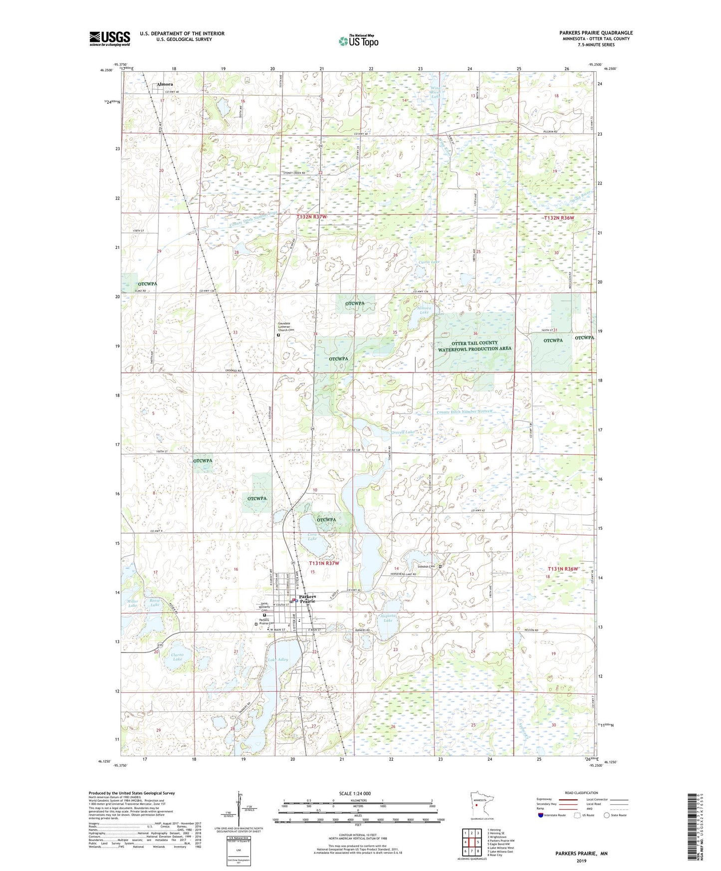
2019 topographic map quadrangle Parkers Prairie in the state of Minnesota. Scale: 1:24000. Based on the newly updated USGS 7.5' US Topo map series, this map is in the following counties: Otter Tail. The map contains contour data, water features, and other items you are used to seeing on USGS maps, but also has updated roads and other features. This is the next generation of topographic maps. Printed on high-quality waterproof paper with UV fade-resistant inks.
Quads adjacent to this one:
West: Parkers Prairie NW
Northwest: Henning
North: Henning SE
Northeast: Wrightstown
East: Eagle Bend NW
Southeast: Rose City
South: Lake Miltona East
Southwest: Lake Miltona West
Contains the following named places: Almora, Almora Lake, Almora Post Office, Augusta Lake, Church of the Confession, City of Parkers Prairie, Clarno Lake, Cora Lake, County Ditch Number Four, County Ditch Number Nineteen, Curtis Lake, Elmo Church, Elmo Post Office, First Baptist Church, First Evangelical Lutheran Church, Gausdale Lutheran Church Cemetery, Graven Lake, Horsehead Lake, Immanuel Lutheran Church, Lake Adley, Miller Lake, Parkers Prairie, Parkers Prairie Ambulance, Parkers Prairie Cemetery, Parkers Prairie City Police Department, Parkers Prairie Fire Department, Parkers Prairie Medical Clinic, Parkers Prairie Park, Parkers Prairie Post Office, Reese Lake, Saint Paul's Lutheran Church Cemetery, Saint Williams Catholic Church, Saint Williams Cemetery, Swedish Cemetery, Township of Elmo, Township of Parkers Prairie, Wing River Lake, ZIP Code: 56361