MyTopo
Lake Miltona West Minnesota US Topo Map
Couldn't load pickup availability
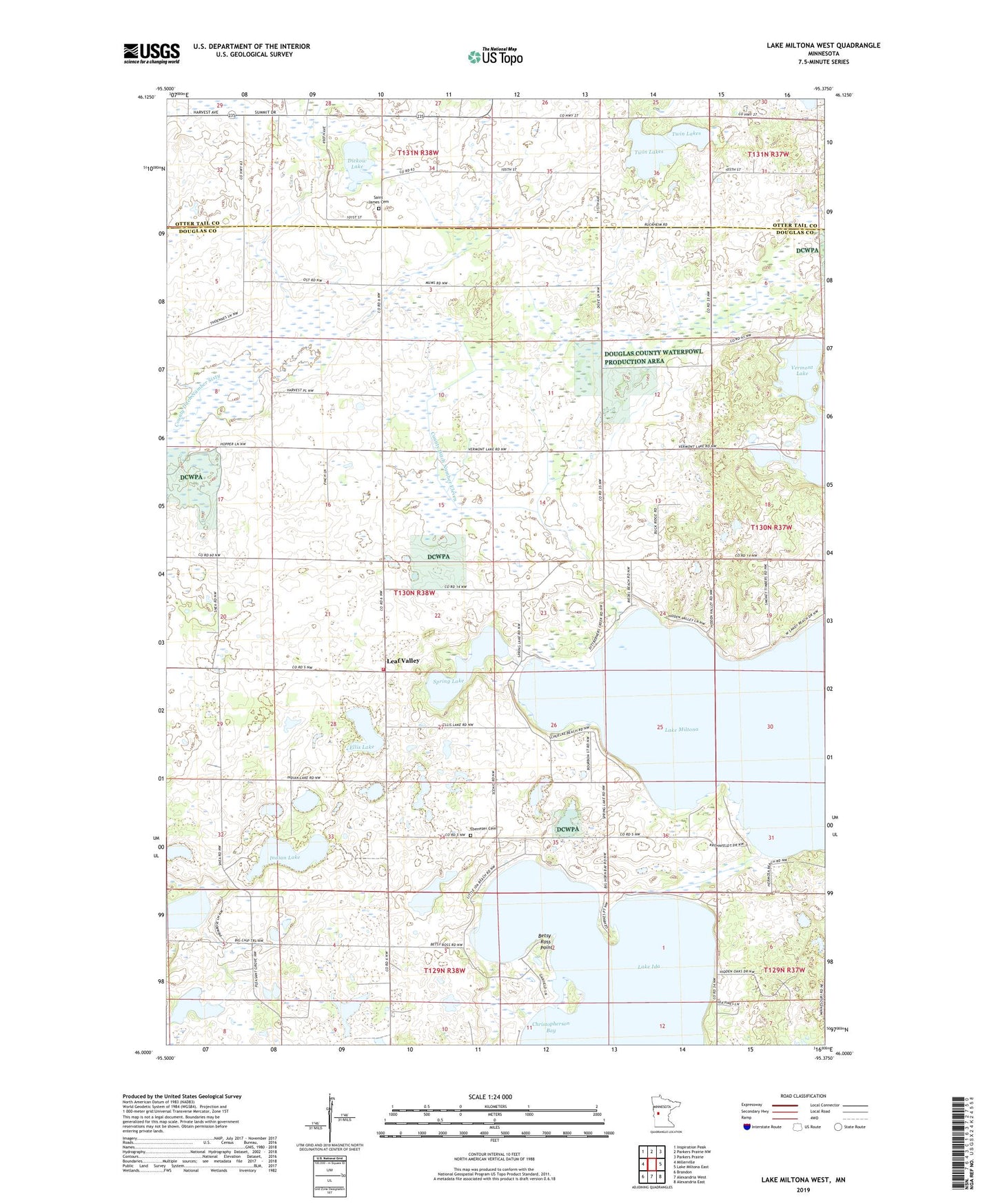
2022 topographic map quadrangle Lake Miltona West in the state of Minnesota. Scale: 1:24000. Based on the newly updated USGS 7.5' US Topo map series, this map is in the following counties: Douglas, Otter Tail. The map contains contour data, water features, and other items you are used to seeing on USGS maps, but also has updated roads and other features. This is the next generation of topographic maps. Printed on high-quality waterproof paper with UV fade-resistant inks.
Quads adjacent to this one:
West: Millerville
Northwest: Inspiration Peak
North: Parkers Prairie NW
Northeast: Parkers Prairie
East: Lake Miltona East
Southeast: Alexandria East
South: Alexandria West
Southwest: Brandon
This map covers the same area as the classic USGS quad with code o46095a4.
Contains the following named places: Aaron Lake, Aaron Lake Dam, Betsy Ross Point, Christopherson Bay, County Ditch Number Eleven, Diekow Lake, Ebenezer Cemetery, Ebenezer Church, Ellis Lake, Indian Lake, Leaf Valley, Leaf Valley Post Office, Leaf Valley Township Fire Department, Lucky Acres Campground, Miltona Lake, Miltona Lake Dam, Private Lake, Saint James Cemetery, Saint James Church, Spring Lake, Township of Leaf Valley, Twin Lakes, Vermont Lake