MyTopo
Ronneby Minnesota US Topo Map
Couldn't load pickup availability
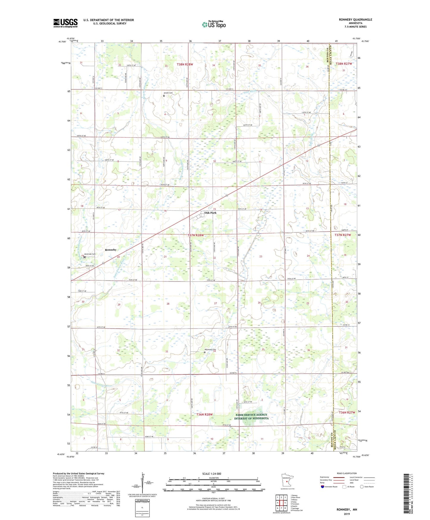
2019 topographic map quadrangle Ronneby in the state of Minnesota. Scale: 1:24000. Based on the newly updated USGS 7.5' US Topo map series, this map is in the following counties: Benton, Mille Lacs. The map contains contour data, water features, and other items you are used to seeing on USGS maps, but also has updated roads and other features. This is the next generation of topographic maps. Printed on high-quality waterproof paper with UV fade-resistant inks.
Quads adjacent to this one:
West: Foley
Northwest: Ramey
North: Rum River
Northeast: Milaca
East: Foreston
Southeast: Princeton SW
South: Santiago
Southwest: Duelm
Contains the following named places: City of Ronneby, County Ditch Number Fourteen, Elwell Cemetery, Estes Brook Church, Hanenburg Farms, Maywood Cemetery, Maywood Church, Maywood Post Office, Oak Park, Oak Park Post Office, Riverside Cemetery, Ronneby, Ronneby Census Designated Place, Ronneby Post Office, School Number 100, School Number 101, School Number 126, Township of Maywood, West Branch Saint Francis River, ZIP Code: 56357