
MyTopo
Rose City Minnesota US Topo Map
Couldn't load pickup availability
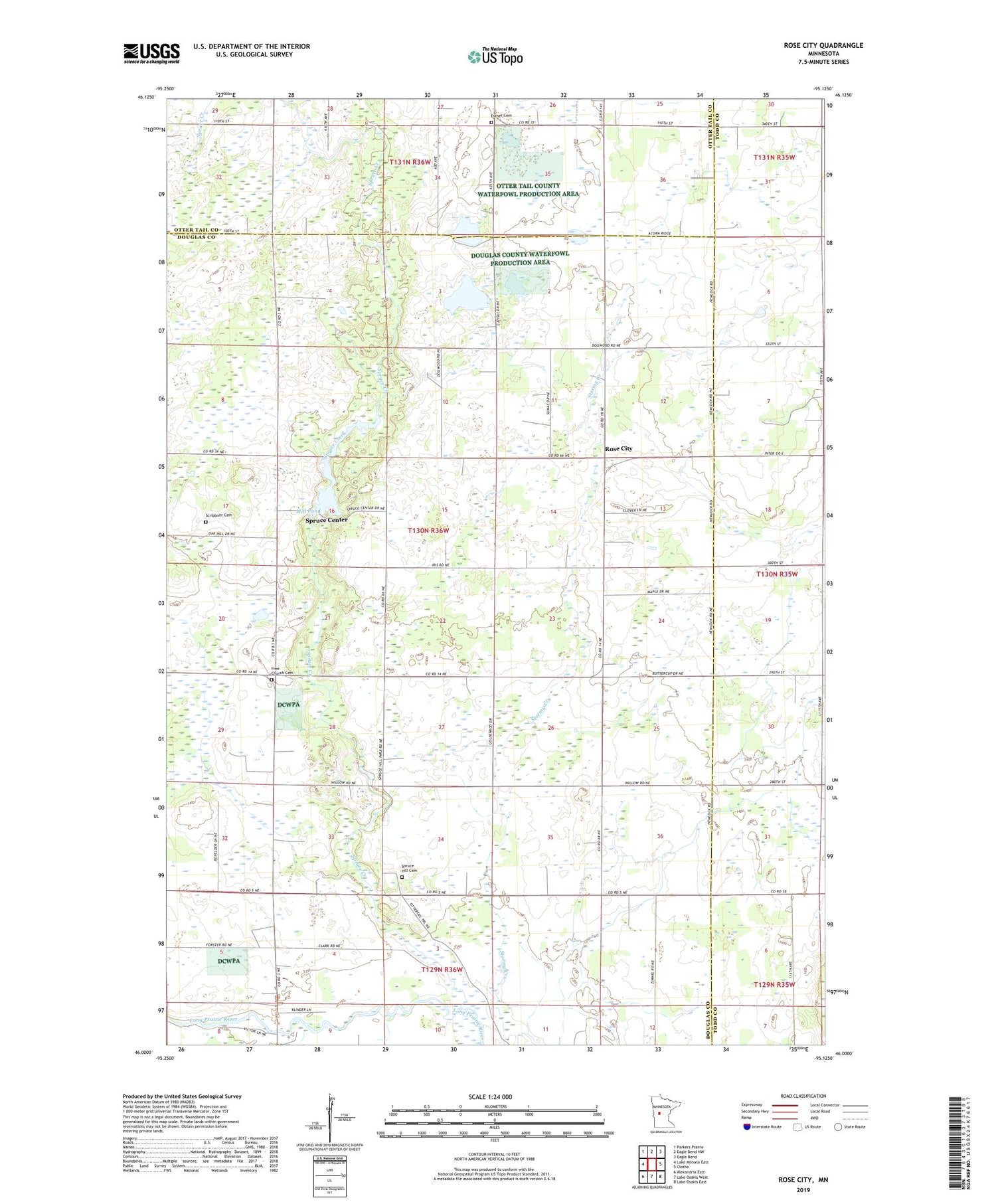
2019 topographic map quadrangle Rose City in the state of Minnesota. Scale: 1:24000. Based on the newly updated USGS 7.5' US Topo map series, this map is in the following counties: Douglas, Todd, Otter Tail. The map contains contour data, water features, and other items you are used to seeing on USGS maps, but also has updated roads and other features. This is the next generation of topographic maps. Printed on high-quality waterproof paper with UV fade-resistant inks.
Quads adjacent to this one:
West: Lake Miltona East
Northwest: Parkers Prairie
North: Eagle Bend NW
Northeast: Eagle Bend
East: Clotho
Southeast: Lake Osakis East
South: Lake Osakis West
Southwest: Alexandria East
Contains the following named places: Big Spruce State Wildlife Management Area, Esther Church, Esther Lutheran Church Cemetery, Free Church Cemetery, Mill Pond, Rose City, Rose City Evangelical Free Church, School Number 2361, Scribbner Cemetery, Spruce Center, Spruce Creek, Spruce Creek Dam, Spruce Creek State Wildlife Management Area, Spruce Hill Cemetery, Spruce Hill Church, Township of Spruce Hill, ZIP Codes: 56319, 56354


