MyTopo
Saint Stephen Minnesota US Topo Map
Couldn't load pickup availability
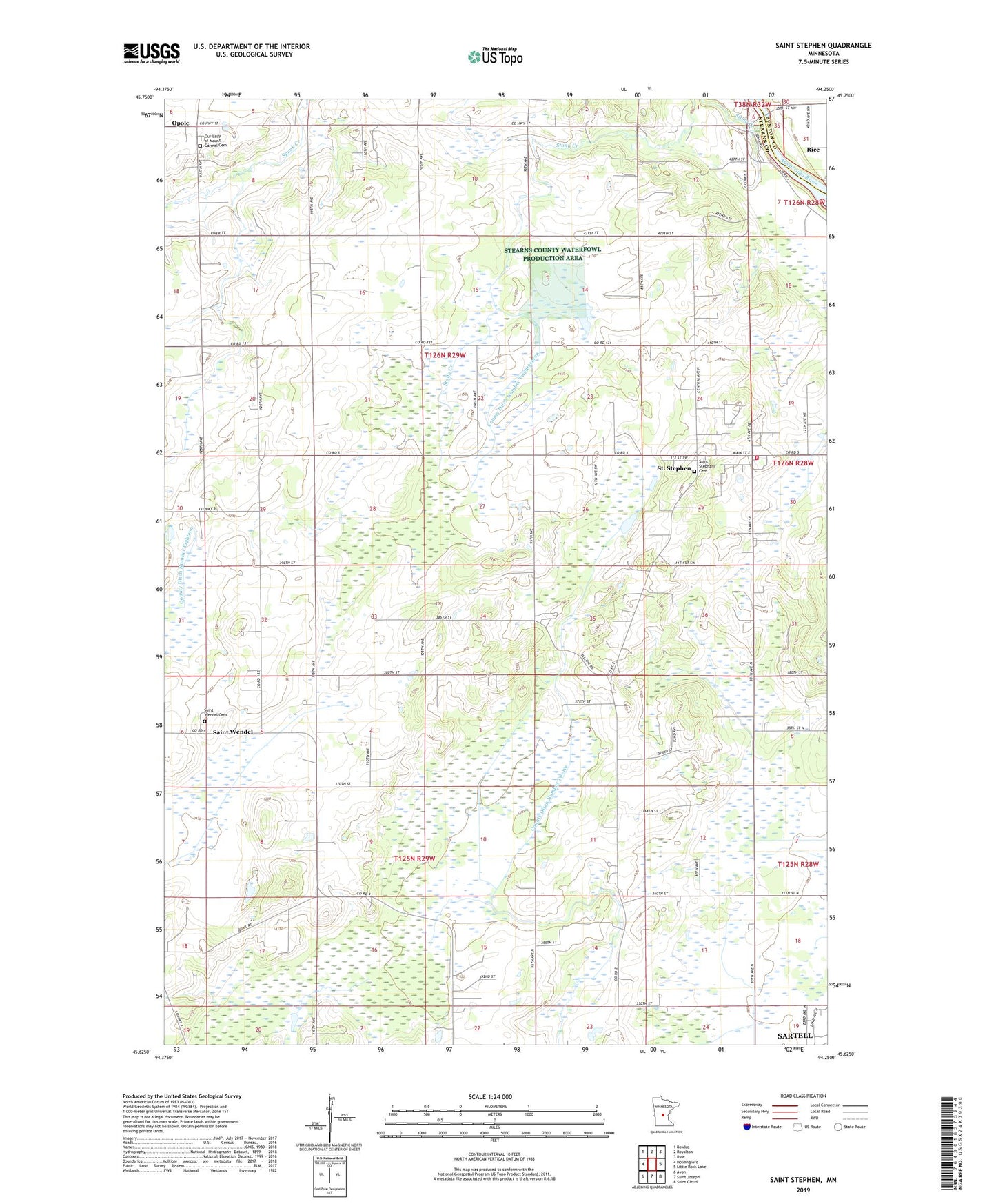
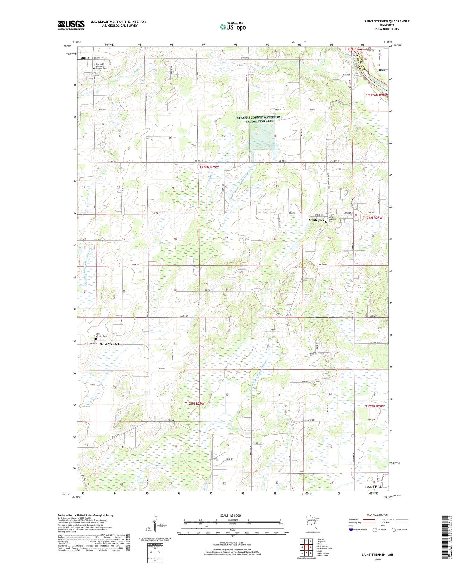
2019 topographic map quadrangle Saint Stephen in the state of Minnesota. Scale: 1:24000. Based on the newly updated USGS 7.5' US Topo map series, this map is in the following counties: Stearns, Benton. The map contains contour data, water features, and other items you are used to seeing on USGS maps, but also has updated roads and other features. This is the next generation of topographic maps. Printed on high-quality waterproof paper with UV fade-resistant inks.
Quads adjacent to this one:
West: Holdingford
Northwest: Bowlus
North: Royalton
Northeast: Rice
East: Little Rock Lake
Southeast: Saint Cloud
South: Saint Joseph
Southwest: Avon
Contains the following named places: City of Saint Stephen, County Ditch Number Twelve, County Ditch Number Twentyseven, John F Kennedy Elementary School, Opole, Opole Post Office, Our Lady of Mount Carmel Cemetery, Saint Stephani Cemetery, Saint Stephen, Saint Stephen Church, Saint Stephen City Hall, Saint Stephen Elementary School, Saint Stephen Fire Station, Saint Wendel Cemetery, Saint Wendel Parish, School Number 1915, School Number 1920, School Number 1921, School Number 1984, School Number 2063, Stony Creek, Township of Brockway, Township of Saint Wendel, ZIP Codes: 56374, 56375