MyTopo
Rice Minnesota US Topo Map
Couldn't load pickup availability
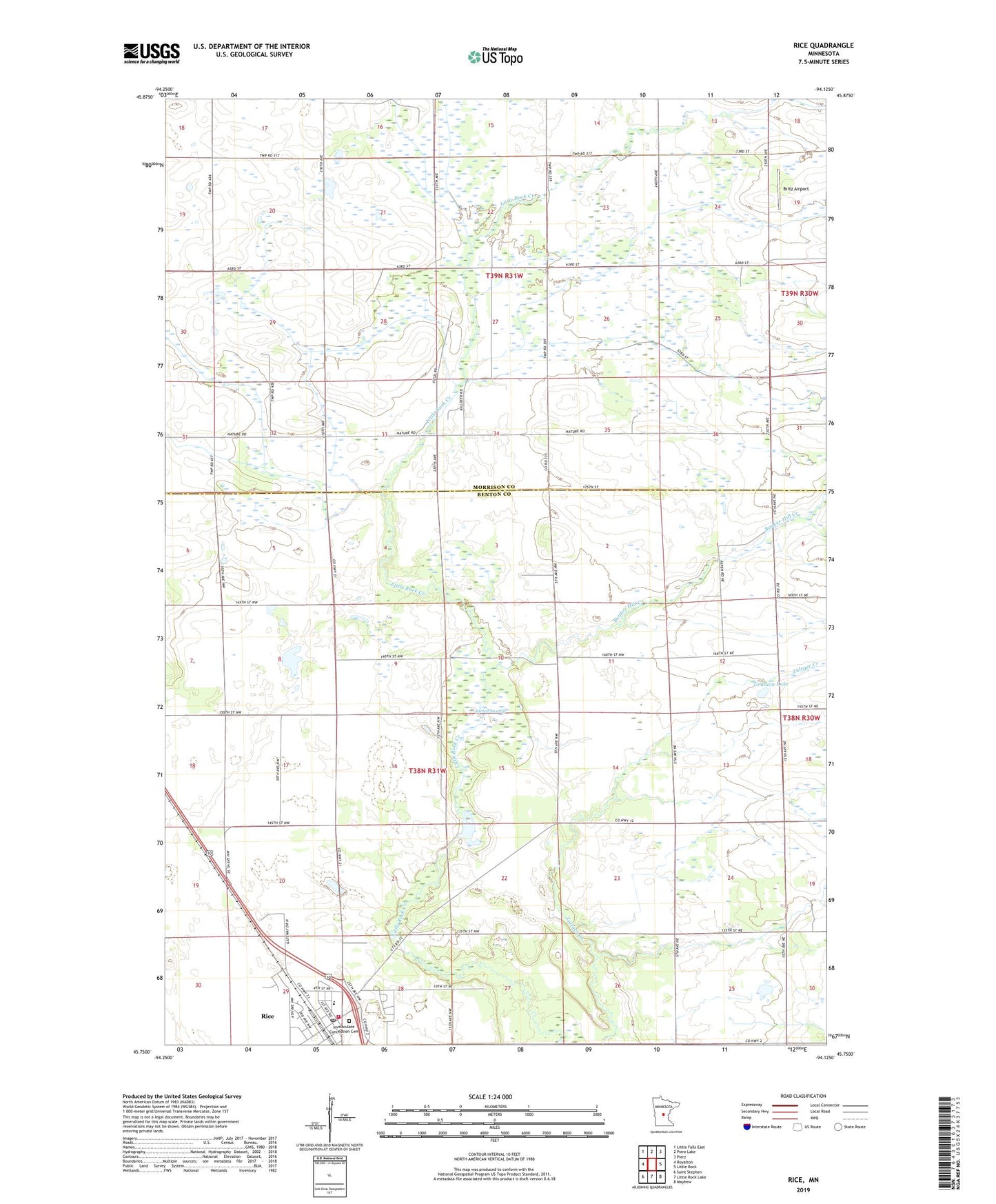
2022 topographic map quadrangle Rice in the state of Minnesota. Scale: 1:24000. Based on the newly updated USGS 7.5' US Topo map series, this map is in the following counties: Benton, Morrison. The map contains contour data, water features, and other items you are used to seeing on USGS maps, but also has updated roads and other features. This is the next generation of topographic maps. Printed on high-quality waterproof paper with UV fade-resistant inks.
Quads adjacent to this one:
West: Royalton
Northwest: Little Falls East
North: Pierz Lake
Northeast: Pierz
East: Little Rock
Southeast: Mayhew
South: Little Rock Lake
Southwest: Saint Stephen
This map covers the same area as the classic USGS quad with code o45094g2.
Contains the following named places: Britz Airport, Bunker Hill Creek, City of Rice, Graham Lake, Immaculate Conception Cemetery, Immaculate Conception Church, KKSR-FM (Sartell), Little Rock Creek, Little Rock Creek Impoundment Structure Dam, Pine Stream Dairy, Rice, Rice City Hall, Rice Elementary School, Rice Fire Department, Rice Police Department, Rice Post Office, Sartell State Wildlife Management Area, Sartell Swamp, Township of Langola, ZIP Codes: 56367, 56373