MyTopo
Salem Corners Minnesota US Topo Map
Couldn't load pickup availability
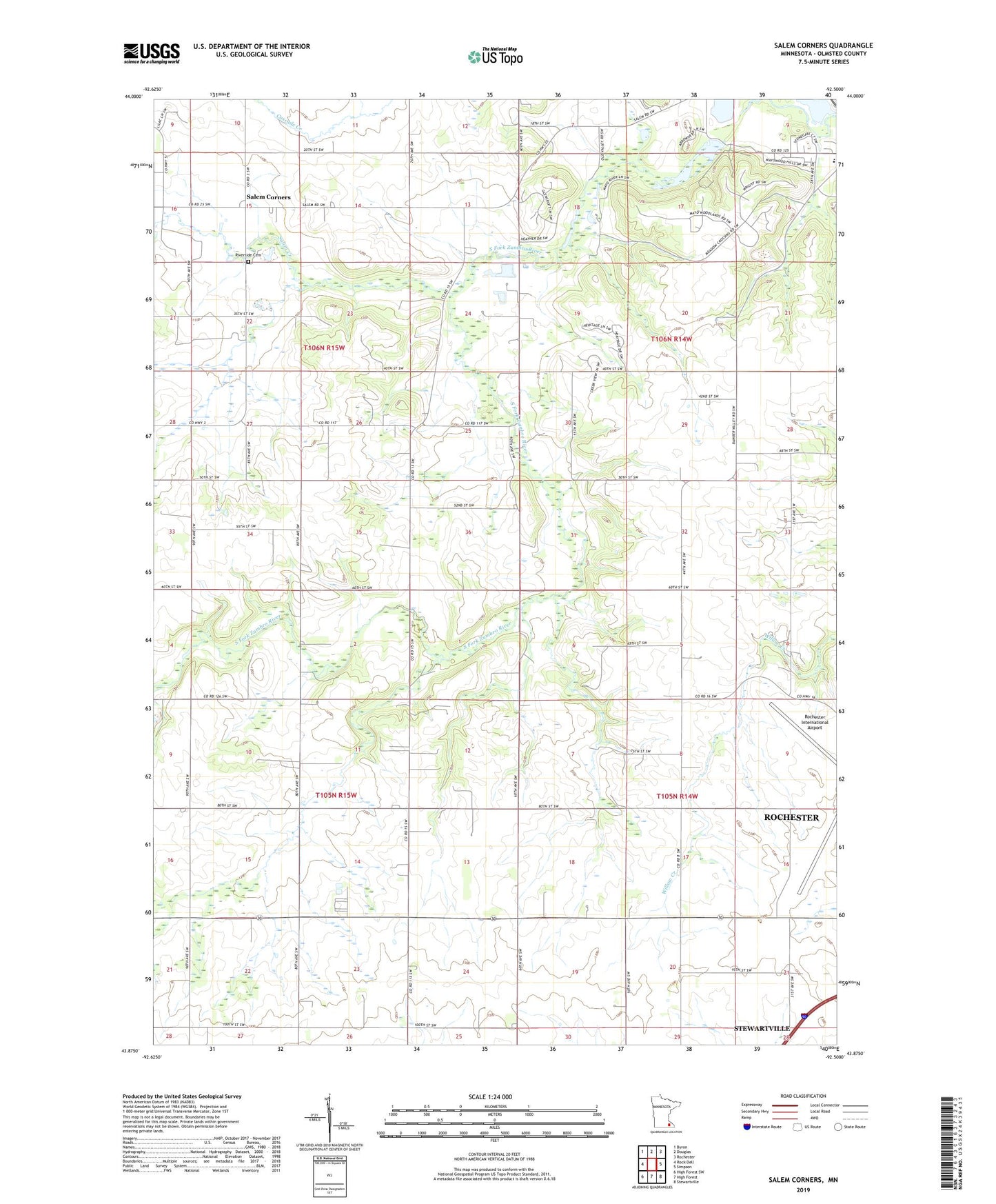
2019 topographic map quadrangle Salem Corners in the state of Minnesota. Scale: 1:24000. Based on the newly updated USGS 7.5' US Topo map series, this map is in the following counties: Olmsted. The map contains contour data, water features, and other items you are used to seeing on USGS maps, but also has updated roads and other features. This is the next generation of topographic maps. Printed on high-quality waterproof paper with UV fade-resistant inks.
Quads adjacent to this one:
West: Rock Dell
Northwest: Byron
North: Douglas
Northeast: Rochester
East: Simpson
Southeast: Stewartville
South: High Forest
Southwest: High Forest SW
Contains the following named places: Bamber Valley School, Dee School, Garten Marketplatz Perennial Farm, Keller State Wildlife Management Area, Mayowood Historical Marker, Mayowood Lake, Mayowood Lake Dam, Mayowood Mansion, Myhere Farms, Riverside Cemetery, Salem Corners, Salem Creek, Suess State Wildlife Management Area, Township of High Forest, Township of Rochester, Township of Rock Dell, Township of Salem, ZIP Code: 55902