MyTopo
High Forest Minnesota US Topo Map
Couldn't load pickup availability
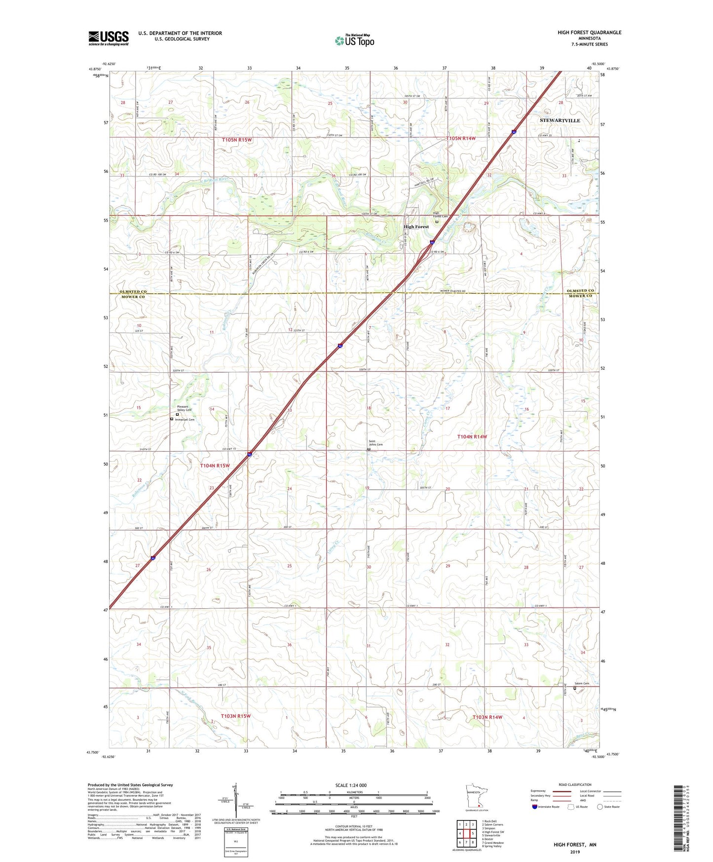
2022 topographic map quadrangle High Forest in the state of Minnesota. Scale: 1:24000. Based on the newly updated USGS 7.5' US Topo map series, this map is in the following counties: Mower, Olmsted. The map contains contour data, water features, and other items you are used to seeing on USGS maps, but also has updated roads and other features. This is the next generation of topographic maps. Printed on high-quality waterproof paper with UV fade-resistant inks.
Quads adjacent to this one:
West: High Forest SW
Northwest: Rock Dell
North: Salem Corners
Northeast: Simpson
East: Stewartville
Southeast: Spring Valley
South: Grand Meadow
Southwest: Dexter
This map covers the same area as the classic USGS quad with code o43092g5.
Contains the following named places: High Forest, High Forest Cemetery, High Forest Census Designated Place, High Forest Community Church, High Forest Post Office, Highforest East Bound Rest Area, Immanuel Cemetery, Pleasant Valley Cemetery, Pleasant Valley Church, Robinson Creek, Saint Johns Cemetery, Salem Cemetery, Schumann State Wildlife Management Area, Scrabeck Airport, Township of Racine, ZIP Code: 55967