MyTopo
Silver Bay Minnesota US Topo Map
Couldn't load pickup availability
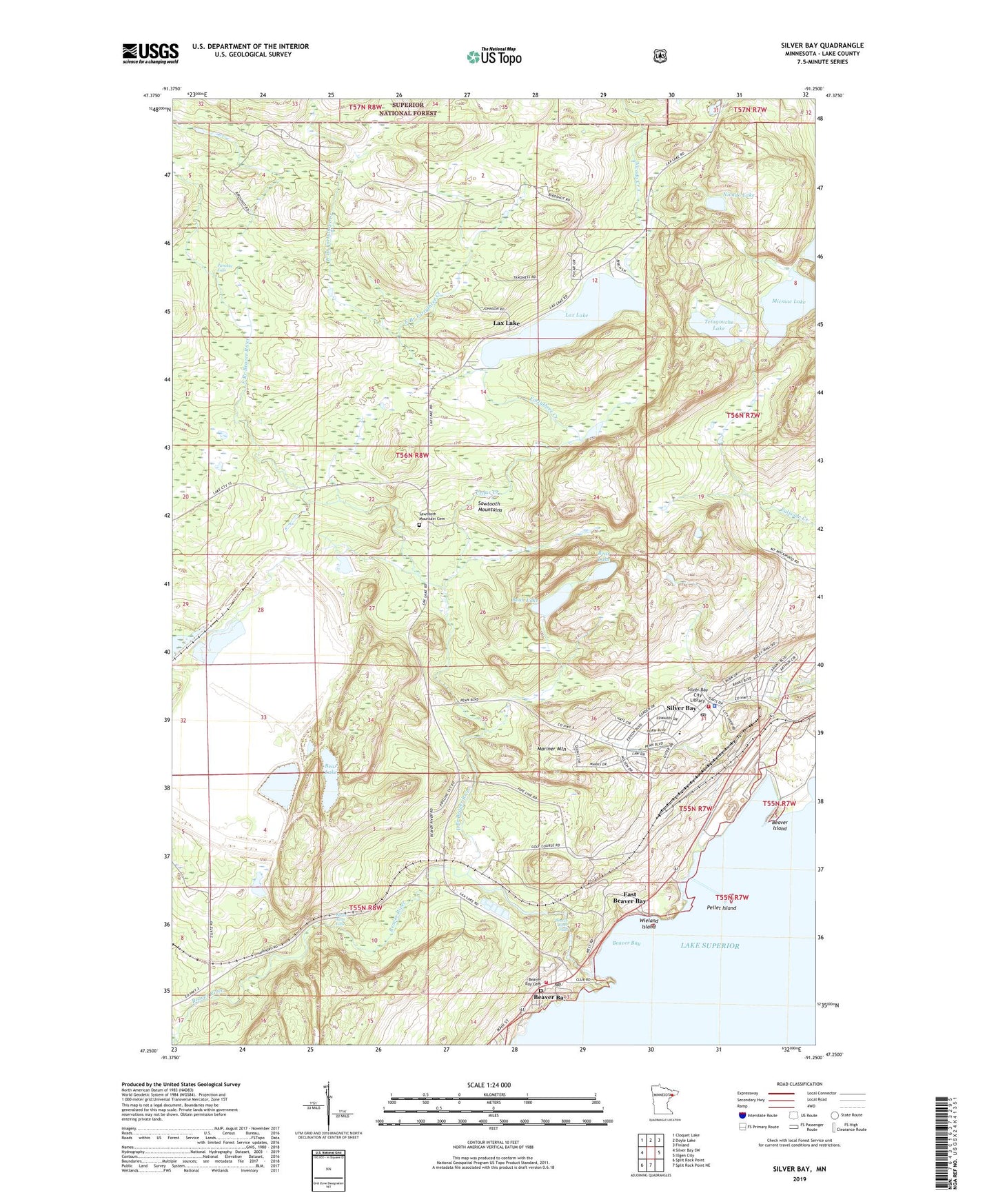
2019 topographic map quadrangle Silver Bay in the state of Minnesota. Scale: 1:24000. Based on the newly updated USGS 7.5' US Topo map series, this map is in the following counties: Lake. The map contains contour data, water features, and other items you are used to seeing on USGS maps, but also has updated roads and other features. This is the next generation of topographic maps. Printed on high-quality waterproof paper with UV fade-resistant inks.
Quads adjacent to this one:
West: Silver Bay SW
Northwest: Cloquet Lake
North: Doyle Lake
Northeast: Finland
East: Illgen City
South: Split Rock Point NE
Southwest: Split Rock Point
Contains the following named places: Bay Area Health Center, Bay Area Vineyard, Bean Lake, Bear Lake, Beaver Bay, Beaver Bay Cemetery, Beaver Bay Post Office, Beaver Bay Volunteer Fire Department, Beaver Island, Beaver River, Beaver River Falls, Cedar Creek, City of Beaver Bay, City of Silver Bay, East Beaver Bay, East Branch Beaver River, East Branch Fortythree Creek, Faith Lutheran Church, Fortythree Creek, Glenn Avon Falls, Kelly High School, Lax Lake, Lax Lake Post Office, Little Thirtynine Creek, MacDonald Middle School, Mariner Mountain, Micmac Lake, Milepost Seven Tailings Ponds, Minnesota Veterans Home, Nicado Creek, Nicado Lake, Pancake Falls, Pellet Island, Saint Mary's Church, Sawtooth Mountain Cemetery, Silver Bay, Silver Bay Baptist Church, Silver Bay City Library, Silver Bay Country Club, Silver Bay Police Department, Silver Bay Post Office, Silver Bay Volunteer Fire Department, Sychar Lutheran Church, Tetagouche Lake, Tetagouche Lake Campground, Tettegouche State Park, Township of Beaver Bay, United Protestant Church, West Branch Beaver River, West Branch Fortythree Creek, Wieland Island