MyTopo
Silver Bay SW Minnesota US Topo Map
Couldn't load pickup availability
Also explore the Silver Bay SW Forest Service Topo of this same quad for updated USFS data
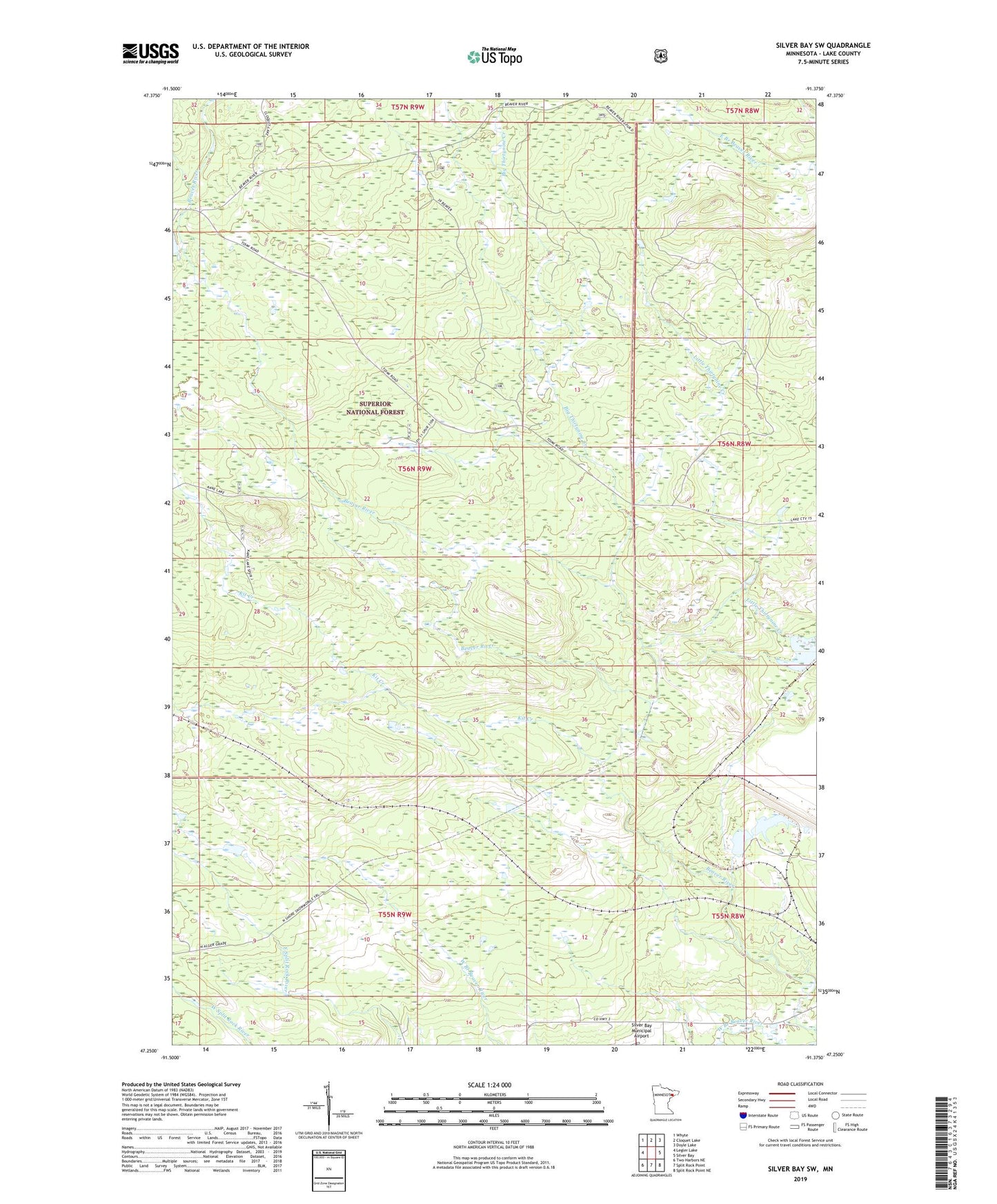
2022 topographic map quadrangle Silver Bay SW in the state of Minnesota. Scale: 1:24000. Based on the newly updated USGS 7.5' US Topo map series, this map is in the following counties: Lake. The map contains contour data, water features, and other items you are used to seeing on USGS maps, but also has updated roads and other features. This is the next generation of topographic maps. Printed on high-quality waterproof paper with UV fade-resistant inks.
Quads adjacent to this one:
West: Legler Lake
Northwest: Whyte
North: Cloquet Lake
Northeast: Doyle Lake
East: Silver Bay
Southeast: Split Rock Point NE
South: Split Rock Point
Southwest: Two Harbors NE
This map covers the same area as the classic USGS quad with code o47091c4.
Contains the following named places: Big Thirtynine Creek, Kit Creek, North Shore Snowmobile Trail, ZIP Code: 55614