MyTopo
Silver Creek Minnesota US Topo Map
Couldn't load pickup availability
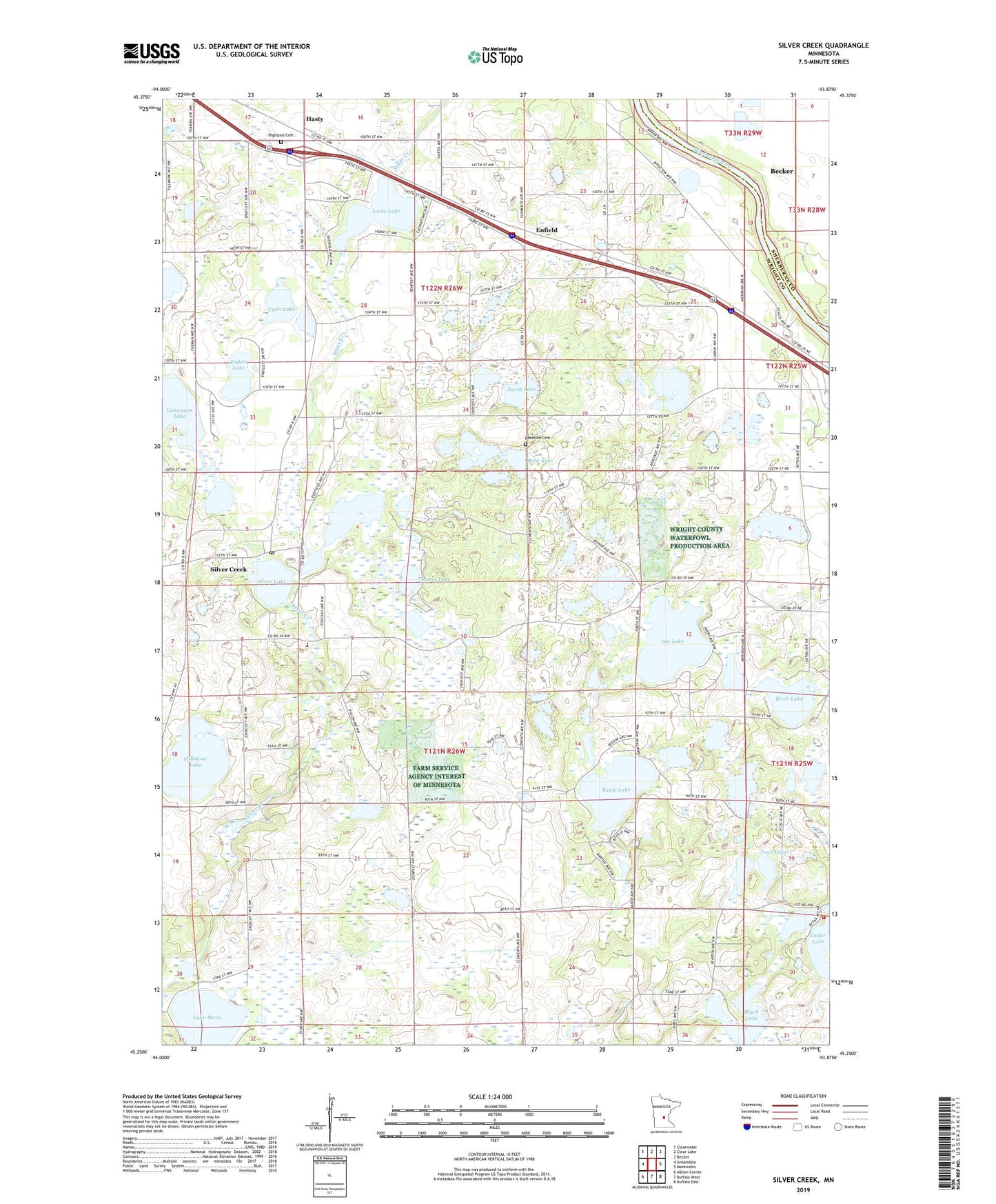
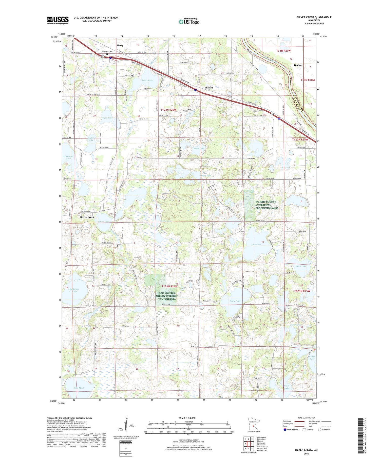
2019 topographic map quadrangle Silver Creek in the state of Minnesota. Scale: 1:24000. Based on the newly updated USGS 7.5' US Topo map series, this map is in the following counties: Wright, Sherburne. The map contains contour data, water features, and other items you are used to seeing on USGS maps, but also has updated roads and other features. This is the next generation of topographic maps. Printed on high-quality waterproof paper with UV fade-resistant inks.
Quads adjacent to this one:
West: Annandale
Northwest: Clearwater
North: Clear Lake
Northeast: Becker
East: Monticello
Southeast: Buffalo East
South: Buffalo West
Southwest: Albion Center
Contains the following named places: Birch Lake, Black Lake, Carter School, Eagle Lake, Ember Lake, Enfield, Enfield East Bound Rest Area, Enfield Post Office, Front Line Plus Fire and Rescue, Hasty, Hasty Post Office, Highland Cemetery, Ida Lake, Immanuel Lutheran Church of Silver Creek, Kelly Meyer State Wildlife Management Area, Lake Maria State Park, Lake Mary, Lakeside Cemetery, Lakeview Cemetery, Limestone Lake, Little Eagle Lake, Locke Lake, Maple Lake State Wildlife Management Area, Maria Lake, Millstone Lake, Minnesotas Highways Historical Marker, North Lake, Olsons Campground, Silver Creek, Silver Creek Census Designated Place, Silver Creek Church, Silver Creek Post Office, Silver Lake, Township of Silver Creek, Twin Lake, Twin Lakes, West Lake, ZIP Code: 55358