MyTopo
Clear Lake Minnesota US Topo Map
Couldn't load pickup availability
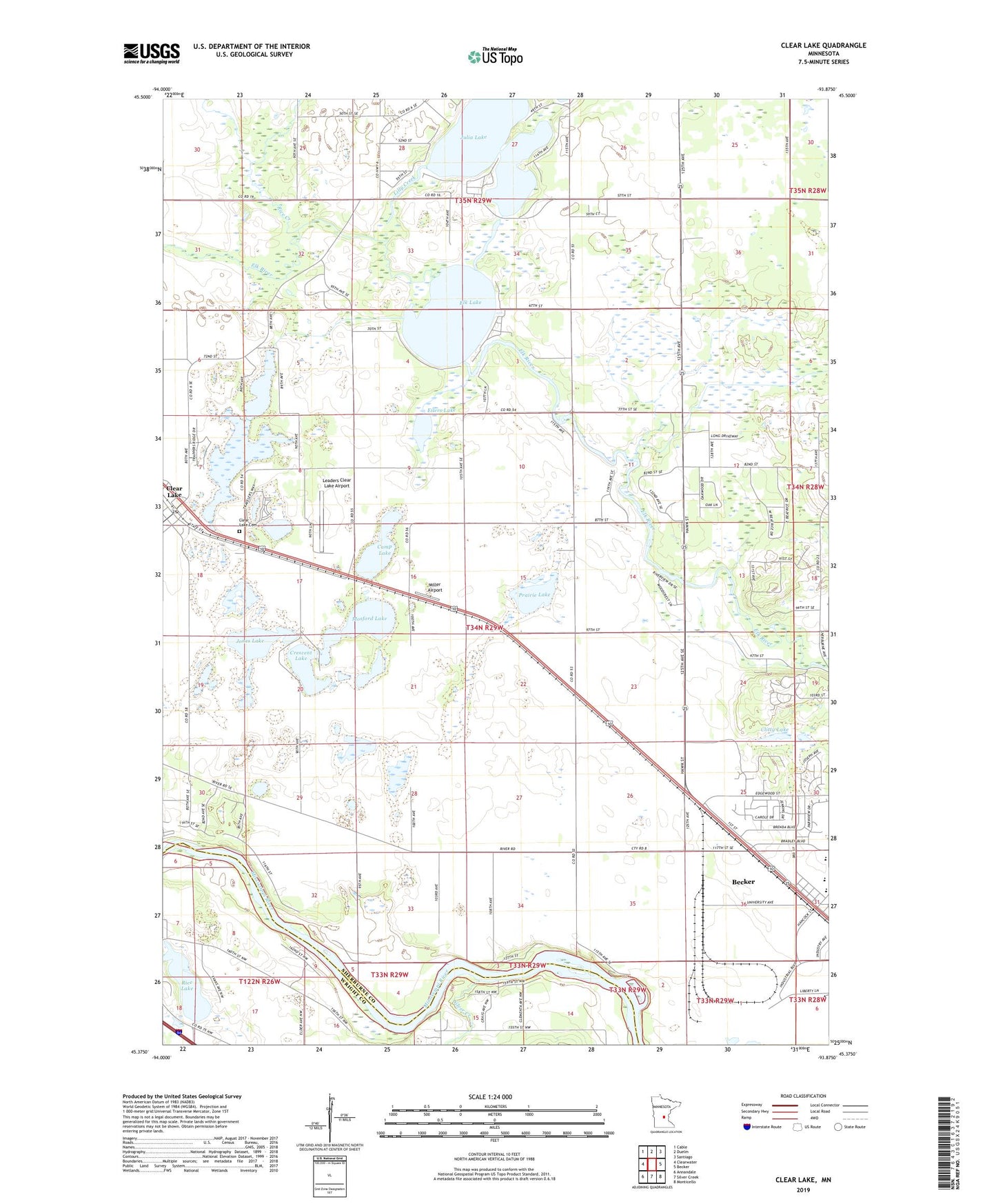
2022 topographic map quadrangle Clear Lake in the state of Minnesota. Scale: 1:24000. Based on the newly updated USGS 7.5' US Topo map series, this map is in the following counties: Sherburne, Wright. The map contains contour data, water features, and other items you are used to seeing on USGS maps, but also has updated roads and other features. This is the next generation of topographic maps. Printed on high-quality waterproof paper with UV fade-resistant inks.
Quads adjacent to this one:
West: Clearwater
Northwest: Cable
North: Duelm
Northeast: Santiago
East: Becker
Southeast: Monticello
South: Silver Creek
Southwest: Annandale
This map covers the same area as the classic USGS quad with code o45093d8.
Contains the following named places: Airstream Park Campgrounds, Becker, Becker Baptist Church, Becker City Park, Briggs Lake, Camp Lake, City of Becker, City of Clear Lake, Clear Lake, Clear Lake Cemetery, Clitty Lake, Crescent Lake, Eilers Lake, Elk Lake, Grace Lutheran Church, Jones Lake, Julia Lake, Lakeview Care Center, Leaders Clear Lake Airport, Lilly Creek, Living Waters Pentecostal Church, Miller Airport, Mosford Lake, Prairie Lake, Rice Creek, Rice Lake, Riverwood RV Park, Rush Lake, Sherburne County Generating Station, Sherburne County Historical Society Museum, Silver Creek, Township of Clear Lake, Travelers Country Club, Travelers Country Club Two, Trinity Lutheran Church, ZIP Code: 55319