MyTopo
Toad Mountain Minnesota US Topo Map
Couldn't load pickup availability
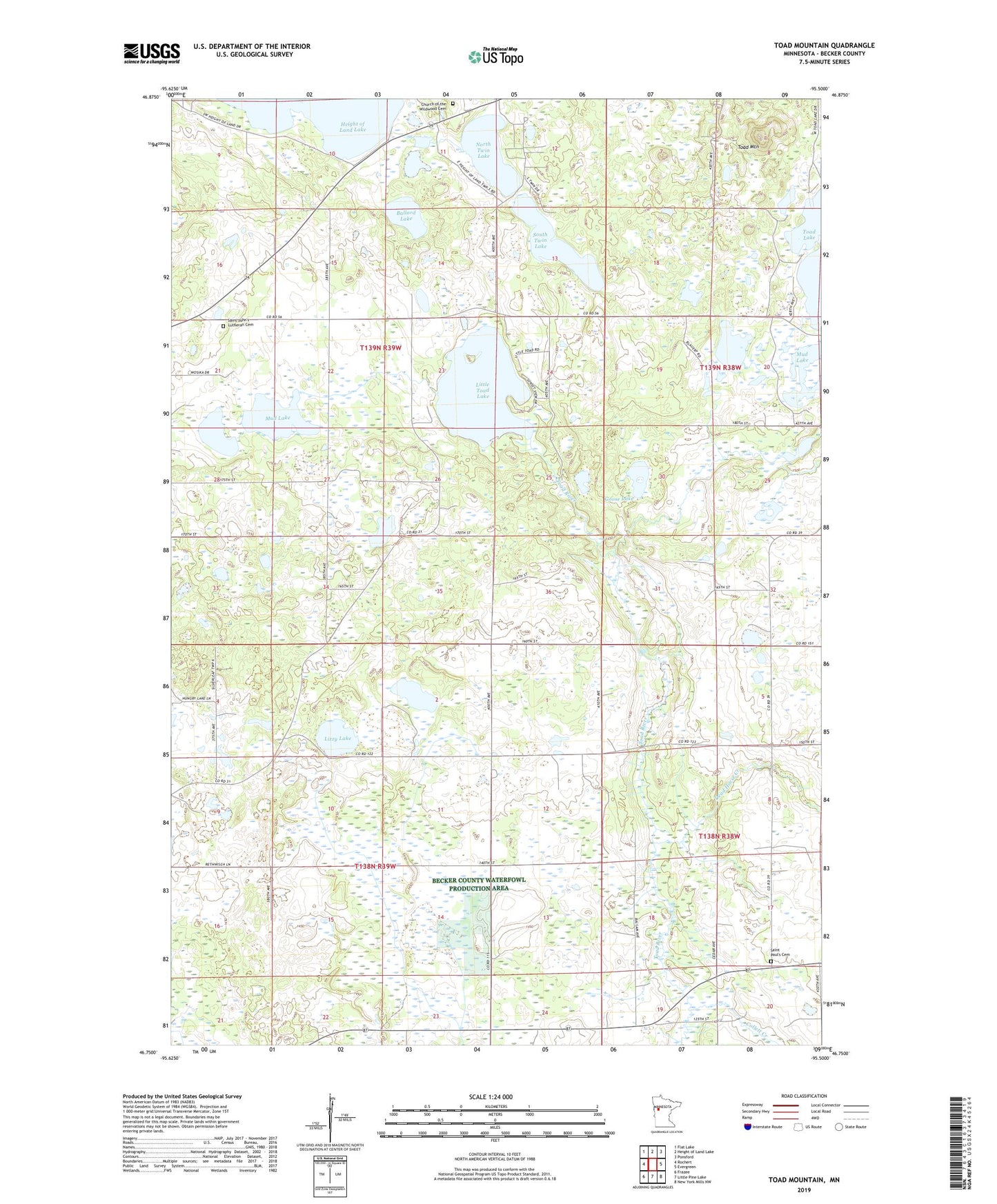
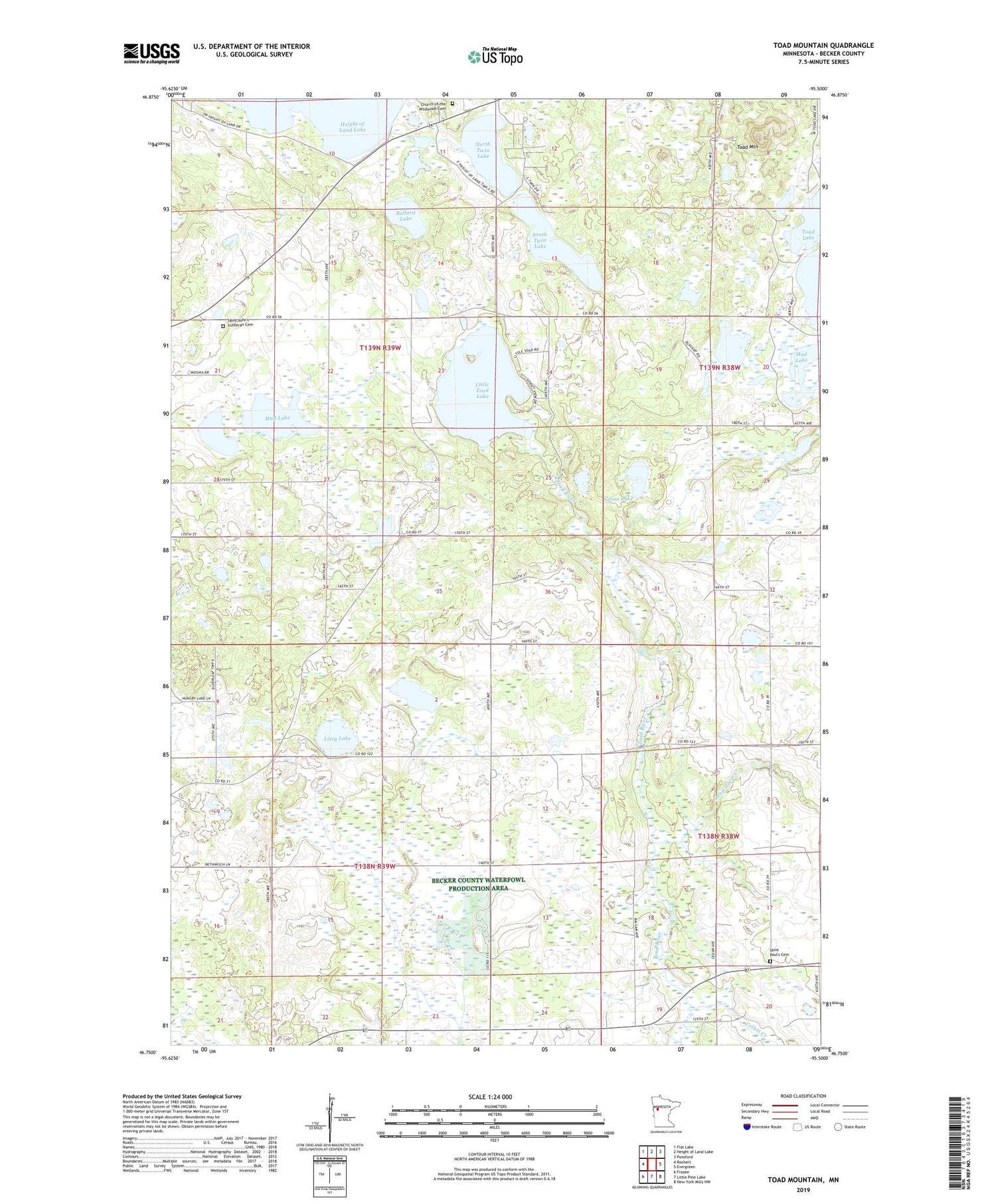
2019 topographic map quadrangle Toad Mountain in the state of Minnesota. Scale: 1:24000. Based on the newly updated USGS 7.5' US Topo map series, this map is in the following counties: Becker. The map contains contour data, water features, and other items you are used to seeing on USGS maps, but also has updated roads and other features. This is the next generation of topographic maps. Printed on high-quality waterproof paper with UV fade-resistant inks.
Quads adjacent to this one:
West: Rochert
Northwest: Flat Lake
North: Height of Land Lake
Northeast: Ponsford
East: Evergreen
Southeast: New York Mills NW
South: Little Pine Lake
Southwest: Frazee
Contains the following named places: Ballard Lake, Birchmere Resort and Campground, Church of the Wildwood Cemetery, Collett Creek, Dead Horse Creek, Engel Dairy Farm, Goose Lake, Jarvis Post Office, Little Toad Lake, Little Toad Lake Campground, Little Toad Lake Dam, Lizzy Lake, Local Post Office, Mud Lake, North Twin Lake, Saint Johns Church, Saint John's Lutheran Cemetery, Saint Paul's Cemetery, Saint Pauls Church, Silver Birch School, Silver Leaf Township State Game Refuge, South Twin Lake, Toad Mountain, Township of Silver Leaf, ZIP Code: 56544