MyTopo
Flat Lake Minnesota US Topo Map
Couldn't load pickup availability
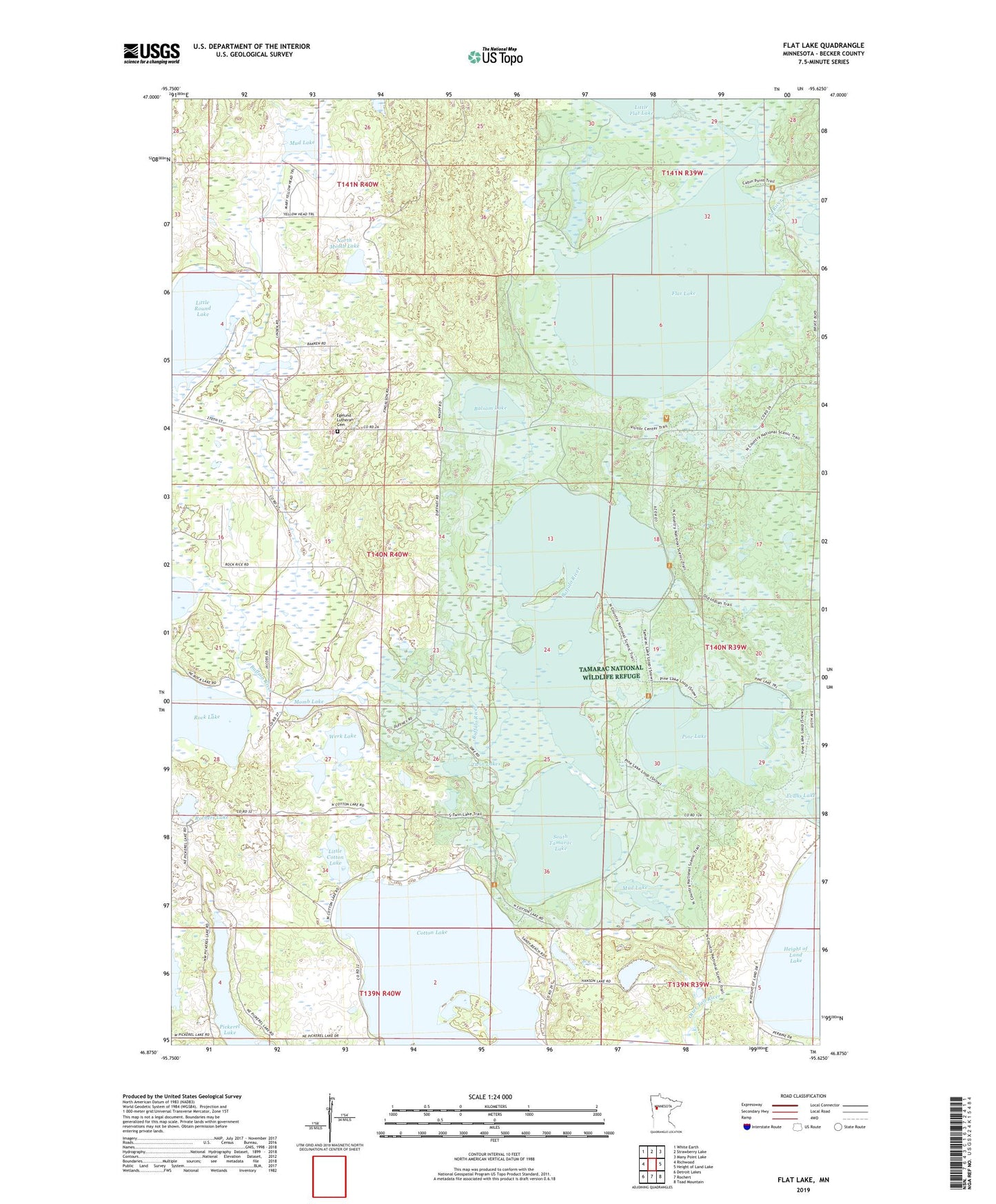
2022 topographic map quadrangle Flat Lake in the state of Minnesota. Scale: 1:24000. Based on the newly updated USGS 7.5' US Topo map series, this map is in the following counties: Becker. The map contains contour data, water features, and other items you are used to seeing on USGS maps, but also has updated roads and other features. This is the next generation of topographic maps. Printed on high-quality waterproof paper with UV fade-resistant inks.
Quads adjacent to this one:
West: Richwood
Northwest: White Earth
North: Strawberry Lake
Northeast: Many Point Lake
East: Height of Land Lake
Southeast: Toad Mountain
South: Rochert
Southwest: Detroit Lakes
This map covers the same area as the classic USGS quad with code o46095h6.
Contains the following named places: Balsam Lake, Balsam Lake Dam, Becker County, Cotton Lake, Egelund Cemetery, Egelund Church, Evans Lake, Flat Lake, Flat Lake Dam, Flat Lake Lookout Tower, Hanson Lake, Height of Land Dam, Little Cotton Lake, Little Flat Lake Lookout Tower, Little Round Lake, Long Lake, Long Lake Dam, Momb Lake, Mud Lake, North Momb Lake, Pine Lake, Rochert Lake, School Number 64, South Tamarac Lake, South Tamarac Lake Dam, Stowe Lake Dam, Stowes Lake, Tamarac Lake, Township of Holmesville, Twin Lakes, Werk Lake, ZIP Code: 56578