MyTopo
Trail Minnesota US Topo Map
Couldn't load pickup availability
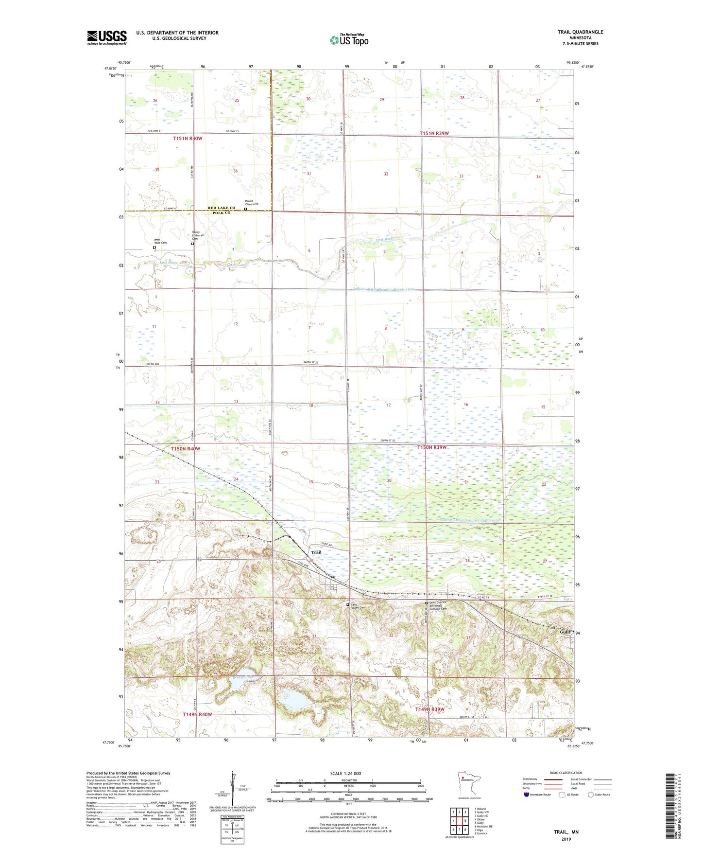
2019 topographic map quadrangle Trail in the state of Minnesota. Scale: 1:24000. Based on the newly updated USGS 7.5' US Topo map series, this map is in the following counties: Polk, Red Lake. The map contains contour data, water features, and other items you are used to seeing on USGS maps, but also has updated roads and other features. This is the next generation of topographic maps. Printed on high-quality waterproof paper with UV fade-resistant inks.
Quads adjacent to this one:
West: Oklee
Northwest: Roland
North: Gully NW
Northeast: Gully NE
East: Gully
Southeast: Gonvick
South: Olga
Southwest: McIntosh NE
Contains the following named places: Bethany Church, Breeze Lake, City of Trail, County Ditch Number Eightynine, Dice Trailer Park, Griebrok Post Office, Hangaard State Wildlife Management Area, Judicial Ditch Number Seventytwo, Mount Olive Cemetery, Saint Charles Borromeo Catholic Cemetery, Saint Charles Church, Sand Valley Cemetery, Township of Gully, Trail, Trail Post Office, Valle Church, Valley Lutheran Cemetery, Wanke Post Office, West Valle Cemetery, ZIP Codes: 56646, 56684