MyTopo
Veseli Minnesota US Topo Map
Couldn't load pickup availability
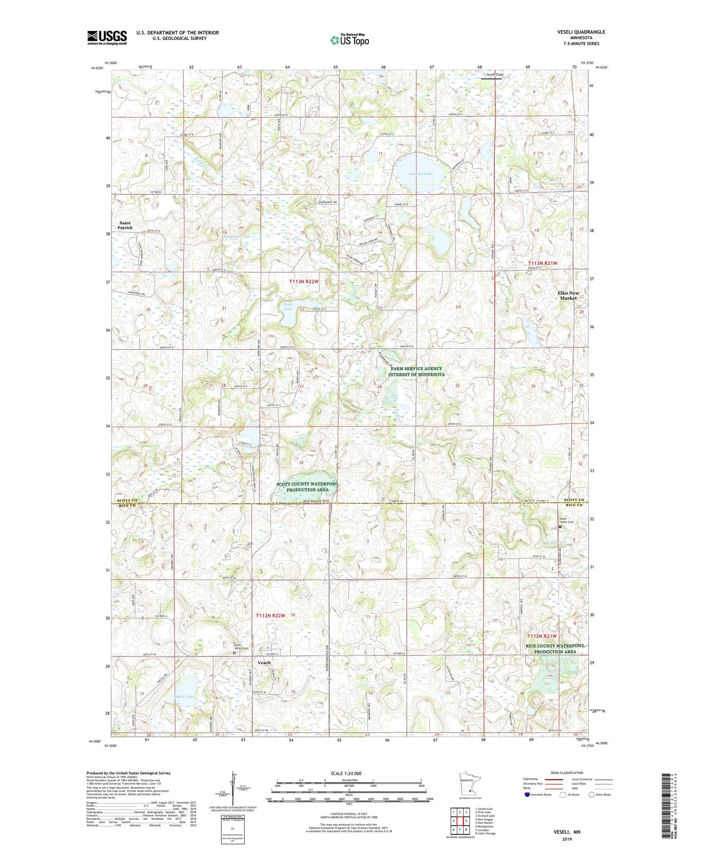
2019 topographic map quadrangle Veseli in the state of Minnesota. Scale: 1:24000. Based on the newly updated USGS 7.5' US Topo map series, this map is in the following counties: Scott, Rice. The map contains contour data, water features, and other items you are used to seeing on USGS maps, but also has updated roads and other features. This is the next generation of topographic maps. Printed on high-quality waterproof paper with UV fade-resistant inks.
Quads adjacent to this one:
West: New Prague
Northwest: Jordan East
North: Prior Lake
Northeast: Orchard Lake
East: New Market
Southeast: Little Chicago
South: Lonsdale
Southwest: Montgomery
Contains the following named places: Bob's Bluebird Orchard, Bradshaw Lake, Cedar Lake, Cedarlake Post Office, Dvorak Wildlife Pond, Dvorak Wildlife Pond Dam, Hatch Lake, Lennon Lake, Nash Lake, Plum Creek Post Office, Porter Creek, Saint Johns Cemetery, Saint Patrick State Wildlife Management Area, Scott County Waterfowl Production Area, Smith Field, Sweetland Orchard, Thomas Dairy Farm, Thompson's Hillcrest Orchard, Township of Cedar Lake, Township of Wheatland, Veseli, ZIP Code: 55088