MyTopo
Warroad NW Minnesota US Topo Map
Couldn't load pickup availability
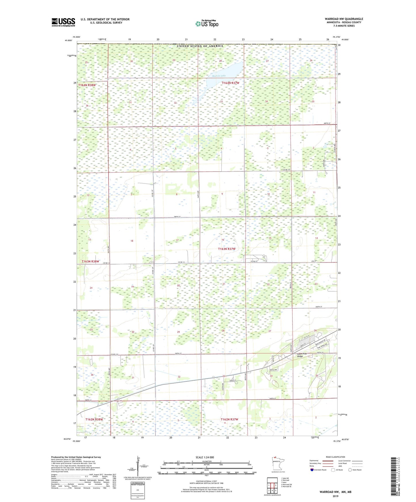
2019 topographic map quadrangle Warroad NW in the state of Minnesota. Scale: 1:24000. Based on the newly updated USGS 7.5' US Topo map series, this map is in the following counties: Roseau. The map contains contour data, water features, and other items you are used to seeing on USGS maps, but also has updated roads and other features. This is the next generation of topographic maps. Printed on high-quality waterproof paper with UV fade-resistant inks.
Quads adjacent to this one:
West: Salol NE
East: Warroad
Southeast: Warroad SE
South: Warroad SW
Southwest: Salol
Contains the following named places: Lone Pine Ridge, Marvin Lake, New Life Assembly of God Church, Township of Lake, United States Customs and Border Protection - Port of Entry - Warroad Minnesota