MyTopo
Warroad SE Minnesota US Topo Map
Couldn't load pickup availability
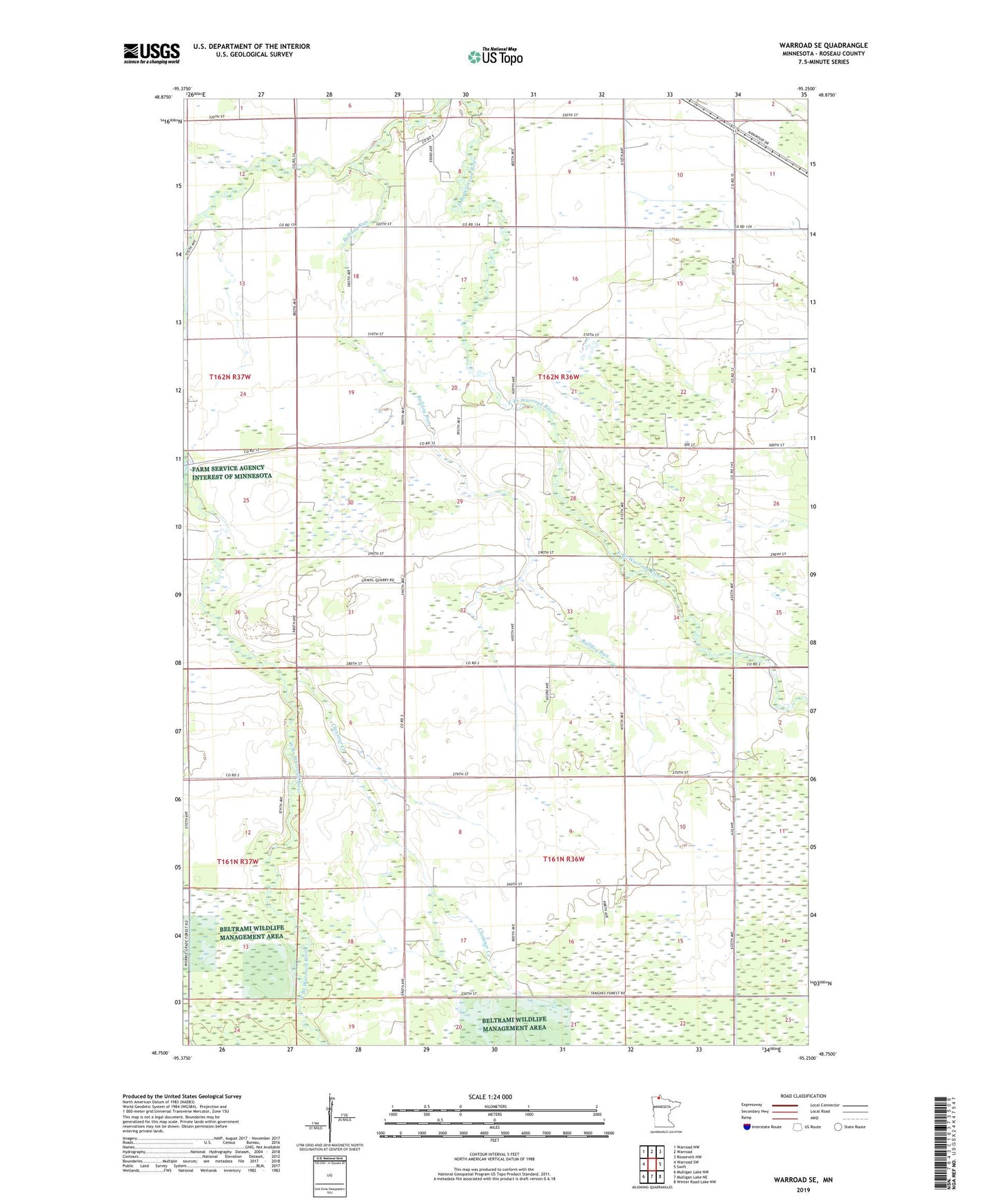
2022 topographic map quadrangle Warroad SE in the state of Minnesota. Scale: 1:24000. Based on the newly updated USGS 7.5' US Topo map series, this map is in the following counties: Roseau. The map contains contour data, water features, and other items you are used to seeing on USGS maps, but also has updated roads and other features. This is the next generation of topographic maps. Printed on high-quality waterproof paper with UV fade-resistant inks.
Quads adjacent to this one:
West: Warroad SW
Northwest: Warroad NW
North: Warroad
Northeast: Roosevelt NW
East: Swift
Southeast: Winter Road Lake NW
South: Mulligan Lake NE
Southwest: Mulligan Lake NW
This map covers the same area as the classic USGS quad with code o48095g3.
Contains the following named places: America Post Office, Bulldog Run, Clausner Creek, County Ditch Number Twentyfive, Mennonite Church, Township of Moranville, ZIP Code: 56763