MyTopo
Welch Minnesota US Topo Map
Couldn't load pickup availability
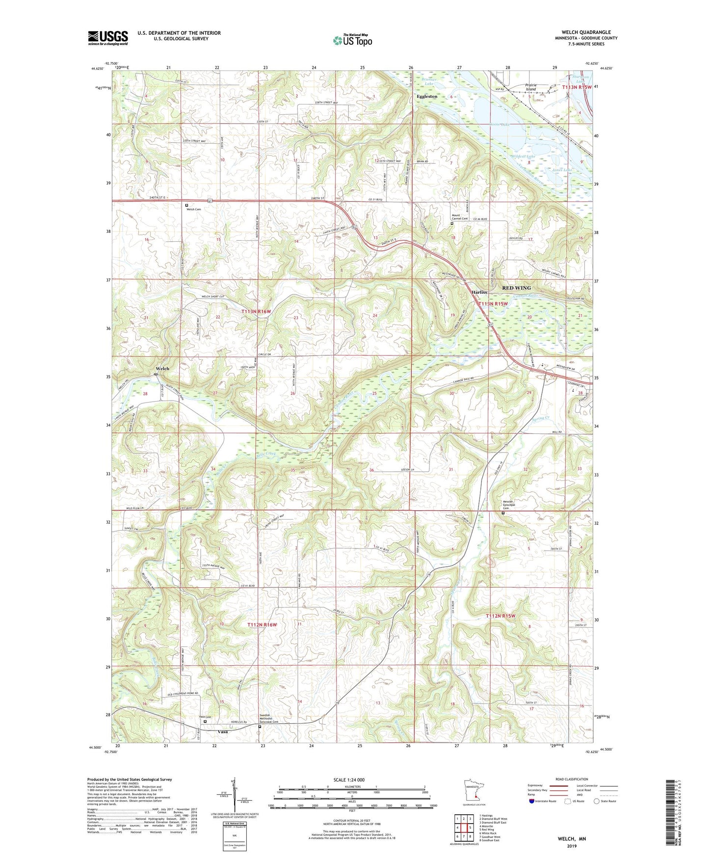
2019 topographic map quadrangle Welch in the state of Minnesota. Scale: 1:24000. Based on the newly updated USGS 7.5' US Topo map series, this map is in the following counties: Goodhue. The map contains contour data, water features, and other items you are used to seeing on USGS maps, but also has updated roads and other features. This is the next generation of topographic maps. Printed on high-quality waterproof paper with UV fade-resistant inks.
Quads adjacent to this one:
West: Miesville
Northwest: Hastings
North: Diamond Bluff West
Northeast: Diamond Bluff East
East: Red Wing
Southeast: Goodhue East
South: Goodhue West
Southwest: White Rock
Contains the following named places: Belle Creek, Birch Lake, Brunner Lake, Burnside School, Catfish Slough, Cross of Christ Church, Donald Johnson Dam, Eggleston, Eggleston Post Office, Goose Lake, Harliss, Harold Eckblad Dam, Indian Slough, Jones Lake, Messiah Episcopal Cemetery, Mount Carmel Cemetery, Swedish Methodist Episcopal Cemetery, Township of Vasa, Township of Welch, Vasa, Vasa Cemetery, Vasa Evangelical Lutheran Church, Vasa Museum, Vasa Post Office, Vasa: Mattson's Settlement Historical Marker, Vermillion River, Welch, Welch Cemetery, Welch Church, Welch Dam, Welch Post Office, Welch Village Ski Area, Wildcat Lake, ZIP Code: 55089