MyTopo
Diamond Bluff East Wisconsin US Topo Map
Couldn't load pickup availability
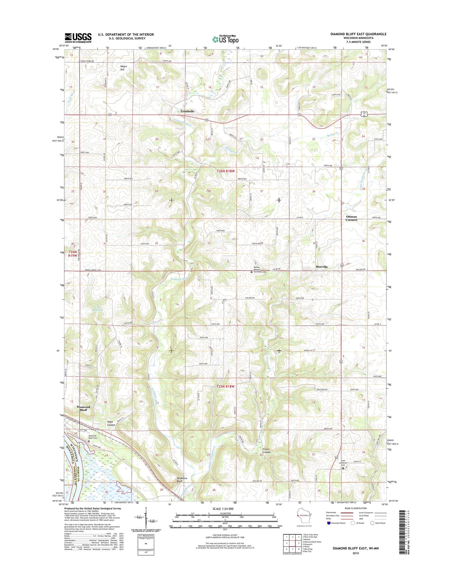
2022 topographic map quadrangle Diamond Bluff East in the state of Wisconsin. Scale: 1:24000. Based on the newly updated USGS 7.5' US Topo map series, this map is in the following counties: Pierce, Goodhue. The map contains contour data, water features, and other items you are used to seeing on USGS maps, but also has updated roads and other features. This is the next generation of topographic maps. Printed on high-quality waterproof paper with UV fade-resistant inks.
Quads adjacent to this one:
West: Diamond Bluff West
Northwest: River Falls West
North: River Falls East
Northeast: Martell
East: Ellsworth
Southeast: Bay City
South: Red Wing
Southwest: Welch
This map covers the same area as the classic USGS quad with code o44092f5.
Contains the following named places: .46 Reservoir, 54014, Bernard Kemmerer G8637 Dam, Bethel Church, Bethel Mission Covenant Cemetery, Diamond Bluff Cemetery, Diamond Bluff Census Designated Place, Fisher Coulee, H G Armbruster Group Dam, Hope Coulee, Lindgren Elementary School, Little Trimbelle Creek, Moeville, Negro Hill, Ottman Corners, Skidmore Bluff, Spring Creek, Svea Lutheran Cemetery, Svea Lutheran Church, Town of Diamond Bluff, Town of Trenton, Town of Trimbelle, Trimbelle