MyTopo
Willow River Minnesota US Topo Map
Couldn't load pickup availability
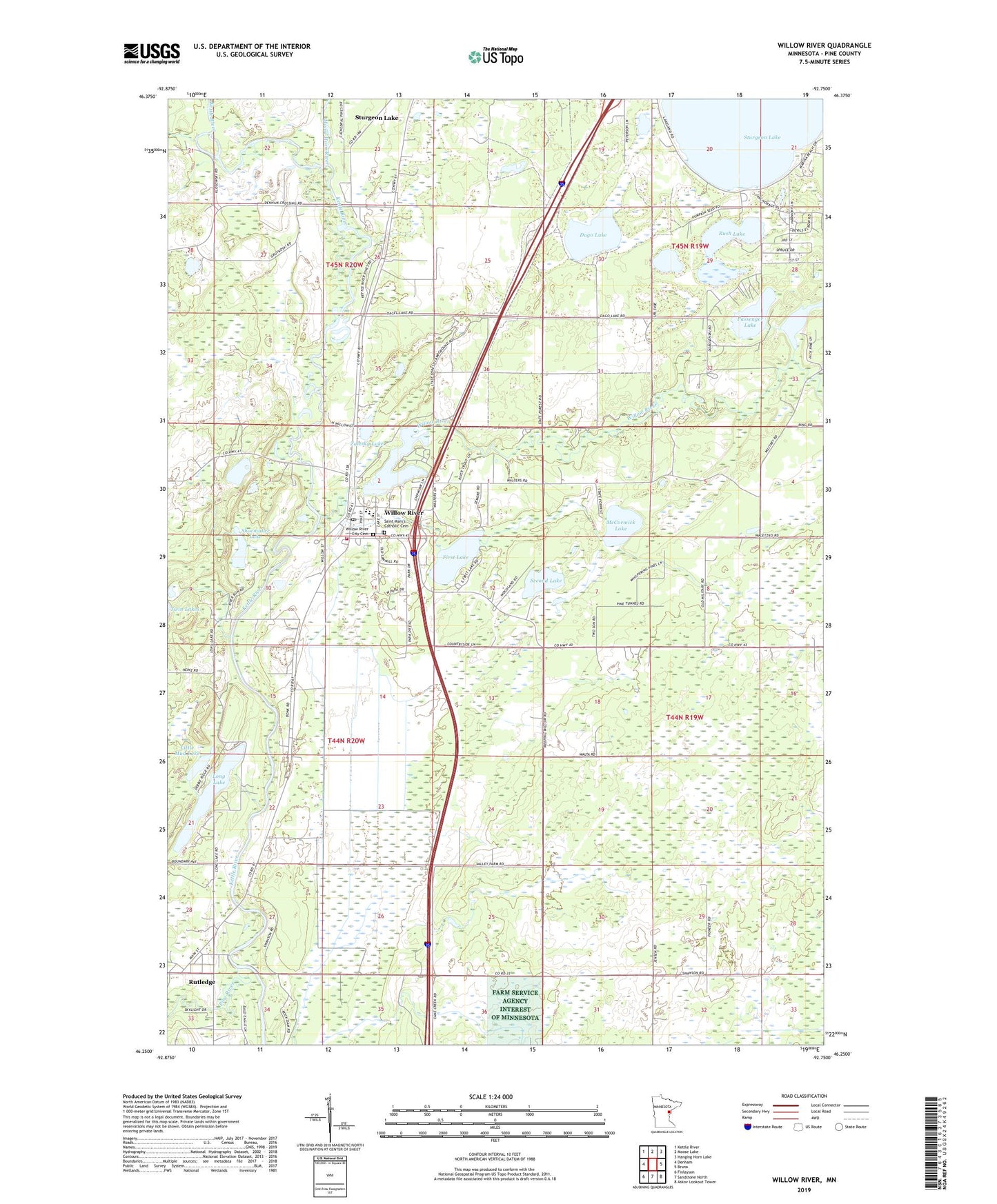
2019 topographic map quadrangle Willow River in the state of Minnesota. Scale: 1:24000. Based on the newly updated USGS 7.5' US Topo map series, this map is in the following counties: Pine. The map contains contour data, water features, and other items you are used to seeing on USGS maps, but also has updated roads and other features. This is the next generation of topographic maps. Printed on high-quality waterproof paper with UV fade-resistant inks.
Quads adjacent to this one:
West: Denham
Northwest: Kettle River
North: Moose Lake
Northeast: Hanging Horn Lake
East: Bruno
Southeast: Askov Lookout Tower
South: Sandstone North
Southwest: Finlayson
Contains the following named places: Big Slough Lake, Birch Creek, Christopher C Andrews Conservation Pioneer Historical Marker, City of Rutledge, City of Willow River, Dago Lake, Edelweiss Campground, First Lake, General Andrews South Bound Rest Area, General C C Andrews State Forest, Little Mud Lake, Long Lake, McCormick Lake, Moose Horn River, Obie's Chengwatana Trail Campground, Passenger Lake, Pine River, Rush Lake, Rutledge, Saint Mary's Catholic Cemetery, Saint Mary's Church, Second Lake, Shoemaker Lake, Township of Kettle River, Township of Sturgeon Lake, West Fork Desmoines River Dam, Wilderness Campgrounds, Willow River, Willow River Camp, Willow River Campground, Willow River City Cemetery, Willow River City Hall, Willow River Dam, Willow River Fire Department, Willow River Lookout Tower, Willow River Mobile Home Park, Willow River Post Office, Willow River Reservoir, Willow River School, Zalesky Lake