MyTopo
Wolverton Minnesota US Topo Map
Couldn't load pickup availability
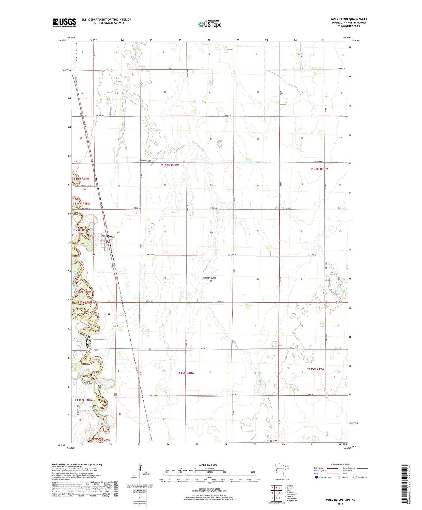
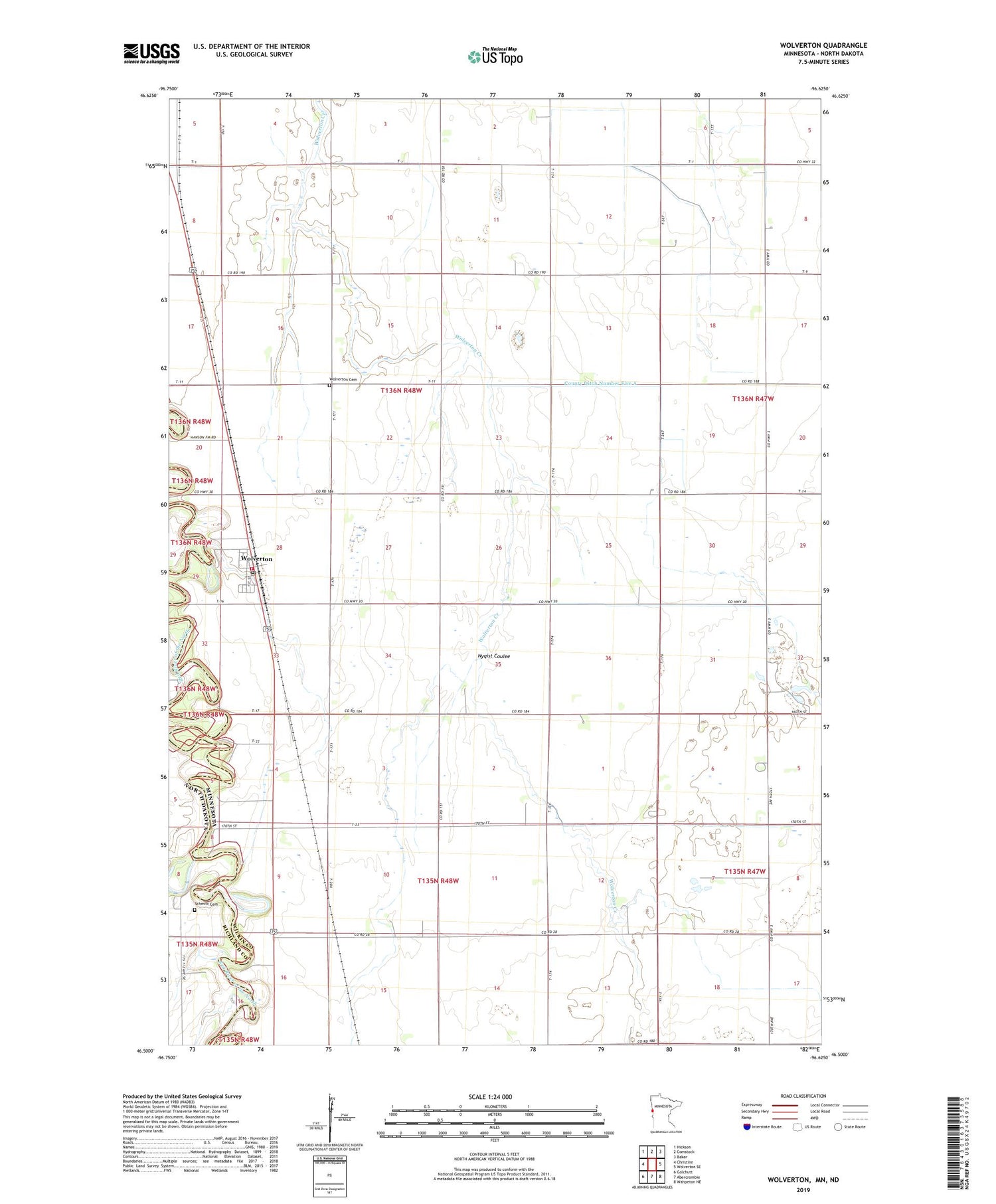
2019 topographic map quadrangle Wolverton in the states of Minnesota, North Dakota. Scale: 1:24000. Based on the newly updated USGS 7.5' US Topo map series, this map is in the following counties: Wilkin, Richland. The map contains contour data, water features, and other items you are used to seeing on USGS maps, but also has updated roads and other features. This is the next generation of topographic maps. Printed on high-quality waterproof paper with UV fade-resistant inks.
Quads adjacent to this one:
West: Christine
Northwest: Hickson
North: Comstock
Northeast: Baker
East: Wolverton SE
Southeast: Wahpeton NE
South: Abercrombie
Southwest: Galchutt
Contains the following named places: City of Wolverton, County Ditch Number Five A, County Ditch Number Twentysix, Deerhorn Church, Evangelical Free Church, Faith Lutheran Church, KLTA-FM (Breckenridge), Nyqist Coulee, Schmitt Cemetery, Township of Roberts, Township of Wolverton, Wolverton, Wolverton Cemetery, Wolverton Fire Department, Wolverton Post Office, ZIP Code: 56594