MyTopo
Abercrombie North Dakota US Topo Map
Couldn't load pickup availability
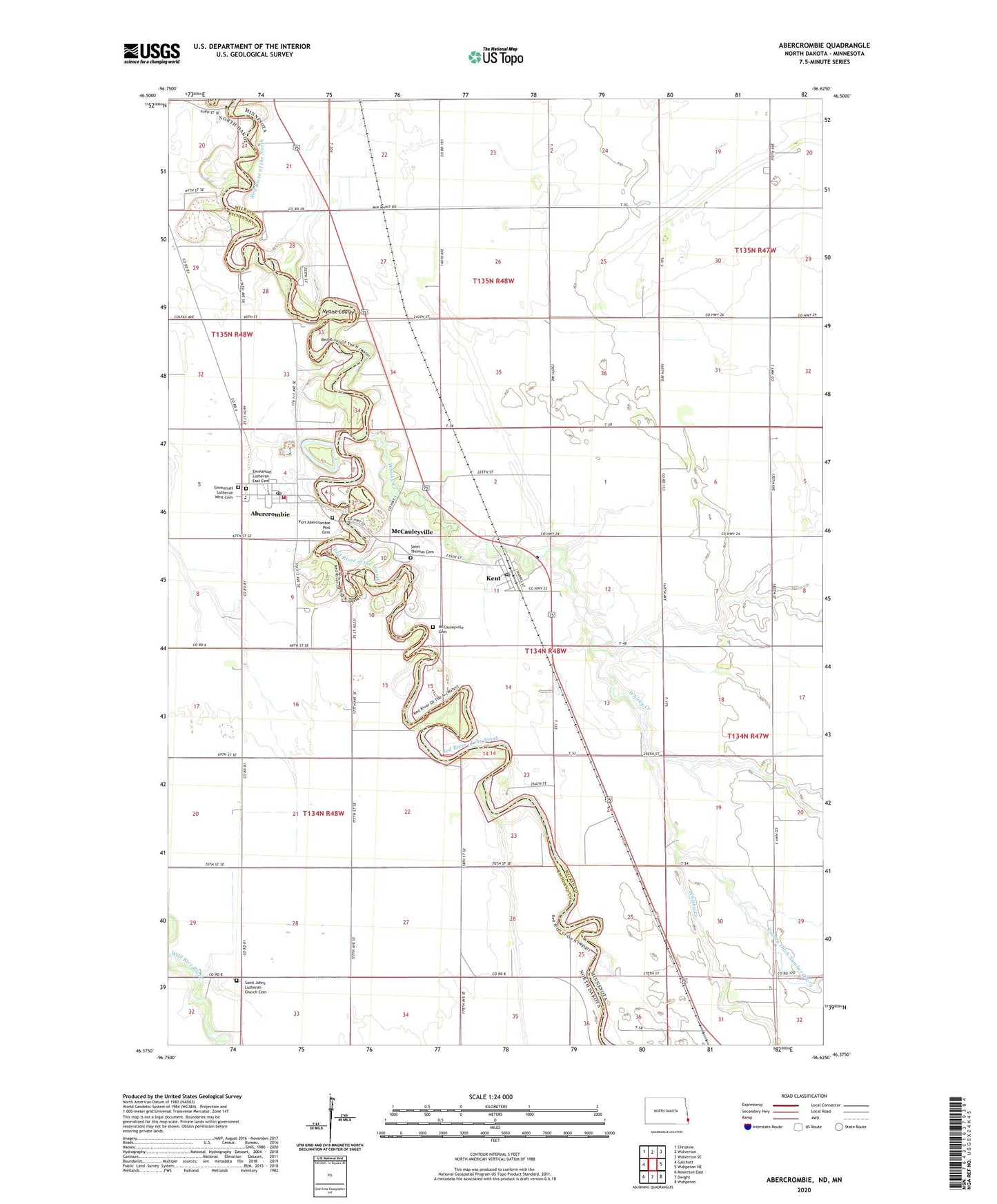
2024 topographic map quadrangle Abercrombie in the states of Minnesota, North Dakota. Scale: 1:24000. Based on the newly updated USGS 7.5' US Topo map series, this map is in the following counties: Richland, Wilkin. The map contains contour data, water features, and other items you are used to seeing on USGS maps, but also has updated roads and other features. This is the next generation of topographic maps. Printed on high-quality waterproof paper with UV fade-resistant inks.
Quads adjacent to this one:
West: Galchutt
Northwest: Christine
North: Wolverton
Northeast: Wolverton SE
East: Wahpeton NE
Southeast: Wahpeton
South: Dwight
Southwest: Mooreton East
This map covers the same area as the classic USGS quad with code o46096d6.
Contains the following named places: Abercrombie, Abercrombie Fire Department, Abercrombie Post Office, City of Abercrombie, City of Kent, County Ditch Number 1, County Ditch Number Twentynine, Emmanuel Lutheran East Cemetery, Emmanuel Lutheran West Cemetery, Fort Abercrombie Historical Marker, Fort Abercrombie Post Cemetery, Fort Abercrombie State Park, Kent, Kent Post Office, McCauleysville Post Office, McCauleyville, McCauleyville Cemetery, Richland Elementary School, Saint Johns Church, Saint Johns Lutheran Church Cemetery, Saint Thomas Catholic Church, Saint Thomas Cemetery, Township of McCauleyville, Whisky Creek, ZIP Code: 58001