MyTopo
Wrightstown Minnesota US Topo Map
Couldn't load pickup availability
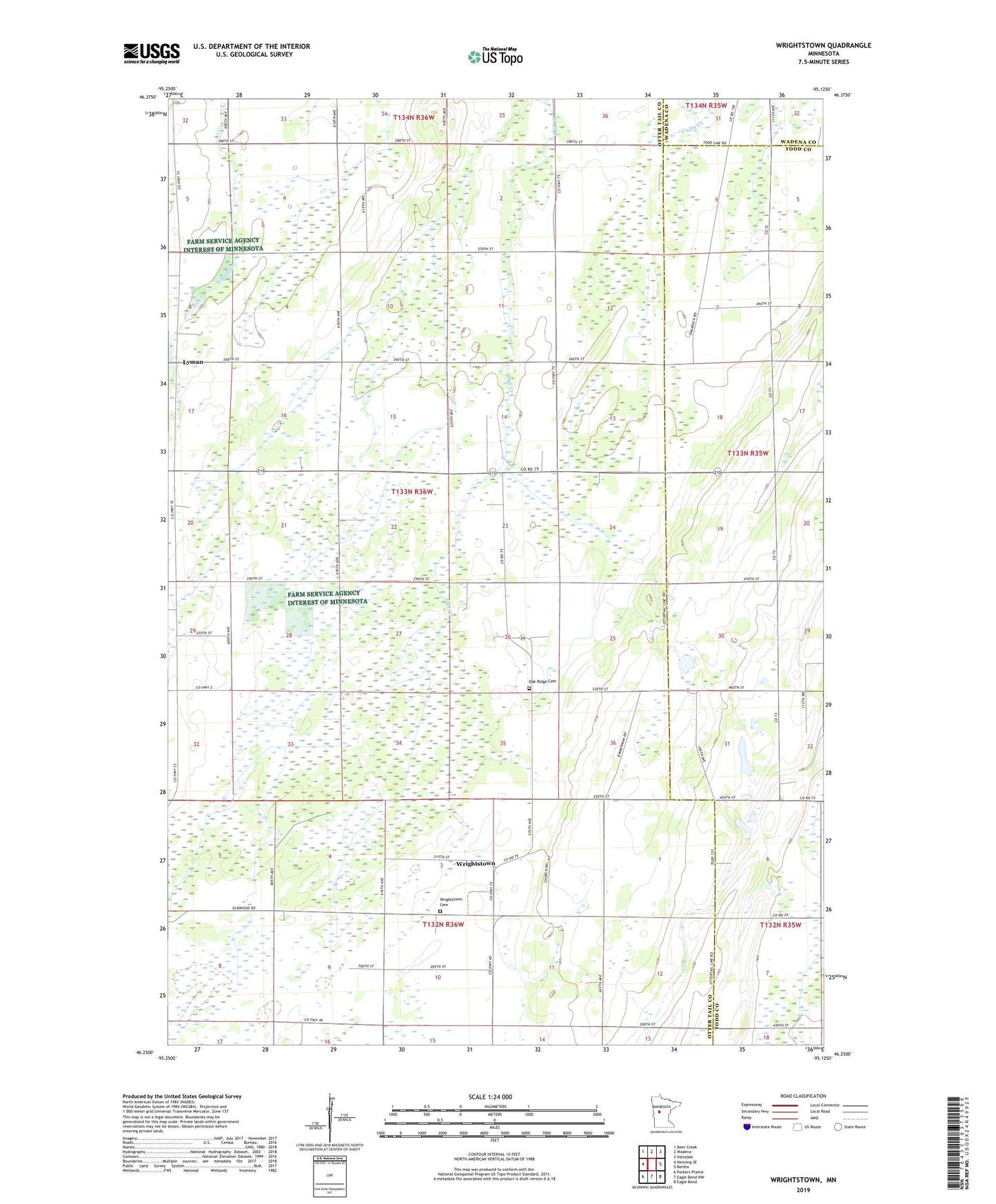
2019 topographic map quadrangle Wrightstown in the state of Minnesota. Scale: 1:24000. Based on the newly updated USGS 7.5' US Topo map series, this map is in the following counties: Otter Tail, Todd, Wadena. The map contains contour data, water features, and other items you are used to seeing on USGS maps, but also has updated roads and other features. This is the next generation of topographic maps. Printed on high-quality waterproof paper with UV fade-resistant inks.
Quads adjacent to this one:
West: Henning SE
Northwest: Deer Creek
North: Wadena
Northeast: Verndale
East: Bertha
Southeast: Eagle Bend
South: Eagle Bend NW
Southwest: Parkers Prairie
Contains the following named places: KWAD-AM (Wadena), Lyman, Lyman Post Office, Oak Ridge Cemetery, Ramsdell Post Office, Township of Oak Valley, Union Corner Church, United Church, Wrightstown, Wrightstown Cemetery, Wrightstown Post Office, ZIP Code: 56453