MyTopo
Bertha Minnesota US Topo Map
Couldn't load pickup availability
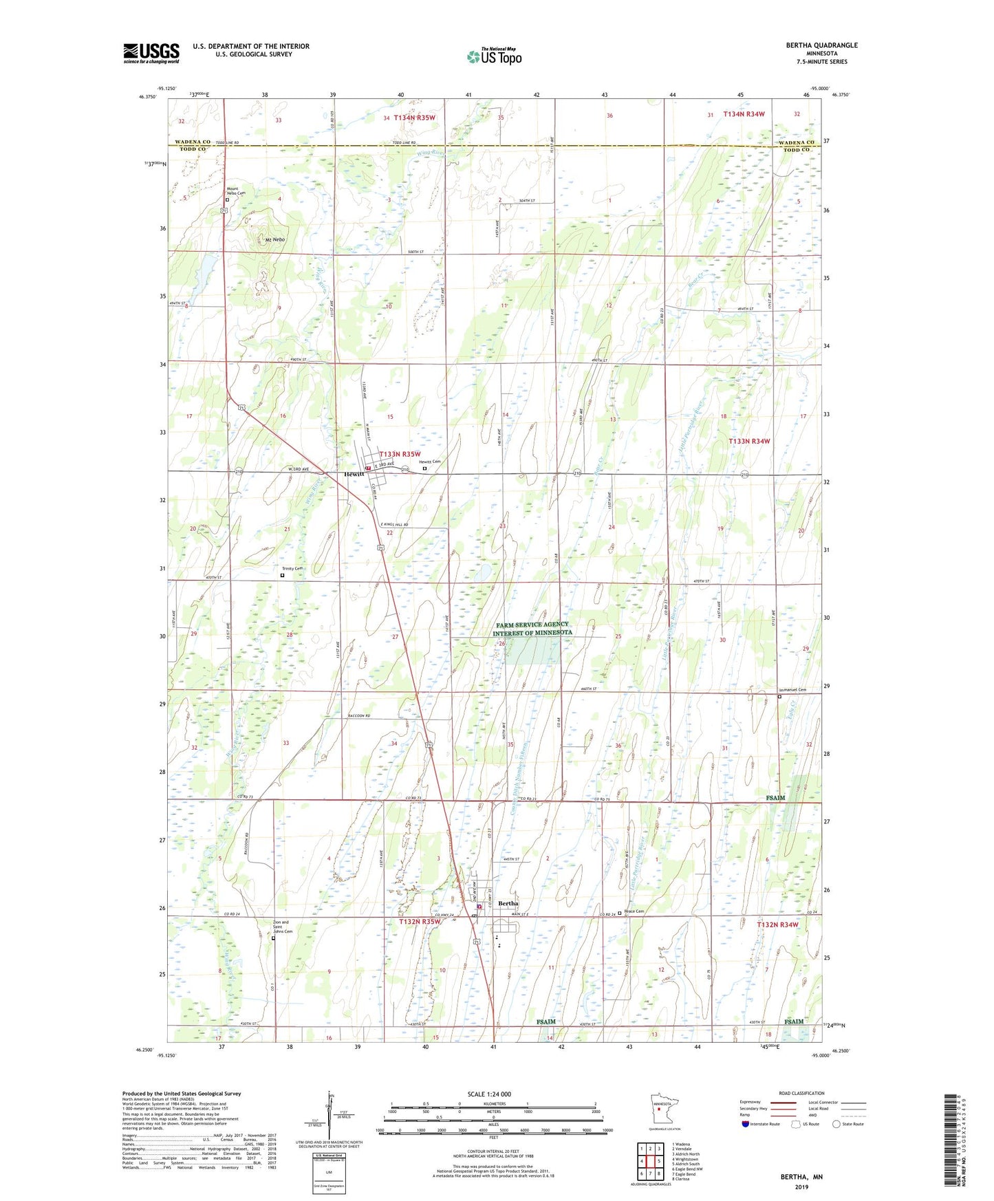
2022 topographic map quadrangle Bertha in the state of Minnesota. Scale: 1:24000. Based on the newly updated USGS 7.5' US Topo map series, this map is in the following counties: Todd, Wadena. The map contains contour data, water features, and other items you are used to seeing on USGS maps, but also has updated roads and other features. This is the next generation of topographic maps. Printed on high-quality waterproof paper with UV fade-resistant inks.
Quads adjacent to this one:
West: Wrightstown
Northwest: Wadena
North: Verndale
Northeast: Aldrich North
East: Aldrich South
Southeast: Clarissa
South: Eagle Bend
Southwest: Eagle Bend NW
This map covers the same area as the classic USGS quad with code o46095c1.
Contains the following named places: Bear Creek, Bertha, Bertha City Hall, Bertha Fire Department, Bertha Hewitt Schools, Bertha Medical Clinic, Bertha Police Department, Bertha Post Office, Bertha Wayside Park, Church of God, Church of the Nazarene, City of Bertha, City of Hewitt, County Ditch Number Fifteen, Faith United Church of Christ, Hewitt, Hewitt Cemetery, Hewitt Fire Department, Hewitt Post Office, Hewitt Rest Area, Immanuel Cemetery, Immanuel Church, Kramer Dam, Kramers Lake, Mount Nebo, Mount Nebo Cemetery, Peace Cemetery, Saint Joseph's Church, Saint Paul's Lutheran Church, Township of Stowe Prairie, Trinity Cemetery, United Methodist Church, Zion and Saint Johns Cemetery