MyTopo
Bagley Lake Mississippi US Topo Map
Couldn't load pickup availability
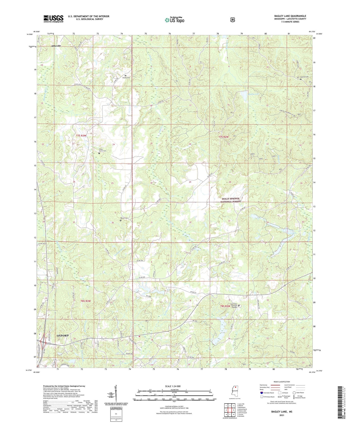
2021 topographic map quadrangle Bagley Lake in the state of Mississippi. Scale: 1:24000. Based on the newly updated USGS 7.5' US Topo map series, this map is in the following counties: Lafayette. The map contains contour data, water features, and other items you are used to seeing on USGS maps, but also has updated roads and other features. This is the next generation of topographic maps. Printed on high-quality waterproof paper with UV fade-resistant inks.
Quads adjacent to this one:
West: Oxford North
Northwest: Laws Hill
North: Malone
Northeast: Bethlehem
East: Puskus Lake
Southeast: Denmark
South: Yocona
Southwest: Oxford South
Contains the following named places: Adams Store, Anderson Chapel, Avent Lake Dam, Bagley Lake, Bay Springs Branch, Bay Springs Church, Brazil Lake Dam, Cambridge School, Camp Hopewell, Cedar Grove Cemetery, Christ United Church, Corner Church, Corner School, Cullen School, First Free Will Baptist Church, Greenville Church, Greenville School, Gunter Lake Dam, Holder School, Hopewell Church, Hopewell School, Jefferson Chapel, Jefferson School, Kingdom Hall, Lafayette County Fire Department Station 2 Highway 30, Little John Store, LT 15-1 Dam, Martin Cemetery, Midway Cemetery, Midway Church, Mitchells School, Oak Grove Memorial Gardens, Owens Cemetery, Oxford Elementary School, Oxford Work Center, Philadelphia Missionary Church, Philadelphia School, Saint Peters Church, Smiths Chapel, Stuart Lake Dam, Tidwell School, Violet Hill School, Woodland Hills Estates, ZIP Code: 38601