MyTopo
Bethlehem Mississippi US Topo Map
Couldn't load pickup availability
Also explore the Bethlehem Forest Service Topo of this same quad for updated USFS data
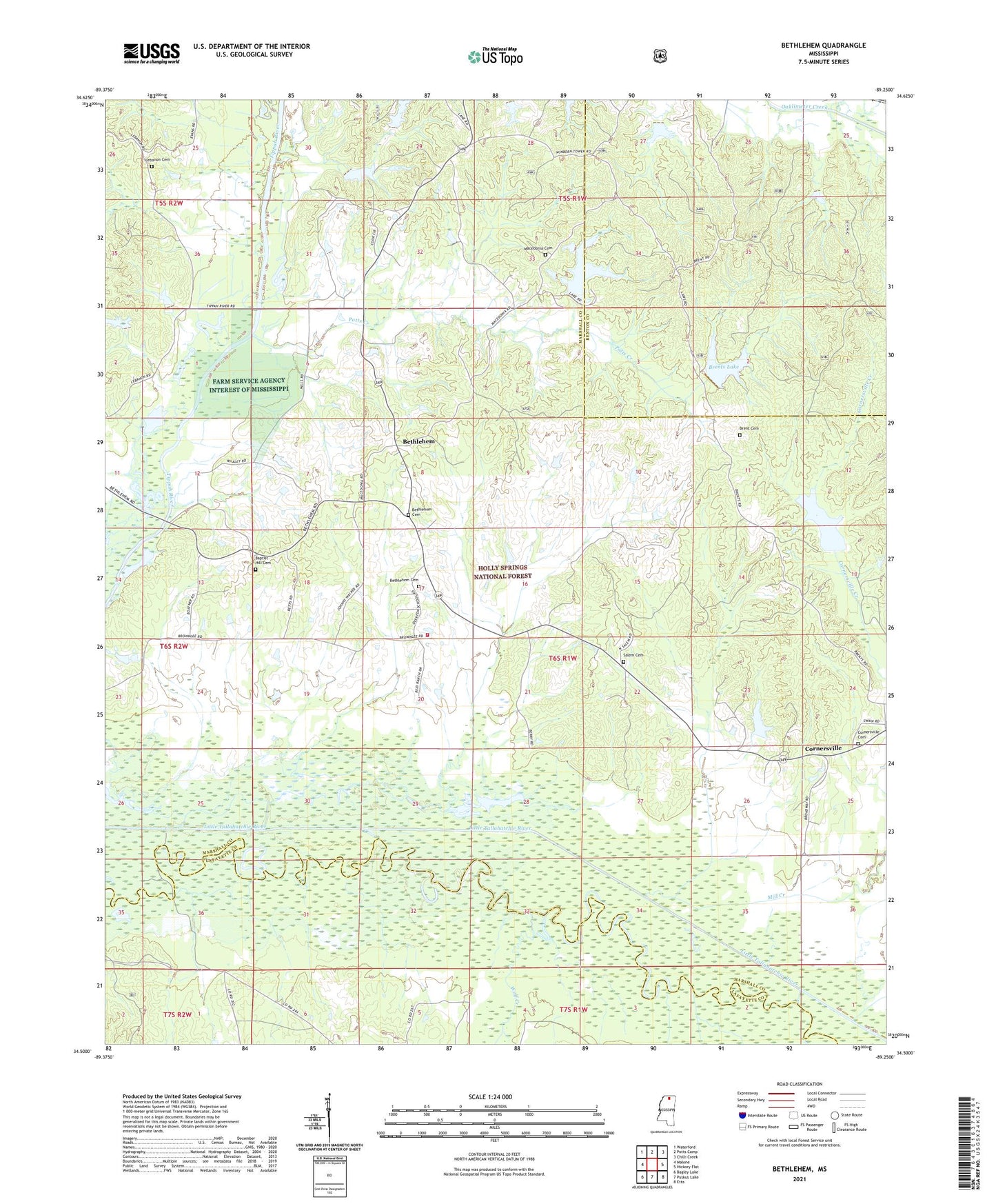
2024 topographic map quadrangle Bethlehem in the state of Mississippi. Scale: 1:24000. Based on the newly updated USGS 7.5' US Topo map series, this map is in the following counties: Marshall, Benton, Lafayette. The map contains contour data, water features, and other items you are used to seeing on USGS maps, but also has updated roads and other features. This is the next generation of topographic maps. Printed on high-quality waterproof paper with UV fade-resistant inks.
Quads adjacent to this one:
West: Malone
Northwest: Waterford
North: Potts Camp
Northeast: Chilli Creek
East: Hickory Flat
Southeast: Etta
South: Puskus Lake
Southwest: Bagley Lake
This map covers the same area as the classic USGS quad with code o34089e3.
Contains the following named places: Baker and Maxie Mill, Baptist Hill Cemetery, Baptist Hill Church, Bethlehem, Bethlehem Cemetery, Bethlehem Census Designated Place, Bethlehem Church, Bethlehem School, Brent Cemetery, Brents Lake, Cornersville, Cornersville Cemetery, Cypress Creek, Goodmans Ferry, Holly Springs National Forest, Lebanon Cemetery, Little Tallahatchie Canal, Macedonia Cemetery, Macedonia Church, Mill Creek, Mount Ollie Church, Oaklimeter Watershed LT-8-21 Dam, Overton School, Potts Camp Volunteer Fire Department Bethlehem Station, Potts Creek, Rhea Lake Dam, Riverside, Riverside Church, Riverside School, Robinson Lake Dam, Salem Cemetery, Salem Church, Spence Branch, Taylor Lake Dam, Tippah River Watershed LT-7-21 Dam, Wares Bridge, Winborn Lookout Tower, Wolf Creek, ZIP Code: 38659