MyTopo
Bellefontaine Mississippi US Topo Map
Couldn't load pickup availability
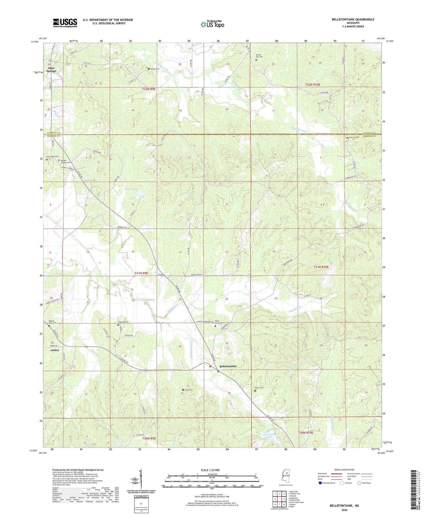
2020 topographic map quadrangle Bellefontaine in the state of Mississippi. Scale: 1:24000. Based on the newly updated USGS 7.5' US Topo map series, this map is in the following counties: Webster, Calhoun. The map contains contour data, water features, and other items you are used to seeing on USGS maps, but also has updated roads and other features. This is the next generation of topographic maps. Printed on high-quality waterproof paper with UV fade-resistant inks.
Quads adjacent to this one:
West: Cadaretta
Northwest: Big Creek
North: Calhoun City
Northeast: Atlanta
East: Hohenlinden
Southeast: Sapa
South: Eupora
Southwest: Little Sand Creek
Contains the following named places: American Legion, Bellefontaine, Bellefontaine Creek, Bellefontaine Methodist Church, Bellefontaine Post Office, Bellefontaine School, Bellefontaine Volunteer Fire Department, Dorroh Lake, Dorroh Lake Chapel, Dorroh Lake Dam, Double Springs Cemetery, Double Springs Church, Double Springs School, Dumas Church, Dumas School, Embry, Fellowship Church, Ford Cemetery, Hardy Lake Dam, Little Creek, Lovette Cemetery, McCain, Middleton, New Hope Baptist Church, New Hope Cemetery, North Union Cemetery, North Union Church, Old Bellefontaine, Pilgrim Rest Church, Pilgrim's Rest Baptist Church Cemetery, Point Pleasant School, Quinn Cemetery, Sabougla Creek, Slate Spring, Spencer Cemetery, Spring Hill Cemetery, Spring Hill Church, Vance, Vance Cemetery, West Lake Dam, ZIP Code: 39737