MyTopo
Cayuga Mississippi US Topo Map
Couldn't load pickup availability
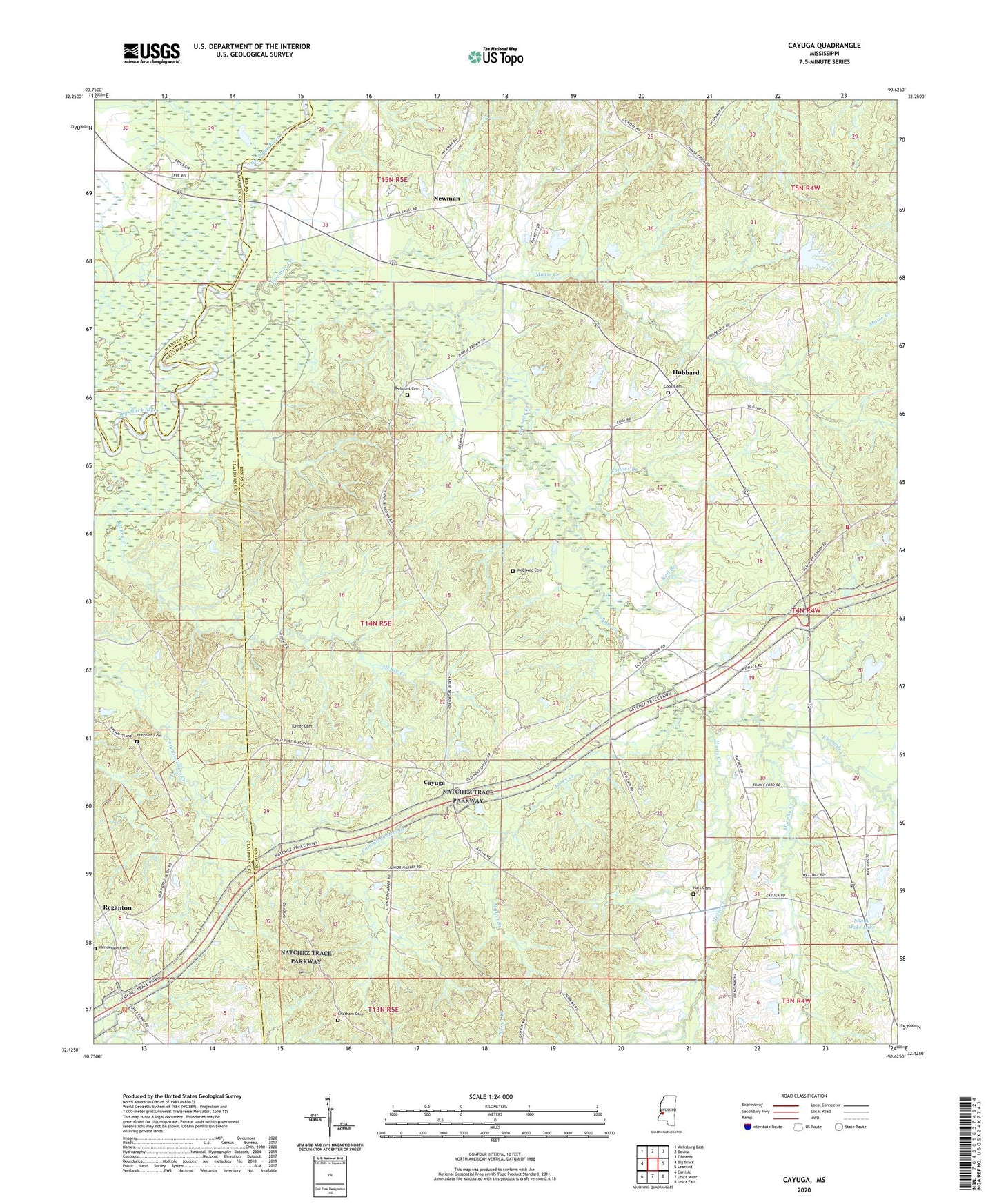
2020 topographic map quadrangle Cayuga in the state of Mississippi. Scale: 1:24000. Based on the newly updated USGS 7.5' US Topo map series, this map is in the following counties: Hinds, Claiborne, Warren. The map contains contour data, water features, and other items you are used to seeing on USGS maps, but also has updated roads and other features. This is the next generation of topographic maps. Printed on high-quality waterproof paper with UV fade-resistant inks.
Quads adjacent to this one:
West: Big Black
Northwest: Vicksburg East
North: Bovina
Northeast: Edwards
East: Learned
Southeast: Utica East
South: Utica West
Southwest: Carlisle
Contains the following named places: Baldwin, Baldwins Ferry, Barlows Pond Dam, Barnes Lake Dam, Beech Grove Church, Belmont Cemetery, Belmont Church, Bench Volunteer Fire Department, Bethesda Church, Cayuga, Cayuga School, Chatham Cemetery, Childs Chapel, Cook Cemetery, Cooper Branch, Currie Creek, Five Mile Lake, Fivemile Creek, Goodrum School, Hart Cemetery, Harts Creek, Henderson Cemetery, Hubbard, Hubbard Pond Dam, Hubbard School, Hutchins Cemetery, Hutchins Store, Jones Creek, Mallet Branch, Maxie Creek, McElwee Cemetery, Mims Lake Dam, Mount Zion Church, Mount Zion School, Murphy Creek, Neil Branch, Newman, Oak Ridge Church, Oak Ridge Plantation, Oak Ridge School, Old Oak Ridge School, Poplar Grove Church, Reganton, Rohelia Church, Shady Oaks Lake, Shady Oaks Lake Dam, Skates, Turner Cemetery, Yates School, Zion Traveler Church