MyTopo
Bovina Mississippi US Topo Map
Couldn't load pickup availability
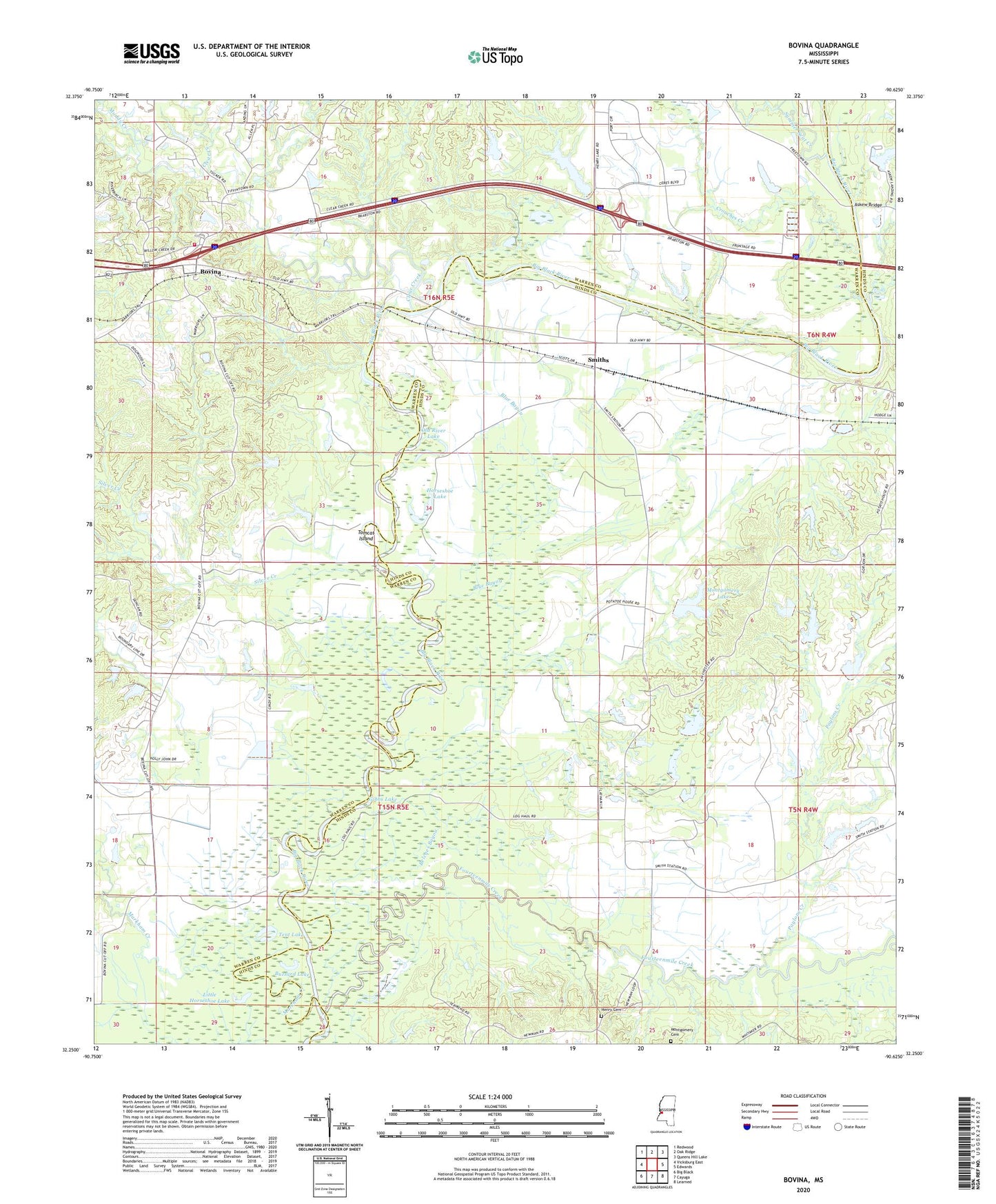
2024 topographic map quadrangle Bovina in the state of Mississippi. Scale: 1:24000. Based on the newly updated USGS 7.5' US Topo map series, this map is in the following counties: Hinds, Warren. The map contains contour data, water features, and other items you are used to seeing on USGS maps, but also has updated roads and other features. This is the next generation of topographic maps. Printed on high-quality waterproof paper with UV fade-resistant inks.
Quads adjacent to this one:
West: Vicksburg East
Northwest: Redwood
North: Oak Ridge
Northeast: Queens Hill Lake
East: Edwards
Southeast: Learned
South: Cayuga
Southwest: Big Black
This map covers the same area as the classic USGS quad with code o32090c6.
Contains the following named places: Amsterdam, Askew Bridge, Askew Pond, Bedford School, Belches Bayou, Bethlehem Church, Bethlehem School, Blue Bayou, Blue Lake, Bovina, Bovina Baptist Church, Bovina Census Designated Place, Bovina Elementary School, Bovina Methodist Church, Bovina Volunteer Fire Department, Bridgeport, Brookhaven Church, Brookhaven School, Brushy Lake, Buzzard Lake, Ceres Plantation, Chichester, Clear Creek, Crouches Creek, Culp Lake Dam, Farm Land Company Lake Dam, Fourteenmile Creek, Gibbs Lake, Gin Lake, Henry Cemetery, Hickory Tree School, Horseshoe Lake, Institute, July Lake, Lake Henry, Lake Henry Dam, Little Horseshoe Lake, Markham Creek, Montgomery Cemetery, Montgomery Lake, Montgomery Lake Dam, Moore Lake Dam, Morning Star Church, Mount Beulah College, Mount Hebron Church, Mount Pisgah Church, Muddy Creek, New Hope Church, Nortrust Farm Management Dam, Nortrust Farm Management Lake Dam, Old River Lake, Palestine Church, Paylons Creek, Pleasant Grove Church, Pleasant Row School, R O Duncan Lake Dam, Saint Albans Church, Saint Paul Church, Silver Creek, Smiths, Smiths Ferry, Summer Seat Creek, Tent Lake, Tomcat Island