MyTopo
Duck Hill Mississippi US Topo Map
Couldn't load pickup availability
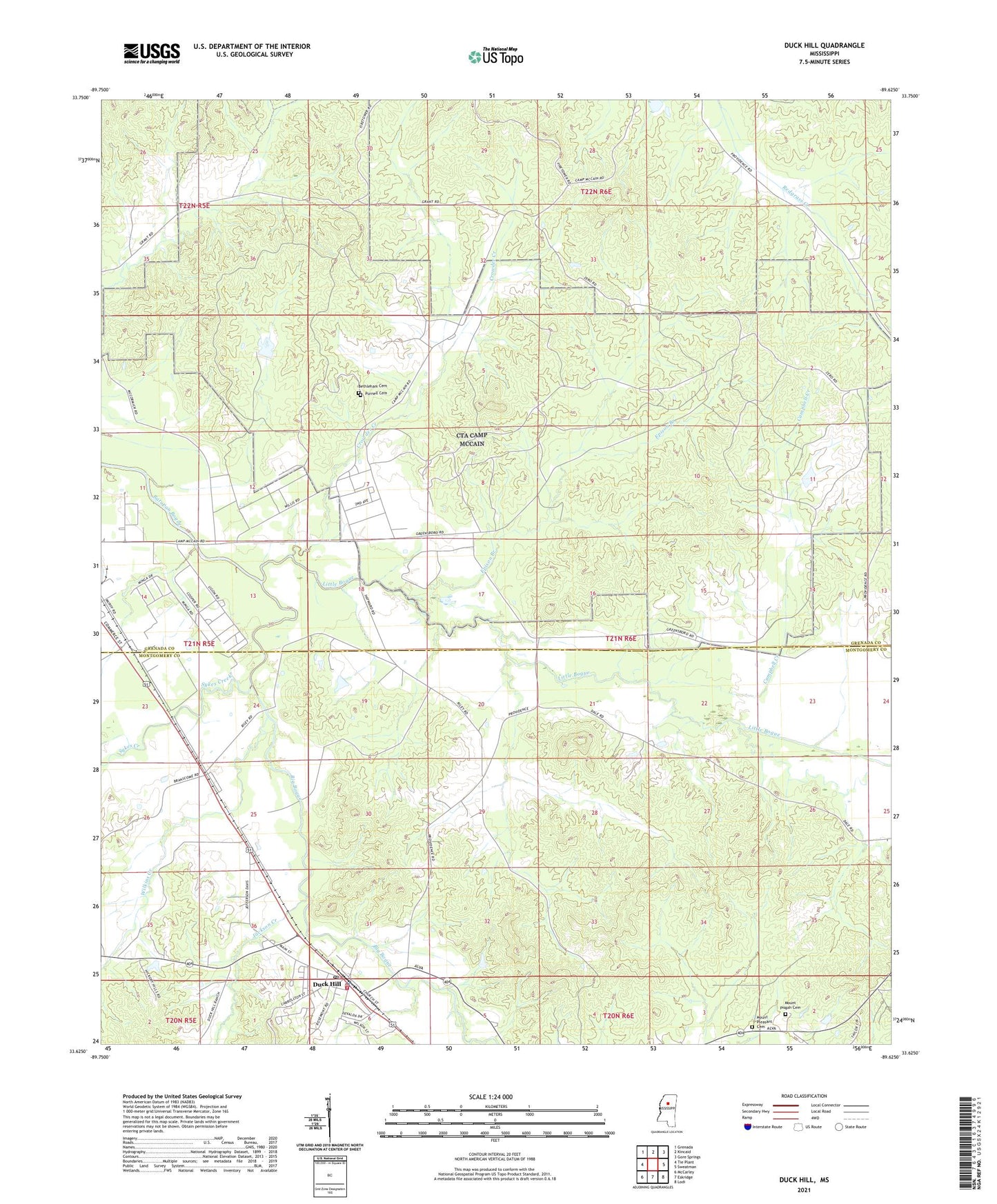
2021 topographic map quadrangle Duck Hill in the state of Mississippi. Scale: 1:24000. Based on the newly updated USGS 7.5' US Topo map series, this map is in the following counties: Grenada, Montgomery. The map contains contour data, water features, and other items you are used to seeing on USGS maps, but also has updated roads and other features. This is the next generation of topographic maps. Printed on high-quality waterproof paper with UV fade-resistant inks.
Quads adjacent to this one:
West: Tie Plant
Northwest: Grenada
North: Kincaid
Northeast: Gore Springs
East: Sweatman
Southeast: Lodi
South: Eskridge
Southwest: McCarley
Contains the following named places: Bethleham Cemetery, Big Bogue, Bogue Watershed Y-30-108 Dam, Bowen, Camp McCain, Camp McCain Military Reservation, Campbell Creek, Crowder Creek, Duck Hill, Duck Hill Baptist Church, Duck Hill Elementary School, Duck Hill High School, Duck Hill Police Department, Duck Hill Post Office, Duck Hill Volunteer Fire Department, Elliott, Epison Branch, Jackson Creek, Little Bogue, Mount Pisgah Church, Mount Pisgah Primitive Baptist Church Cemetery, Mount Pleasant Church, Mount Pleasant Church Cemetery, Purnell Cemetery, Supervisor District 1, Supervisor District 2, Sykes Creek, Town of Duck Hill, Wilkins Creek, Worsham Creek, ZIP Code: 38925