MyTopo
McCarley Mississippi US Topo Map
Couldn't load pickup availability
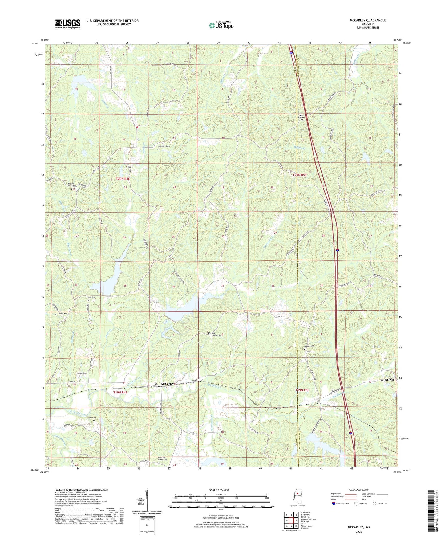
2024 topographic map quadrangle McCarley in the state of Mississippi. Scale: 1:24000. Based on the newly updated USGS 7.5' US Topo map series, this map is in the following counties: Carroll, Montgomery. The map contains contour data, water features, and other items you are used to seeing on USGS maps, but also has updated roads and other features. This is the next generation of topographic maps. Printed on high-quality waterproof paper with UV fade-resistant inks.
Quads adjacent to this one:
West: North Carrollton
Northwest: Jefferson
North: Tie Plant
Northeast: Duck Hill
East: Eskridge
Southeast: Winona
South: Bailey Lake
Southwest: Coila
This map covers the same area as the classic USGS quad with code o33089e7.
Contains the following named places: Allen Cemetery, Ambrose Church, American Legion Lake, American Legion Lake Dam, Barrentine Lake, Bear Den Creek, Beat 1 - Carroll County Volunteer Fire Department, Big Sand Watershed Y-32-10 Dam, Big Sand Watershed Y-32-11 Dam, Big Sand Watershed Y-32-22 Dam, Big Sand Watershed Y-32-8 Dam, Church of God, Eden Cemetery, Eden Methodist Church, Eden School, Ellis Lake Dam, Hickory Grove Baptist Church, Hickory Grove Cemetery, Magic Creek, McAnerney, McCarley, McCarley Community Center, McCarley Post Office, Mission Cemetery, Mission Church, Mount Olive Church, Mullen Branch, Pink Flower Cemetery, Pink Flower Church, Pleasant Green Baptist Church, Pleasant Green Cemetery, Potacocowa Structure Y-31a-5 Dam, Potacocowa Watershed Y-31a-12 Dam, Primitive Cemetery, Prospect Cemetery, Prospect Church, Supervisor District 1, Supervisor District 2, Thompson Creek, Wall Cemetery, Whitehead Creek, WONA-FM (Winona), Zion Church, ZIP Code: 38943