MyTopo
Evergreen Mississippi US Topo Map
Couldn't load pickup availability
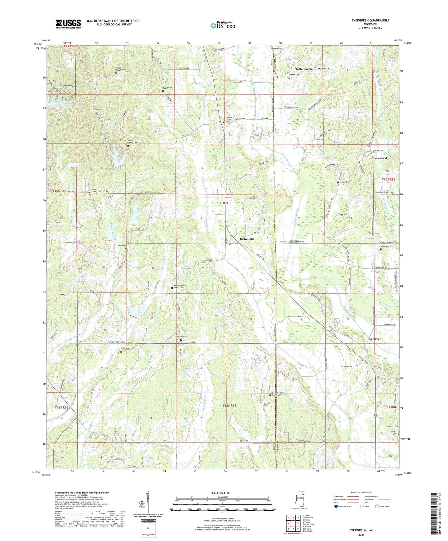
2021 topographic map quadrangle Evergreen in the state of Mississippi. Scale: 1:24000. Based on the newly updated USGS 7.5' US Topo map series, this map is in the following counties: Lee, Itawamba. The map contains contour data, water features, and other items you are used to seeing on USGS maps, but also has updated roads and other features. This is the next generation of topographic maps. Printed on high-quality waterproof paper with UV fade-resistant inks.
Quads adjacent to this one:
West: Verona
Northwest: Tupelo
North: Mooreville
Northeast: Fulton
East: Beans Ferry
Southeast: Smithville
South: Nettleton
Southwest: Shannon
Contains the following named places: Andrews Chapel, Andrews Chapel Cemetery, Ballardsville, Bowlin Family Cemetery, Center Ridge School, Dorsey Elementary School, Elliott Cemetery, Evergreen, Evergreen - Carolina Volunteer Fire Department Station 300, Evergreen - Carolina Volunteer Fire Department Station 302, Fairfield Cemetery, Francis Cemetery, Friendship Church, Greenwood, Greenwood Baptist Church, Gregory Cemetery, Hussey Cemetery, Kedron School, Kellys Chapel Cemetery, Lake Wilhelmina, Lake Wilhelmina Dam, Lake Willow Manor Dam, Limestone Church, New Bethany School, New Chapel, Orr-Patterson Family Cemetery, Palestine Baptist Church Cemetery, Palestine Church, Palestine School, Payne Cemetery, Pennington Lake Dam, Pettigrew-Ivy Family Cemetery, Piney Grove Church, Pleasant Grove Missionary Baptist Church, Pleasant Hill Church, Richmond, Richmond Fire Department, Richmond Lee, Richmondlee, Rick Luther Lake Dam, Shiloh, Shiloh Church, Shumpert Cemetery, Tombigbee State Park, Union Hill Church, Unity Cemetery, Unity Church, Wesley Chapel Cemetery, Whiteside Cemetery, Woodlawn, Woodman of the World Lake Dam, ZIP Code: 38862