MyTopo
Fair Oak Springs Mississippi US Topo Map
Couldn't load pickup availability
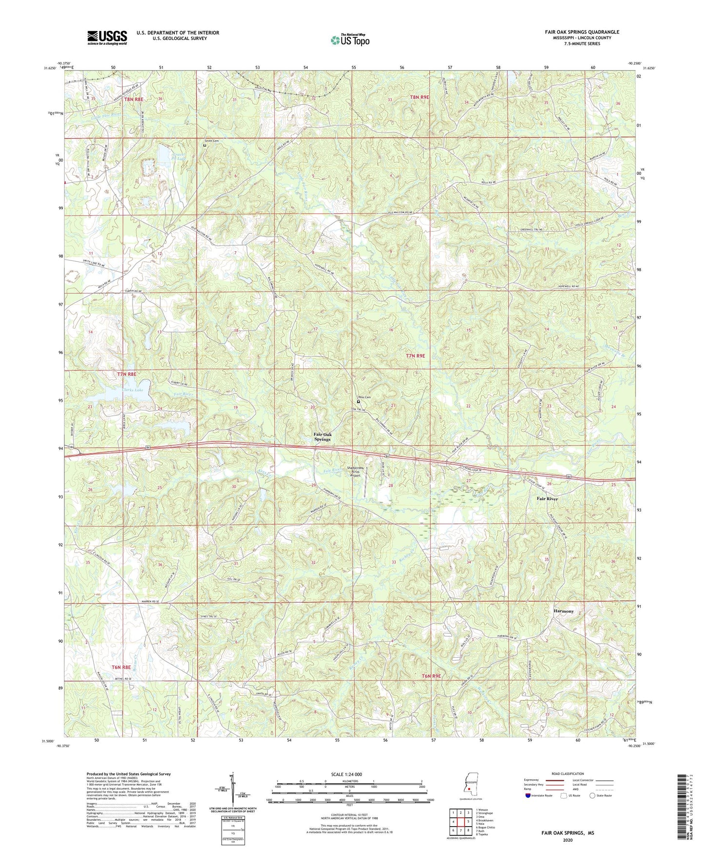
2020 topographic map quadrangle Fair Oak Springs in the state of Mississippi. Scale: 1:24000. Based on the newly updated USGS 7.5' US Topo map series, this map is in the following counties: Lincoln. The map contains contour data, water features, and other items you are used to seeing on USGS maps, but also has updated roads and other features. This is the next generation of topographic maps. Printed on high-quality waterproof paper with UV fade-resistant inks.
Quads adjacent to this one:
West: Brookhaven
Northwest: Wesson
North: Stronghope
Northeast: Oma
East: Nola
Southeast: Topeka
South: Ruth
Southwest: Bogue Chitto
Contains the following named places: Bethel Temple Church, Big Springs Church, Big Springs School, Chester Clarke Dam, Clarks Lake, Fair Oak Springs, Fair Oak Springs Consolidated School, Fair River, Fair River Church, Fair River Hall School, Fair River Store, Gravel Pit Lake, Harmony, Harmony Church, Heucks Lookout Tower, Heucks Retreat, Heucks Retreat Baptist Church, Holly Springs Church, Hopewell Church, Huecks Retreat Lake Dam, Kees Cemetery, Kees Creek, Lewis Mullens Lake Dam, Little Fair River, Macedonia Church, McNair Mill, Oak Grove School, Old Malcum, Perch Creek, Richey Creek, Shadycreek Acres Airport, Smith Cemetery, Soegaard, Souls Harbor Church, Supervisor District 1, Turkey Branch, Union Baptist Church, Walkers Creek