MyTopo
Stronghope Mississippi US Topo Map
Couldn't load pickup availability
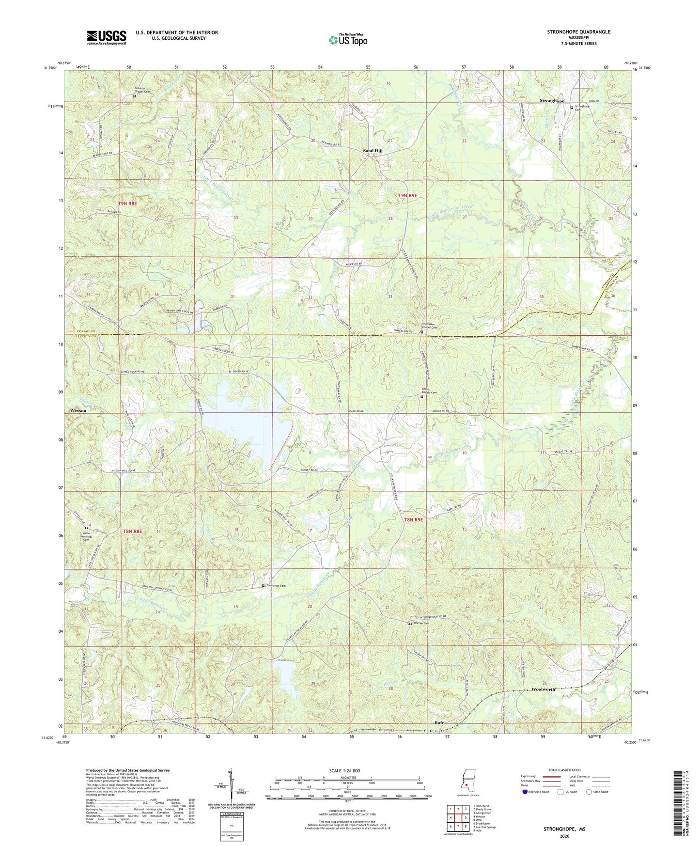
2024 topographic map quadrangle Stronghope in the state of Mississippi. Scale: 1:24000. Based on the newly updated USGS 7.5' US Topo map series, this map is in the following counties: Lincoln, Copiah. The map contains contour data, water features, and other items you are used to seeing on USGS maps, but also has updated roads and other features. This is the next generation of topographic maps. Printed on high-quality waterproof paper with UV fade-resistant inks.
Quads adjacent to this one:
West: Wesson
Northwest: Hazlehurst
North: Shady Grove
Northeast: Georgetown
East: Oma
Southeast: Nola
South: Fair Oak Springs
Southwest: Brookhaven
This map covers the same area as the classic USGS quad with code o31090f3.
Contains the following named places: Bahala Creek Watershed Structure 1 Dam, Bahala Creek Watershed Structure 2 Dam, Bahala Creek Watershed Structure 5 Dam, Bahaloa, Clear Creek, Fords Creek, Franklin Chapel Cemetery, Furr Branch, Lee Mullins Lake Dam, Little Bahala Cemetery, Little Bahala Church, Little Beaverdam Creek, Little Memorial Cemetery, Little Rock Church, Magees Mill, Martin Creek, Mayoville, Mission Hill Church, Pine Grove Church, Rafn, Sand Hill, Spring Hill Church, Stronghope, Stronghope Baptist Church, Stronghope Cemetery, Supervisor District 2, Thompson Cemetery, Thompson Chapel, Thompson Chapel Cemetery, Union Grove Church, Warren Cemetery, Woolworth, Zion Hill Church