MyTopo
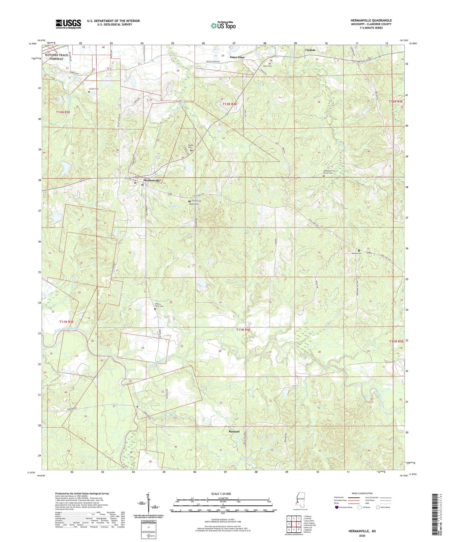
Hermanville Mississippi US Topo Map
Couldn't load pickup availability
2020 topographic map quadrangle Hermanville in the state of Mississippi. Scale: 1:24000. Based on the newly updated USGS 7.5' US Topo map series, this map is in the following counties: Claiborne. The map contains contour data, water features, and other items you are used to seeing on USGS maps, but also has updated roads and other features. This is the next generation of topographic maps. Printed on high-quality waterproof paper with UV fade-resistant inks.
Quads adjacent to this one:
West: Port Gibson
Northwest: Willows
North: Carlisle
Northeast: Utica West
East: Dentville NW
Southeast: Barlow
South: McBride
Southwest: Red Lick
Contains the following named places: Barland, Barland Creek, Center Cemetery, Center School, Cherry Farm Cemetery, Cherry Farm School, Claiborne County Fire Department Station 4, Clarks Creek, Cold Springs Plantation, Farm Land Company Lake Dam, First Baptist Church, First Christian Church, Freedman Hill Church, French Cemetery, Hermanville, Hermanville Baptist Church, Hermanville Census Designated Place, Hermanville Consolidated Elementary School, Hermanville Methodist Church, Hermanville Post Office, Hermanville Presbyterian Church, Holly Grove Baptist Church, Jameson Branch, Jones Cemetery, Montro Church, Montrose Church, Mount Olive Missionary Baptist Church, Mount Olive School, Mount Vernon Church, Old Mount Tro Grove Cemetery, Patona Cemetery, Pattona, Porter Lake Dam, Puckett Lake Dam, Rocky Falls, Rush Lake Dam, Saint Elmo, Saint Elmo Christian Church, Shannon Branch, Shelby, Shelby Cemetery, Shield Cemetery, Supervisor District 4, White Hall Baptist Church, White Hall Plantation, ZIP Code: 39086