MyTopo
McBride Mississippi US Topo Map
Couldn't load pickup availability
Also explore the McBride Forest Service Topo of this same quad for updated USFS data
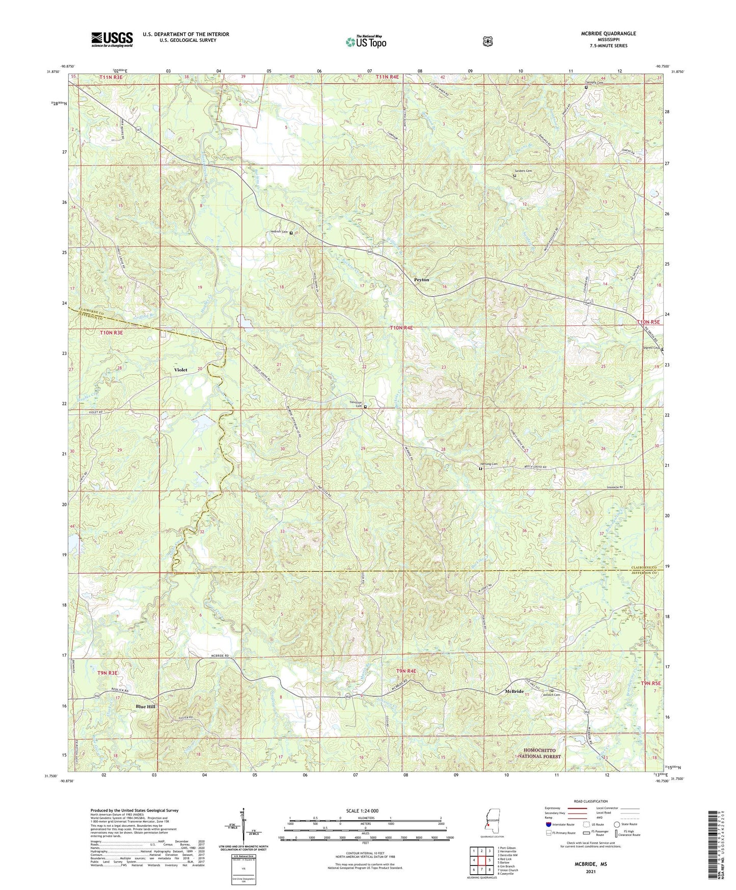
2024 topographic map quadrangle McBride in the state of Mississippi. Scale: 1:24000. Based on the newly updated USGS 7.5' US Topo map series, this map is in the following counties: Claiborne, Jefferson. The map contains contour data, water features, and other items you are used to seeing on USGS maps, but also has updated roads and other features. This is the next generation of topographic maps. Printed on high-quality waterproof paper with UV fade-resistant inks.
Quads adjacent to this one:
West: Red Lick
Northwest: Port Gibson
North: Hermanville
Northeast: Dentville NW
East: Barlow
Southeast: Caseyville
South: Union Church
Southwest: Gin Branch
This map covers the same area as the classic USGS quad with code o31090g7.
Contains the following named places: Antioch Cemetery, Antioch Church, Beech Grove Baptist Church, Beech Grove School, Blue Goose Creek, Blue Hill, Blue Hill Church, Buckins Creek, Clarks Creek Church, Clarks Creek School, Crow Creek, Forest Grove Church, Forest Grove School, Foster Creek, Griffing Branch, Hedrich Cemetery, Herlong Cemetery, Hervey, Hughes Creek, Johnson Creek, Martinsville School, Mason Branch, McBride, Middleton Lake Dam, Mount Pleasant Baptist Church, Old Sarepta Baptist Church, Owens Branch, Peyton, Peyton Lookout Tower, Philadelphia Baptist Church, Pierce Branch, Pine Ridge School, Saint Johns Church, Saint Marks Church, Saint Peters Baptist Church, Salem Church, Sanders Branch, Sanders Cemetery, Sarepta, Sarepta Cemetery, Segrest Cemetery, Serepta School, Singletary Creek, Supervisor District 5, Trevillion Cemetery, Unity Church, Vaughn Lake Dam, Violet, Williams Branch, ZIP Code: 39144