MyTopo
Kingston Mississippi US Topo Map
Couldn't load pickup availability
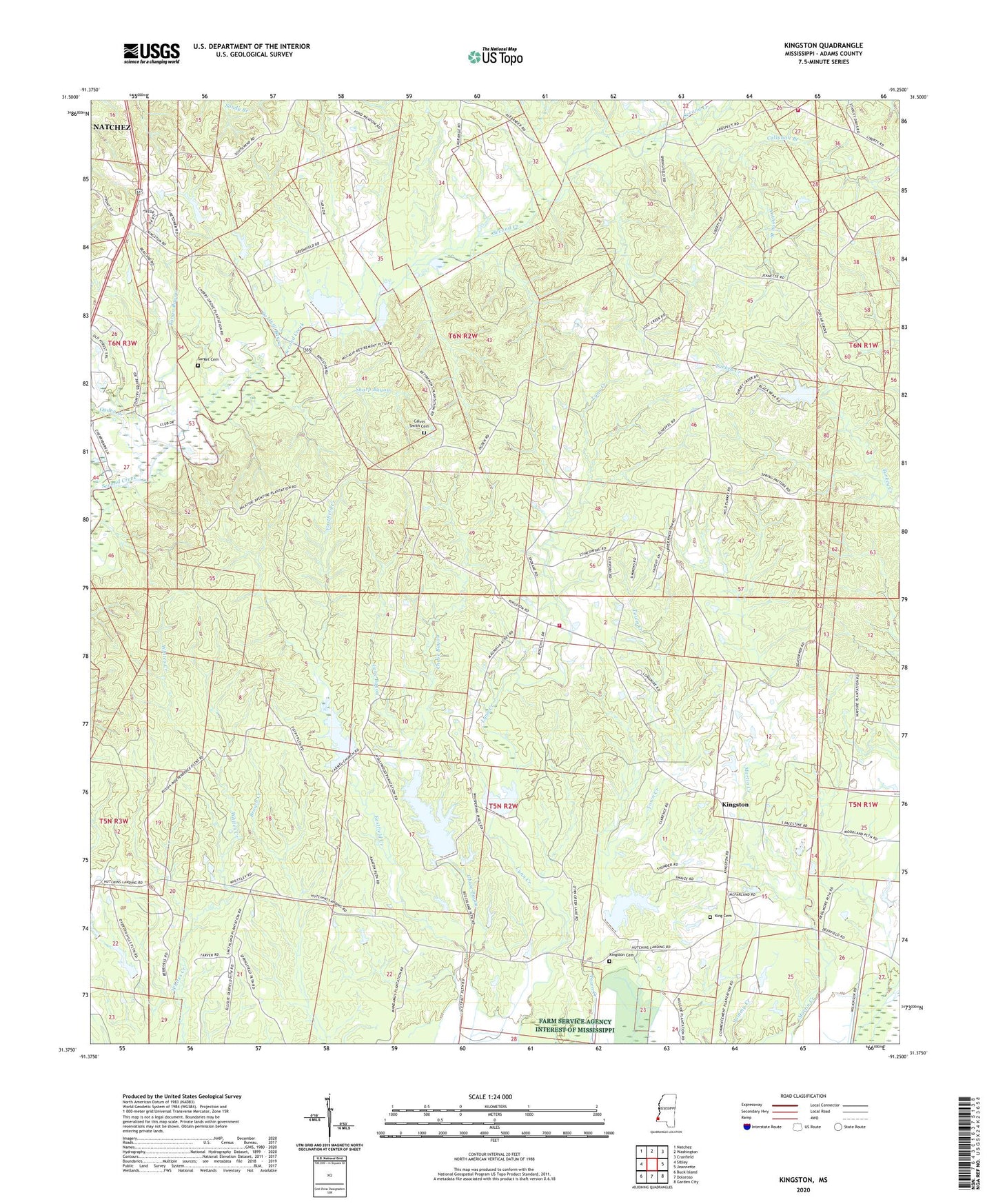
2020 topographic map quadrangle Kingston in the state of Mississippi. Scale: 1:24000. Based on the newly updated USGS 7.5' US Topo map series, this map is in the following counties: Adams. The map contains contour data, water features, and other items you are used to seeing on USGS maps, but also has updated roads and other features. This is the next generation of topographic maps. Printed on high-quality waterproof paper with UV fade-resistant inks.
Quads adjacent to this one:
West: Sibley
Northwest: Natchez
North: Washington
Northeast: Cranfield
East: Jeannette
Southeast: Garden City
South: Doloroso
Southwest: Buck Island
Contains the following named places: Adams County, Anthony Branch, Bethel Church, Callahan Branch, Calvary Church, Calvin Smith Cemetery, Cane Bayou, Carmel Church, Cave Bayou, Cliff Temple Church, Clifford Oil Field, Coldhill Bayou, Eastfield Creek, Eqypt Baptist Church, Farrar - King Cemetery, Glendale Oil Field, Jeannette Oil Field, Jerusalem Church, Kingston, Kingston Cemetery, Kingston Church, Kingston Oil Field, Kingston Volunteer Fire Department, L J Denny Lake Dam, LaGrange Church, Liberty Road Volunteer Fire Department, Magnolia Oil Field, Mantua Oil Field, Morning Star Church, Moss Hill Oil Field, North Kingston Oil Field, North Overton Oil Field, Ogden Branch, Overton Oil Field, Overton School, Poplar Grove Oil Field, Poplar Grove School, Saint Marks Church, Second Creek Structure 10b Dam, Second Creek Structure 11 Dam, Second Creek Structure 12 Dam, Second Creek Structure 7 Dam, Sharp Bayou, South Kingston Oil Field, South Lagrange Oil Field, Southeast Moss Hill Oil Field, Southwood Church, Southwood Lodge Lake Dam, Southwood Oil Field, Supervisor District 2, Surget Cemetery, Tango Bayou, Wayside Oil Field, Webb Carter Junior Lake Dam