MyTopo
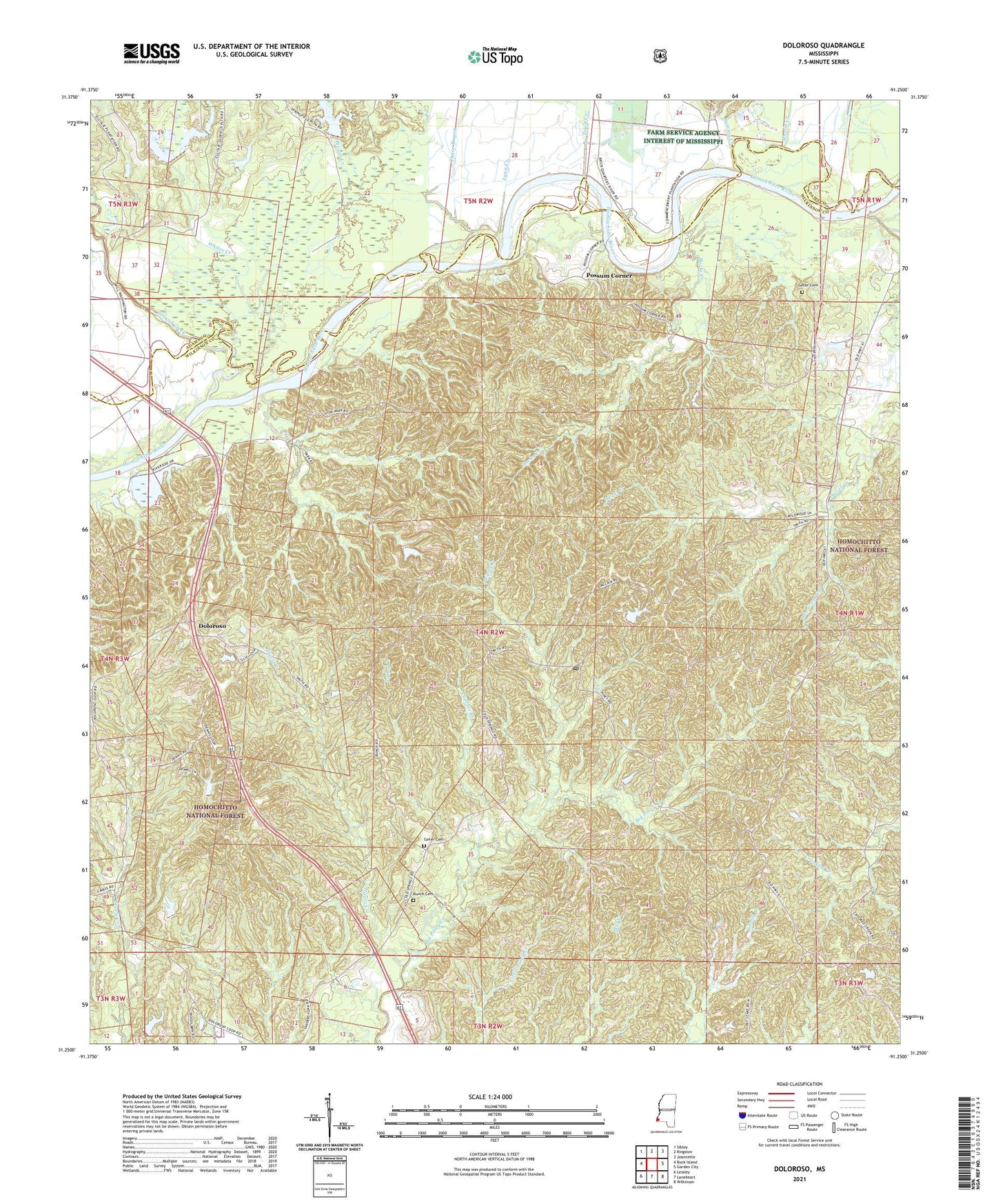
Doloroso Mississippi US Topo Map
Couldn't load pickup availability
Also explore the Doloroso Forest Service Topo of this same quad for updated USFS data
2024 topographic map quadrangle Doloroso in the state of Mississippi. Scale: 1:24000. Based on the newly updated USGS 7.5' US Topo map series, this map is in the following counties: Wilkinson, Adams. The map contains contour data, water features, and other items you are used to seeing on USGS maps, but also has updated roads and other features. This is the next generation of topographic maps. Printed on high-quality waterproof paper with UV fade-resistant inks.
Quads adjacent to this one:
West: Buck Island
Northwest: Sibley
North: Kingston
Northeast: Jeannette
East: Garden City
Southeast: Wilkinson
South: Laneheart
Southwest: Lessley
This map covers the same area as the classic USGS quad with code o31091c3.
Contains the following named places: Armstrong Oil Field, Brown Creek, Bucks Creek, Buena Vista Church, Bunch Cemetery, Chase Bayou, Commencement Oil Field, Crooked Creek, Crosby Post Office, Cypress Branch, Darrington Oil Field, Doloroso, Doloroso Oil Field, East Commencement Oil Field, Folley Creek, Free Spring Church, Geter Cemetery, Hazlit Creek, Hazlit Creek Oil Field, Hurricane Creek, Hyde Park School, Lynn Creek, Mandamus Oil Field, Mars Hill Church, Martin Creek, Oak Grove Church, Phipps Creek, Pine Creek Oil Field, Possum Corner, Possum Corner Oil Field, Rose Hill Church, Sammy Creek, Sandy Creek Oil Field, Second Creek, Second Creek Structure 8 Dam, Second Creek Structure 9 Dam, South Possum Corner Oil Field, South Sammy Creek Oil Field, Southeast Ellislie Oil Field, Town Creek, West Possum Corner Oil Field, Whites Creek