MyTopo
Learned Mississippi US Topo Map
Couldn't load pickup availability
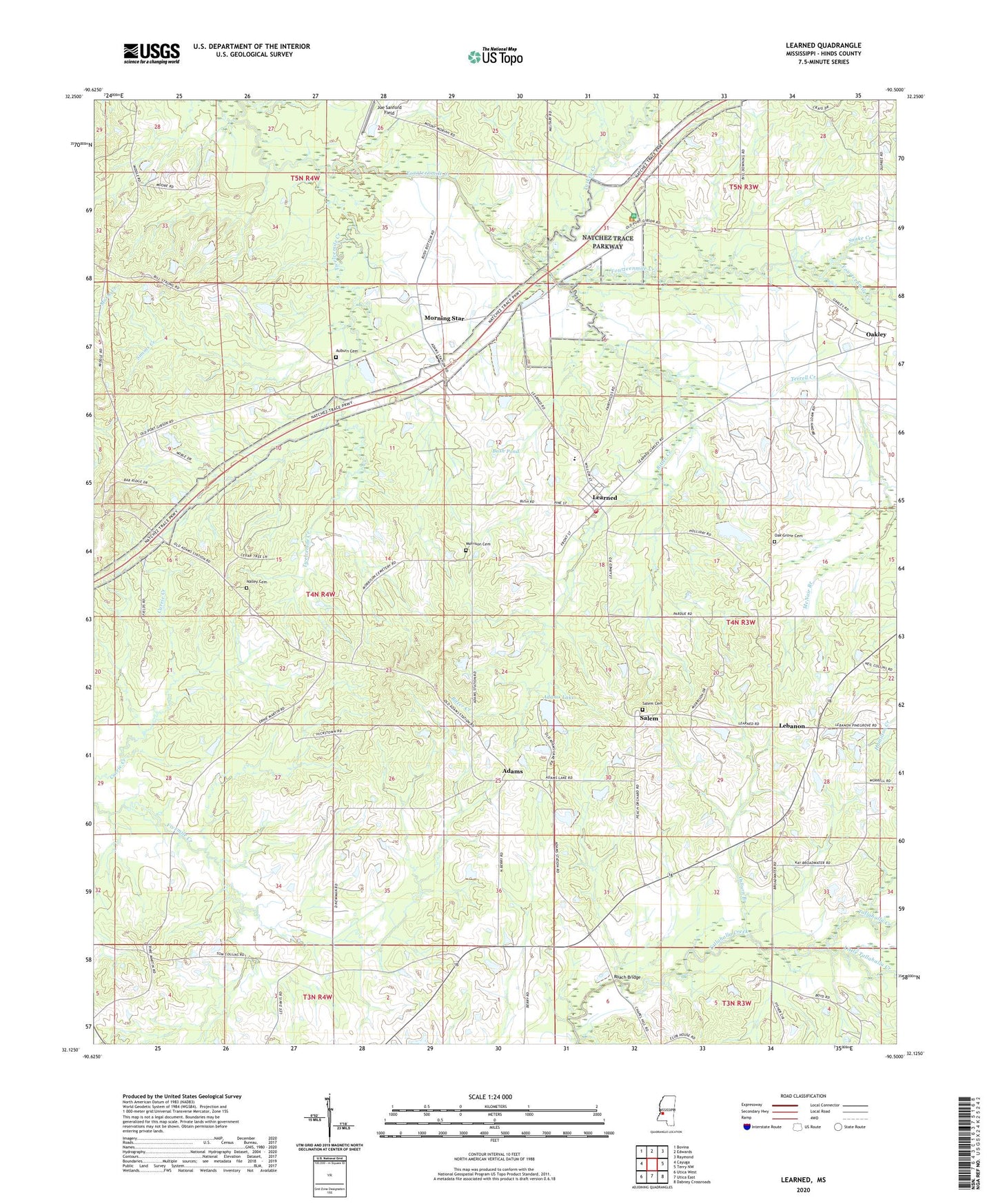
2020 topographic map quadrangle Learned in the state of Mississippi. Scale: 1:24000. Based on the newly updated USGS 7.5' US Topo map series, this map is in the following counties: Hinds. The map contains contour data, water features, and other items you are used to seeing on USGS maps, but also has updated roads and other features. This is the next generation of topographic maps. Printed on high-quality waterproof paper with UV fade-resistant inks.
Quads adjacent to this one:
West: Cayuga
Northwest: Bovina
North: Edwards
Northeast: Raymond
East: Terry NW
Southeast: Dabney Crossroads
South: Utica East
Southwest: Utica West
Contains the following named places: Adams, Adams Lake, Adams Lake Dam, Antioch Church, Auburn, Auburn Cemetery, Auburn School, Bar Ridge Church, Biggs Gin, Bitter Creek, Brocks Pond Dam, Brown Loam Branch Experiment Station, Bryants Store, Burleigh Hamilton School, Bush Pond, Cherry Grove Church, Crawford Pond Dam, Dillons Stand, Dudley Nobel Pond Dam, Green Hill Church, Hamilton Creek, Hopewell Church, Hutchins School, Joe Sanford Field, Learned, Learned Volunteer Fire Department, Lebanon, Lebanon Church, Lebanon School, Little Tallahalla Creek, McNair Branch, Moore Spring Branch, Morning Star, Morning Star Church, Morrison Cemetery, Mount Olive Church, Nalley Cemetery, New Salem Church, Oak Grove Cemetery, Oak Grove Church, Oakley, Oakley State Farm, Oakley Training School, Old Auburn, Osborns Lake Dam, Osburn Branch, Pleasant Green Church, Reeves Chapel, Roach Bridge, Salem, Salem Baptist Church, Salem Cemetery, Simms Creek, Snake Creek, Spring Ridge Church, Spring Ridge School, Terrell Creek, Town of Learned, Turkey Creek, Twelvemile Creek, Welcome Church