MyTopo
Little Sand Creek Mississippi US Topo Map
Couldn't load pickup availability
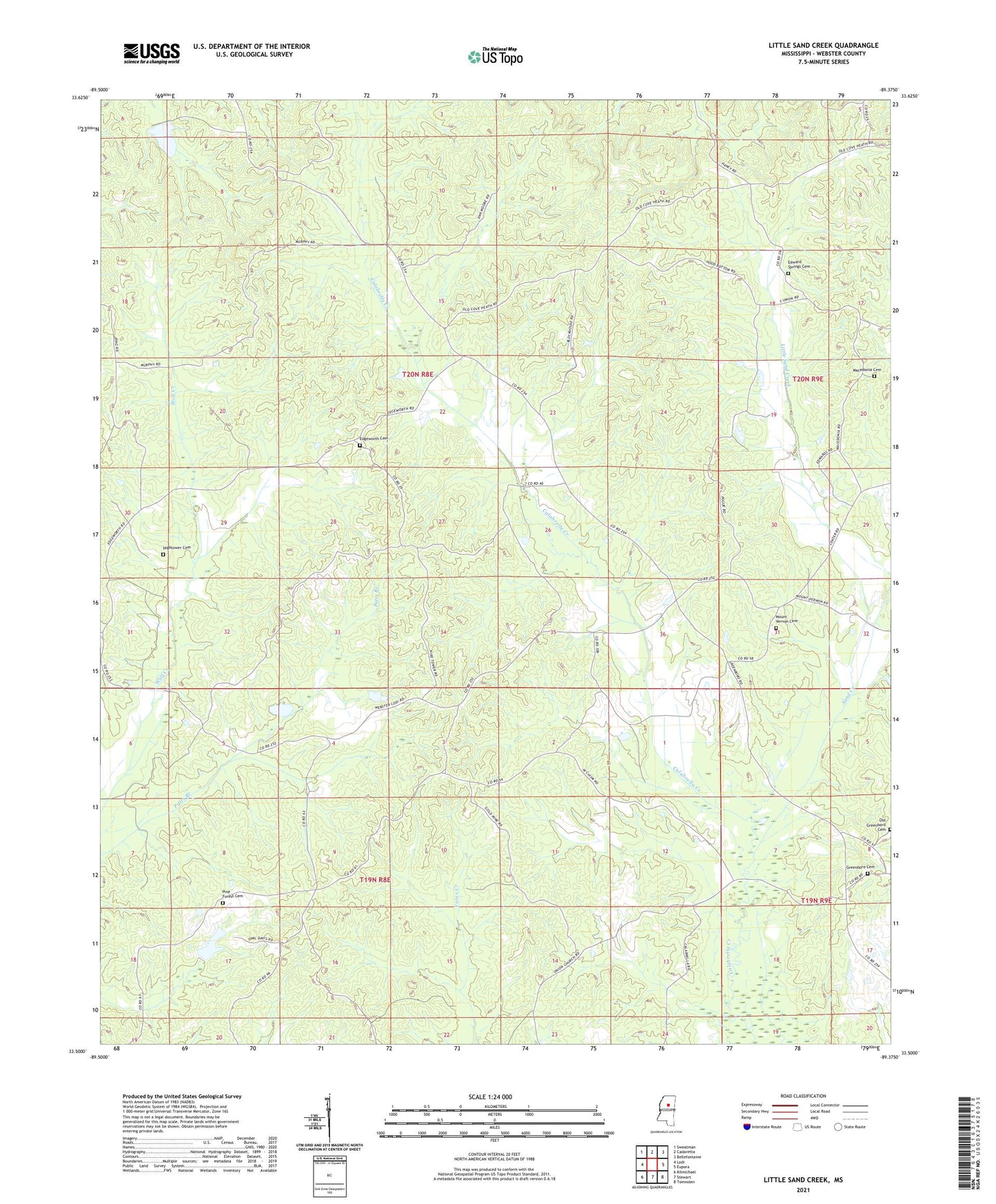
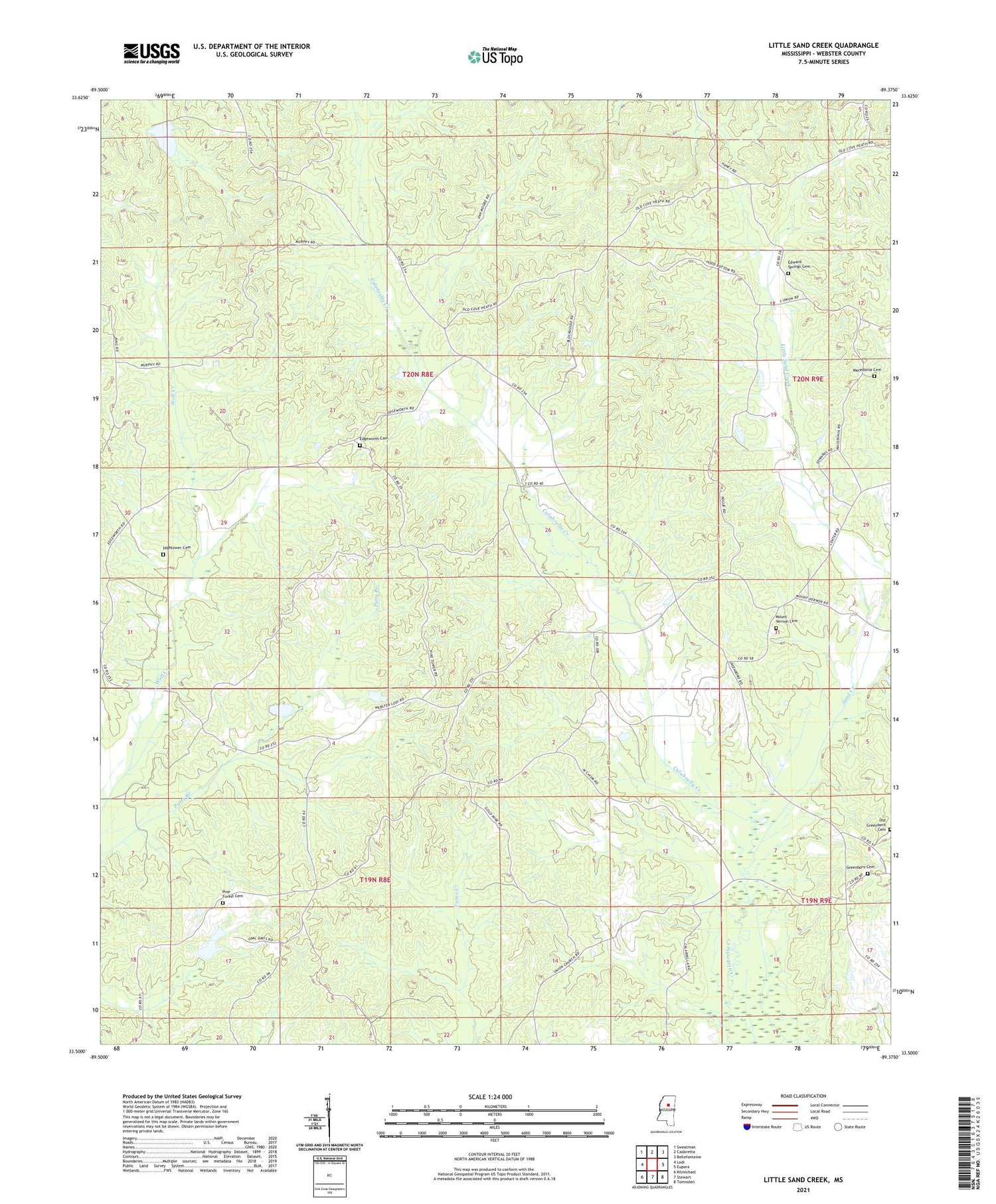
2021 topographic map quadrangle Little Sand Creek in the state of Mississippi. Scale: 1:24000. Based on the newly updated USGS 7.5' US Topo map series, this map is in the following counties: Webster. The map contains contour data, water features, and other items you are used to seeing on USGS maps, but also has updated roads and other features. This is the next generation of topographic maps. Printed on high-quality waterproof paper with UV fade-resistant inks.
Quads adjacent to this one:
West: Lodi
Northwest: Sweatman
North: Cadaretta
Northeast: Bellefontaine
East: Eupora
Southeast: Tomnolen
South: Stewart
Southwest: Kilmichael
Contains the following named places: Bogue Watershed Y-30-53 Dam, Edgeworth Cemetery, Edgeworth Church, Edward Springs Cemetery, Edward Springs Church, Greenboro Cemetery, Greenboro Church, Greensboro, Greensboro Methodist Church, Hightower Cemetery, Little Sand Creek, Macedonia Cemetery, Macedonia Church, Mount Vernon Cemetery, Mount Vernon Church, Mount Vernon School, Old Greenboro Cemetery, Pine Forest Cemetery, Pine Forest Church, Sand Creek, Supervisor District 1, Supervisor District 3, Wood Chapel