MyTopo
Kilmichael Mississippi US Topo Map
Couldn't load pickup availability
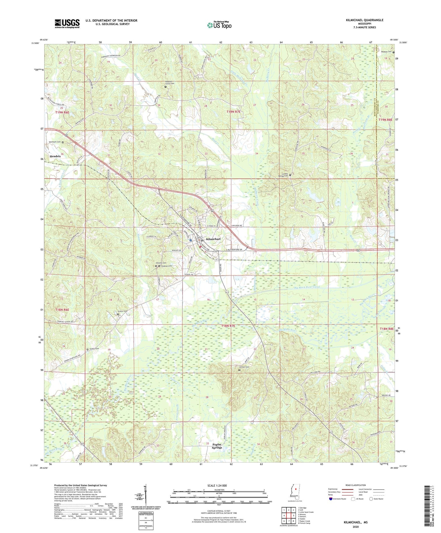
2024 topographic map quadrangle Kilmichael in the state of Mississippi. Scale: 1:24000. Based on the newly updated USGS 7.5' US Topo map series, this map is in the following counties: Montgomery, Webster. The map contains contour data, water features, and other items you are used to seeing on USGS maps, but also has updated roads and other features. This is the next generation of topographic maps. Printed on high-quality waterproof paper with UV fade-resistant inks.
Quads adjacent to this one:
West: Winona
Northwest: Eskridge
North: Lodi
Northeast: Little Sand Creek
East: Stewart
Southeast: French Camp
South: Poplar Creek
Southwest: Vaiden
This map covers the same area as the classic USGS quad with code o33089d5.
Contains the following named places: Armstrong Branch, Barrett Lake Dam, Bethlehem Church, Big Black River Canal, Crape Creek, Dorris Bridge, Elkhorn Church, Flowers Cemetery, Flowers Creek, Griffin Cemetery, H M Alexander Lake Dam, Hurricane Branch, J W Braswell Pond Dam, Jacks Slough, Kilmichael, Kilmichael Baptist Church, Kilmichael Elementary School, Kilmichael High School, Kilmichael Hospital, Kilmichael Lagoon Dam, Kilmichael Police Department, Kilmichael Post Office, Kilmichael Vocational High School, Kilmichael Volunteer Fire Department, Kindred Cemetery, Lindsay Bridge, Lindsey Spring Church, Lindsey Springs Cemetery, Little Mulberry Creek, Mississippi No Name 222 Dam, Mississippi No Name 226 Dam, Montgomery County, Mulberry Creek, Nation Community Center, Nations Poplar Creek Church, Old Channel Big Black River, Peebles Cemetery, Pleasant Grove Cemetery, Pleasant Grove Church, Poplar Creek, Poplar Springs, Reed Creek, Sewells Ferry, Sibleyton, Stinson Cemetery, Supervisor District 4, Town of Kilmichael, W M Lott Pond Dam, Wilmount Cemetery, Wilmount Church, Wolf Creek, ZIP Code: 39747