MyTopo
Paris Mississippi US Topo Map
Couldn't load pickup availability
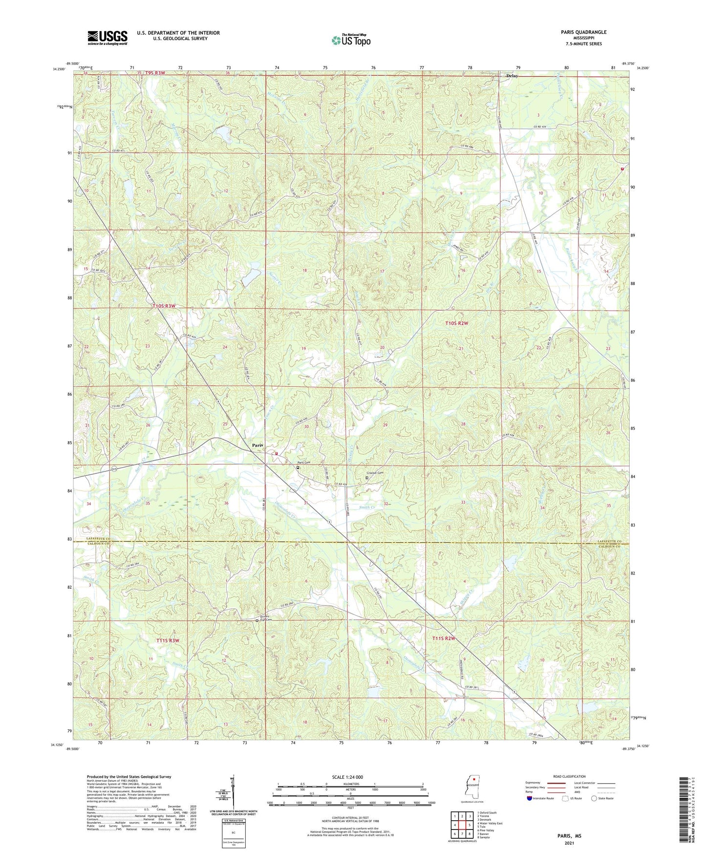
2021 topographic map quadrangle Paris in the state of Mississippi. Scale: 1:24000. Based on the newly updated USGS 7.5' US Topo map series, this map is in the following counties: Lafayette, Calhoun. The map contains contour data, water features, and other items you are used to seeing on USGS maps, but also has updated roads and other features. This is the next generation of topographic maps. Printed on high-quality waterproof paper with UV fade-resistant inks.
Quads adjacent to this one:
West: Water Valley East
Northwest: Oxford South
North: Yocona
Northeast: Denmark
East: Tula
Southeast: Sarepta
South: Banner
Southwest: Pine Valley
Contains the following named places: Cannons Store, Colemans Mill, Crains Store, Crocker Cemetery, Delay, Dickey Creek, Drivers Flat Cemetery, Drivers Flat Church, Dry Branch, Harwell Pond Dam, Lafayette County Fire Department Station 14 Paris, Lafayette County Fire Department Station 6 Tula, Moore Creek, Murray Creek Y-13a-4 Dam, Paris, Paris Baptist Church, Paris Cemetery, Paris Census Designated Place, Pattons Store, Providence Church, Red Hill School, Rock Hill Church, Shippy Creek, Smith Creek, Supervisor District 5, Town Creek, Union Church, ZIP Codes: 38913, 38949