MyTopo
Water Valley East Mississippi US Topo Map
Couldn't load pickup availability
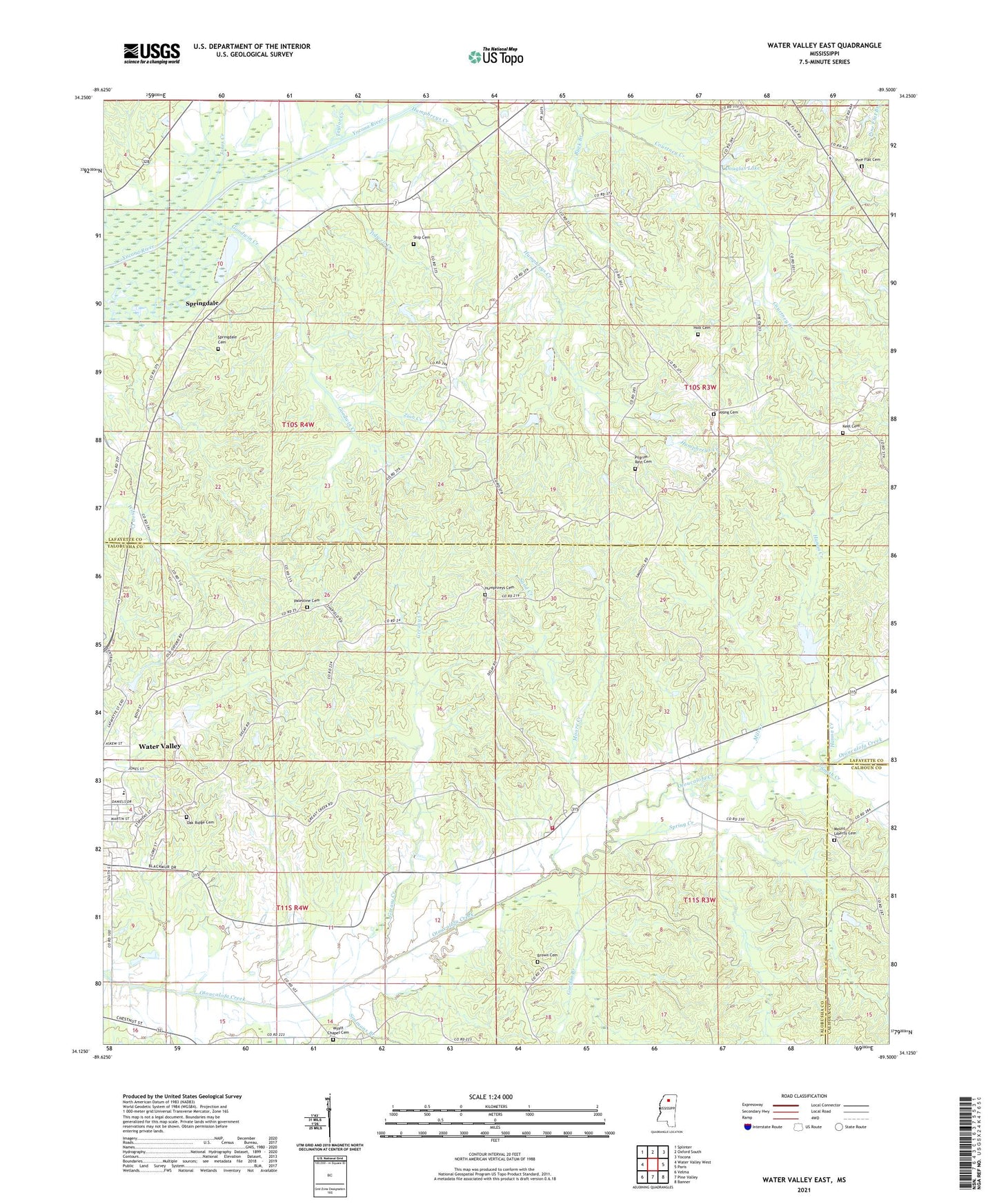
2024 topographic map quadrangle Water Valley East in the state of Mississippi. Scale: 1:24000. Based on the newly updated USGS 7.5' US Topo map series, this map is in the following counties: Yalobusha, Lafayette, Calhoun. The map contains contour data, water features, and other items you are used to seeing on USGS maps, but also has updated roads and other features. This is the next generation of topographic maps. Printed on high-quality waterproof paper with UV fade-resistant inks.
Quads adjacent to this one:
West: Water Valley West
Northwest: Splinter
North: Oxford South
Northeast: Yocona
East: Paris
Southeast: Banner
South: Pine Valley
Southwest: Velma
This map covers the same area as the classic USGS quad with code o34089b5.
Contains the following named places: Anchor Baptist Church, B Morris Catfish Ponds Dam, Brown Cemetery, Buck Branch, Davidson School, Douglas Lake, Goodwin Creek, Gordon Branch, Greasy Creek, Hanna Creek, Higginbothan Store, Hitchcock Creek, Holt Cemetery, Humphreys Cemetery, Humphreys Church, Humphreys Creek, Jones Creek, Keel Cemetery, Live Oak Academy, Lows Store, Mill Creek, Moore Creek, Mount Liberty Baptist Church, Mount Liberty Cemetery, Murray Creek Y-13a-2 Dam, Oak Ridge Cemetery, Otoucalofa Church, O'Tuckalofa School, Otuckolofa Volunteer Fire Department, Palestine, Palestine Cemetery, Palestine Church, Pilgrim Rest Cemetery, Pilgrim Rest Church, Pine Flat, Pine Flat Cemetery, Pine Flat Church, Pine Flat School, Pleasant Ridge Church, Sand Creek, Sand Hill Church, Sarter Creek, Ship Cemetery, Simmons Branch, Smith Creek, South Hopewell Church, Spring Creek, Springdale, Springdale Cemetery, Supervisor District 4, Taylor Creek, Tidwell Creek, Union Hall, Wyatt Chapel Cemetery, Young Cemetery, Zion Creek, ZIP Code: 38965