MyTopo
Robbs Mississippi US Topo Map
Couldn't load pickup availability
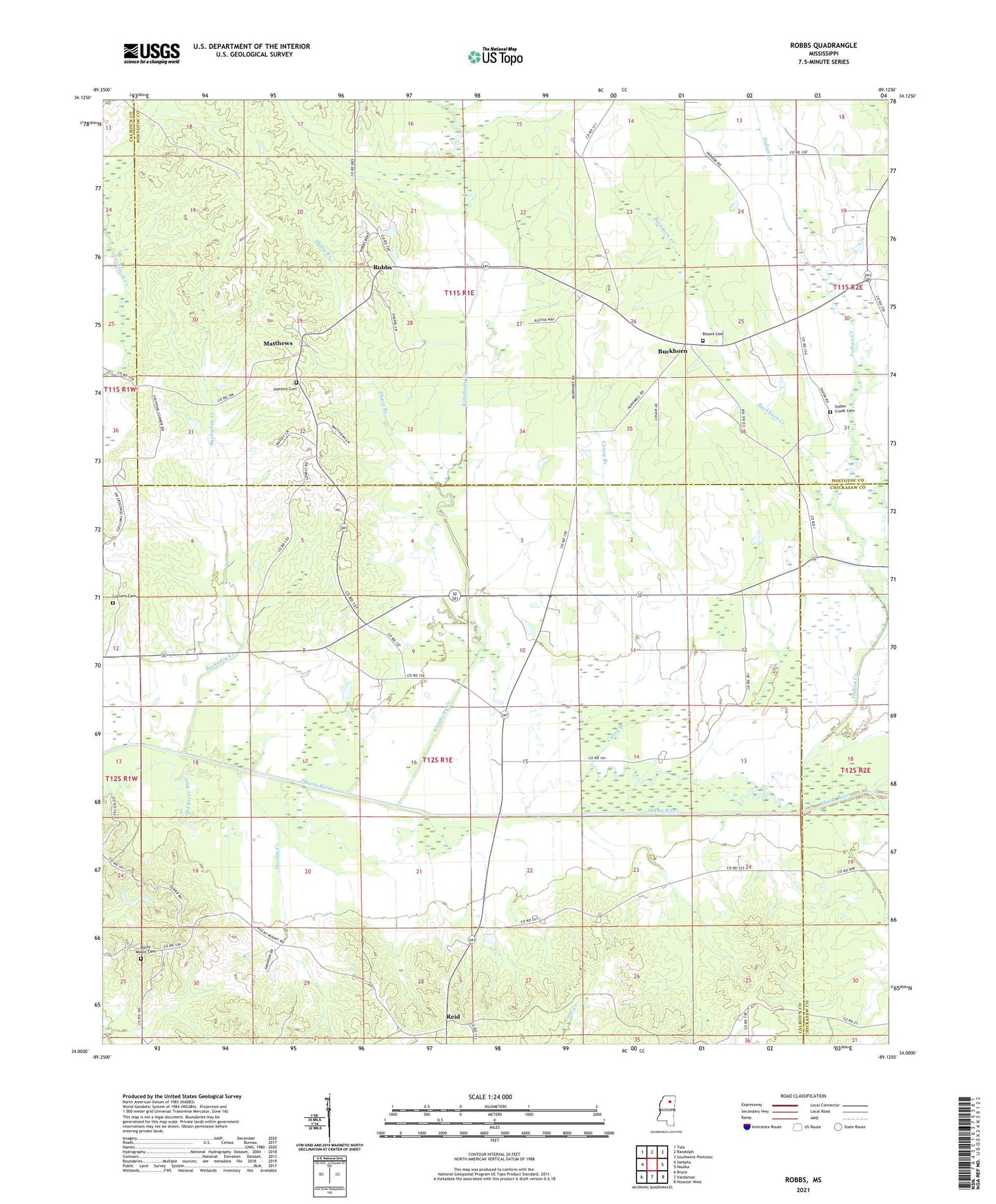
2021 topographic map quadrangle Robbs in the state of Mississippi. Scale: 1:24000. Based on the newly updated USGS 7.5' US Topo map series, this map is in the following counties: Calhoun, Pontotoc, Chickasaw. The map contains contour data, water features, and other items you are used to seeing on USGS maps, but also has updated roads and other features. This is the next generation of topographic maps. Printed on high-quality waterproof paper with UV fade-resistant inks.
Quads adjacent to this one:
West: Sarepta
Northwest: Tula
North: Randolph
Northeast: Southwest Pontotoc
East: Houlka
Southeast: Houston West
South: Vardaman
Southwest: Bruce
Contains the following named places: Blount Cemetery, Buckhorn, Buckhorn Church, Buckhorn Creek, Buckyday Creek, Caney Branch, Carrs Precinct, Clarks Chapel, Collums Cemetery, E L Hardin Lake Dam, Hardin Creek, Hopewell Baptist Church, Hopewell School, Huckleberry Creek, Hunters Cemetery, Indian Creek, Indian Creek Cemetery, Judah, Kenneth Jenkins Pond Dam, Kittahutty Creek, Matthews, Mays Chapel, Miller School, O D Mize Lake Dam, Pilgrims Rest Church, Reid, Robbs, Robbs Chapel, Robbs Chapel School, Robbs United Methodist Church, Rocky Mount Cemetery, Rocky Mount Church, Roy Young Dam, Sharp Branch, Splinterback Church, Victory Baptist Church