MyTopo
Southwest Pontotoc Mississippi US Topo Map
Couldn't load pickup availability
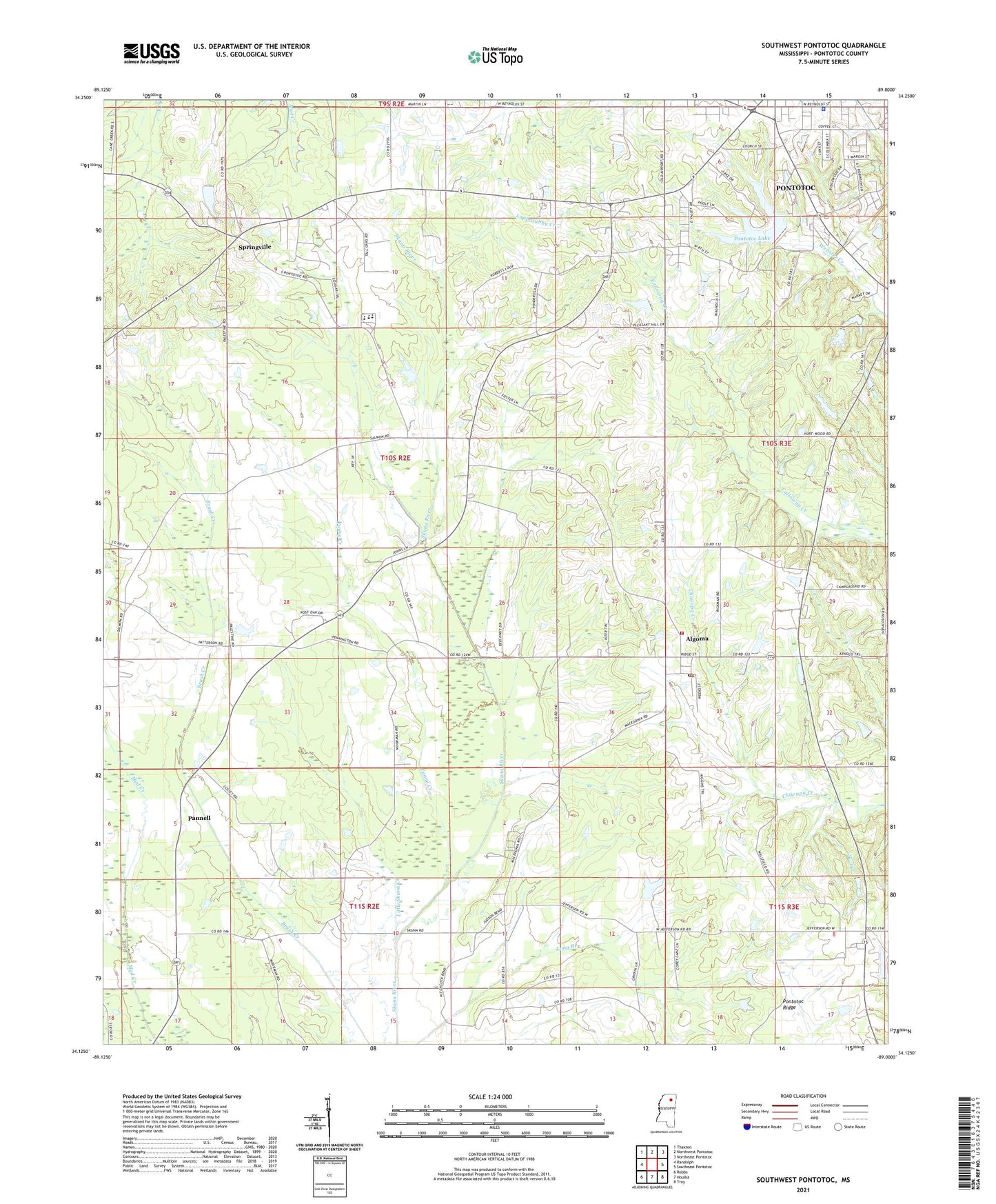
2024 topographic map quadrangle Southwest Pontotoc in the state of Mississippi. Scale: 1:24000. Based on the newly updated USGS 7.5' US Topo map series, this map is in the following counties: Pontotoc. The map contains contour data, water features, and other items you are used to seeing on USGS maps, but also has updated roads and other features. This is the next generation of topographic maps. Printed on high-quality waterproof paper with UV fade-resistant inks.
Quads adjacent to this one:
West: Randolph
Northwest: Thaxton
North: Northwest Pontotoc
Northeast: Northeast Pontotoc
East: Southeast Pontotoc
Southeast: Troy
South: Houlka
Southwest: Robbs
This map covers the same area as the classic USGS quad with code o34089b1.
Contains the following named places: Algoma, Algoma Baptist Church, Algoma Post Office, Algoma United Methodist Church, Algoma Volunteer Fire Department, Chiwapa Structure 3 Dam, Fairview Church, Funny Creek, G R Patterson Lake Dam, Liberty Church, Little Skuna Creek, Lochinvar, Macedonia Union Church, Midway Church, Midway School, Monroe, Montgomery Chapel, Newells Lake Dam, Old Algoma, Old Monroe Church, Palestine Church, Palestine School, Pannell, Pleasant Grove, Pleasant Grove Church, Pleasant Grove School, Pontotoc County, Pontotoc Lake, Pontotoc Police Department, Pontotoc Ridge, Pontotoc Ridge Experiment Lake Dam, Pontotoc Ridge-flatlands State Experiment Station, Reynolds Chapel, Scott Lake Dam, Springville, Springville Chapel Missionary Baptist Church, Springville Church, Town of Algoma, Usher Valley Church, Walls Lake Dam, West Pontotoc Church, ZIP Code: 38863